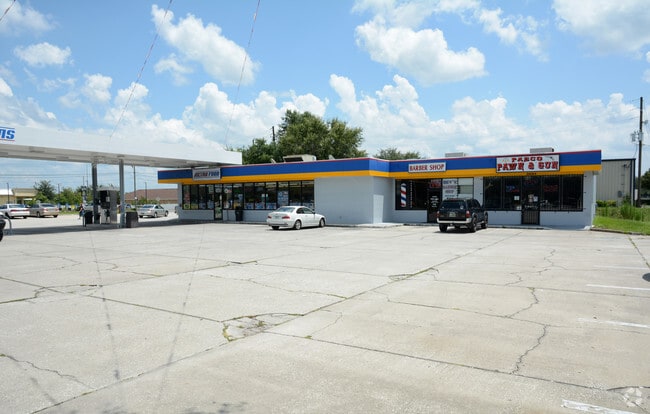
Property Record
1943 Foggy Ridge Pkwy, Lutz, FL 33559
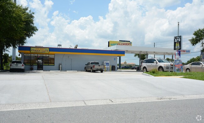
NEARBY LISTINGS FOR SALE OR LEASE
Property Detail
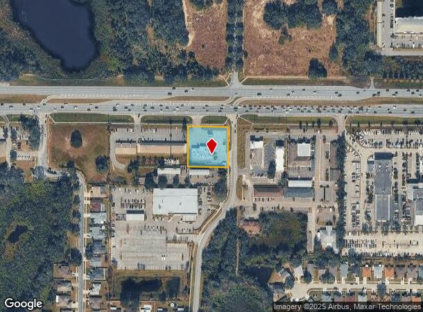
1943 Foggy Ridge Pkwy
Tampa-St. Petersburg-Clearwater, FL
S.R. 54
33-26-19-0000-00400-0020
COM AT NW COR OF SEC 33 TH S00DEG08 39W ALG WEST BDY THEREOF 51.62 FT TO POINT ON SOUTH R/W LINE OF SR 54 TH S89DEG59 20E ALG SOUTH R/W LINE 386.98 FT FOR POB TH CONT S89DEG59 20E ALG SOUTH R/W LINE 200 FT TH S00DEG07 58W ALG A LINE 72.00 FT WEST OF
Storebuilding
Pasco
X
Florida
12101C0416F
2
2024
0.88 AC
2025
Pasco County
032014
Tampa/St Petersburg
5,600 SF
DEMOGRAPHICS near 1943 Foggy Ridge Pkwy
1 Mile
3 Mile
5 Mile
2024 Total Population
9,109
39,371
116,791
2029 Population
10,922
46,397
136,038
Pop Growth 2024-2029
+ 19.90%
+ 17.85%
+ 16.48%
Average Age
39
40
39
2024 Total Households
3,501
14,890
43,086
HH Growth 2024-2029
+ 19.91%
+ 17.92%
+ 16.53%
Median Household Inc
$84,277
$93,322
$101,330
Avg Household Size
2.50
2.60
2.70
2024 Avg HH Vehicles
2.00
2.00
2.00
Median Home Value
$289,812
$325,191
$350,252
Median Year Built
2003
2001
2002
Nearby Places
Map Layers
Map Styles
 Street
 Aerial
- Restaurants
- Banks
- Shops
- Fitness
- Groceries
PUBLIC TRANSPORTATION
AIRPORT
Tampa International
DRIVE
WALK
Distance
Tampa International
38 min
28.1 mi
St Pete-Clearwater International
DRIVE
WALK
Distance
St Pete-Clearwater International
55 min
37.3 mi
Freight Ports
Port of Tampa Bay
DRIVE
WALK
Distance
Port of Tampa Bay
34 min
23.7 mi
Nearby Properties
Address
Land Use
TOTAL SIZE
Lot Size
Zoning
Address
Land Use
TOTAL SIZE
Lot Size
Zoning
455,090 SF
52.24 AC
MPUD
Address
Land Use
TOTAL SIZE
Lot Size
Zoning
603,350 SF
28.81 AC
MPUD
Address
Land Use
TOTAL SIZE
Lot Size
Zoning
380,937 SF
13.58 AC
MPUD
Address
Land Use
TOTAL SIZE
Lot Size
Zoning
366,691 SF
51.90 AC
MPUD
Address
Land Use
TOTAL SIZE
Lot Size
Zoning
425,129 SF
12.72 AC
MPUD
Address
Land Use
TOTAL SIZE
Lot Size
Zoning
324,184 SF
19.12 AC
MPUD
Address
Land Use
TOTAL SIZE
Lot Size
Zoning
269,998 SF
12.25 AC
MPUD
Address
Land Use
TOTAL SIZE
Lot Size
Zoning
285,532 SF
57.73 AC
MF1
Address
Land Use
TOTAL SIZE
Lot Size
Zoning
192,698 SF
19.31 AC
MPUD
Address
Land Use
TOTAL SIZE
Lot Size
Zoning
138,949 SF
11.74 AC
MPUD
Address
Land Use
TOTAL SIZE
Lot Size
Zoning
147,238 SF
13.89 AC
MPUD
Address
Land Use
TOTAL SIZE
Lot Size
Zoning
62,553 SF
43.31 AC
PD
Address
Land Use
TOTAL SIZE
Lot Size
Zoning
136,319 SF
26.11 AC
MPUD
Address
Land Use
TOTAL SIZE
Lot Size
Zoning
89,269 SF
9.42 AC
C2
Address
Land Use
TOTAL SIZE
Lot Size
Zoning
85,151 SF
23.18 AC
C2
Address
Land Use
TOTAL SIZE
Lot Size
Zoning
88,803 SF
6.46 AC
C2
Address
Land Use
TOTAL SIZE
Lot Size
Zoning
63,500 SF
32.29 AC
PD
Address
Land Use
TOTAL SIZE
Lot Size
Zoning
129,324 SF
4.95 AC
C2
Address
Land Use
TOTAL SIZE
Lot Size
Zoning
98,841 SF
3.81 AC
MPUD
Address
Land Use
TOTAL SIZE
Lot Size
Zoning
63,427 SF
12.17 AC
C2
Address
Land Use
TOTAL SIZE
Lot Size
Zoning
152,366 SF
16.80 AC
MPUD
Address
Land Use
TOTAL SIZE
Lot Size
Zoning
115,684 SF
1.98 AC
MPUD
Address
Land Use
TOTAL SIZE
Lot Size
Zoning
98,701 SF
2.09 AC
MPUD
Address
Land Use
TOTAL SIZE
Lot Size
Zoning
98,292 SF
3.43 AC
MPUD
Address
Land Use
TOTAL SIZE
Lot Size
Zoning
21,039 SF
5.51 AC
MPUD
Address
Land Use
TOTAL SIZE
Lot Size
Zoning
129,365 SF
5 AC
C2
Address
Land Use
TOTAL SIZE
Lot Size
Zoning
104,550 SF
14.03 AC
C2
Address
Land Use
TOTAL SIZE
Lot Size
Zoning
84,751 SF
2.62 AC
MPUD
Address
Land Use
TOTAL SIZE
Lot Size
Zoning
120,547 SF
40.64 AC
C2
Address
Land Use
TOTAL SIZE
Lot Size
Zoning
94,538 SF
29.91 AC
PUD
The World's #1 Commercial Real Estate Marketplace
Connect with us
© 2025 CoStar Group
The information above has been obtained from sources believed reliable. While we do not doubt its accuracy we have not verified it and make no guarantee, warranty or representation about it. It is your responsibility to independently confirm its accuracy and completeness. Any projections, opinions, assumptions, or estimates used are for example only and do not represent the current or future performance of the property. The value of this transaction to you depends on tax and other factors which should be evaluated by your tax, financial, and legal advisors. You and your advisors should conduct a careful, independent investigation of the property to determine to your satisfaction the suitability of the property for your needs.