Property Record
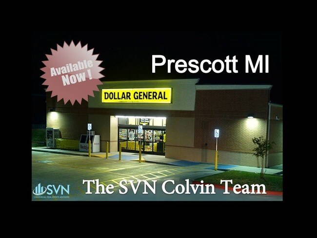
1943 Greenwood Rd, Prescott, MI 48756


NEARBY LISTINGS FOR SALE OR LEASE
-
-
View all Prescott listings for sale on LoopNet.com
Property Detail
1943 Greenwood Rd
010-027-023-10
2007 COMB OF 010-027-023-00 W/010-027-025-00 ML-27 13-A SEC 27 T21N R3E 10.04 AC M/L W 1/2 OF E 1/2 OF SE 1/4 OF NE 1/4 DESC
Commercialnec
Ogemaw
2024
Michigan
2025
10.05 AC
950901
Michigan North Central Area
3,056 SF
Other Market Areas
DEMOGRAPHICS near 1943 Greenwood Rd
1 Mile
3 Mile
5 Mile
2024 Total Population
1,933
3,952
6,694
2029 Population
1,990
4,067
6,902
Pop Growth 2024-2029
+ 2.95%
+ 2.91%
+ 3.11%
Average Age
43
44
46
2024 Total Households
831
1,694
2,931
HH Growth 2024-2029
+ 2.89%
+ 2.77%
+ 3.00%
Median Household Inc
$31,365
$33,825
$41,394
Avg Household Size
2.30
2.20
2.20
2024 Avg HH Vehicles
2.00
2.00
2.00
Median Home Value
$61,433
$65,606
$86,102
Median Year Built
1973
1974
1978
Nearby Places
Map Layers
Map Styles
 Street
 Aerial
- Restaurants
- Banks
- Shops
- Fitness
- Groceries
SALE & LEASE HISTORY
LISTING DATE
SALE/LEASE

Mar 16, 2017
For Sale
Aug 10, 2017
For Sale
Nearby Properties
Address
Land Use
TOTAL SIZE
Lot Size
Zoning
Address
Land Use
TOTAL SIZE
Lot Size
Zoning
0.43 AC
Address
Land Use
TOTAL SIZE
Lot Size
Zoning
9,100 SF
2.82 AC
Address
Land Use
TOTAL SIZE
Lot Size
Zoning
1,488 SF
118.20 AC
Address
Land Use
TOTAL SIZE
Lot Size
Zoning
9,180 SF
1.39 AC
Address
Land Use
TOTAL SIZE
Lot Size
Zoning
6,144 SF
4.97 AC
Address
Land Use
TOTAL SIZE
Lot Size
Zoning
23,296 SF
3 AC
Address
Land Use
TOTAL SIZE
Lot Size
Zoning
107 AC
Address
Land Use
TOTAL SIZE
Lot Size
Zoning
3,474 SF
4.20 AC
Address
Land Use
TOTAL SIZE
Lot Size
Zoning
19,703 SF
9.59 AC
Address
Land Use
TOTAL SIZE
Lot Size
Zoning
Address
Land Use
TOTAL SIZE
Lot Size
Zoning
98.80 AC
Address
Land Use
TOTAL SIZE
Lot Size
Zoning
55.72 AC
Address
Land Use
TOTAL SIZE
Lot Size
Zoning
3,844 SF
1.35 AC
Address
Land Use
TOTAL SIZE
Lot Size
Zoning
Address
Land Use
TOTAL SIZE
Lot Size
Zoning
5,232 SF
2.07 AC
Address
Land Use
TOTAL SIZE
Lot Size
Zoning
8,848 SF
6.52 AC
Address
Land Use
TOTAL SIZE
Lot Size
Zoning
6,124 SF
1.01 AC
Address
Land Use
TOTAL SIZE
Lot Size
Zoning
1,157 SF
5 AC
Address
Land Use
TOTAL SIZE
Lot Size
Zoning
12,212 SF
1.13 AC
Address
Land Use
TOTAL SIZE
Lot Size
Zoning
9,000 SF
5 AC
Address
Land Use
TOTAL SIZE
Lot Size
Zoning
3,200 SF
0.46 AC
Address
Land Use
TOTAL SIZE
Lot Size
Zoning
Address
Land Use
TOTAL SIZE
Lot Size
Zoning
8,036 SF
0.54 AC
Address
Land Use
TOTAL SIZE
Lot Size
Zoning
63.72 AC
Address
Land Use
TOTAL SIZE
Lot Size
Zoning
3,020 SF
0.48 AC
Address
Land Use
TOTAL SIZE
Lot Size
Zoning
2,496 SF
0.52 AC
Address
Land Use
TOTAL SIZE
Lot Size
Zoning
2,415 SF
0.47 AC
Address
Land Use
TOTAL SIZE
Lot Size
Zoning
Address
Land Use
TOTAL SIZE
Lot Size
Zoning
2.50 AC
The World's #1 Commercial Real Estate Marketplace
Connect with us
© 2026 CoStar Group
The information above has been obtained from sources believed reliable. While we do not doubt its accuracy we have not verified it and make no guarantee, warranty or representation about it. It is your responsibility to independently confirm its accuracy and completeness. Any projections, opinions, assumptions, or estimates used are for example only and do not represent the current or future performance of the property. The value of this transaction to you depends on tax and other factors which should be evaluated by your tax, financial, and legal advisors. You and your advisors should conduct a careful, independent investigation of the property to determine to your satisfaction the suitability of the property for your needs.