Property Record
19449 Us Highway 12, New Buffalo, MI 49117

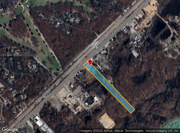
This Property Is For Sale
NEARBY LISTINGS FOR SALE OR LEASE
-
-
View all New Buffalo listings for sale on LoopNet.com
Property Detail
19449 Us Highway 12
Niles-Benton Harbor, MI
Berrien
11-13-0019-0003-02-0
Michigan
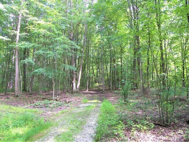
Sfr
3.33 AC
X
Michigan Southwest Area
26021C0318D
Other Market Areas
1,325 SF
DEMOGRAPHICS near 19449 Us Highway 12
1 Mile
3 Mile
5 Mile
2024 Total Population
1,309
7,346
14,965
2029 Population
1,476
7,991
15,938
Pop Growth 2024-2029
+ 12.76%
+ 8.78%
+ 6.50%
Average Age
53
52
49
2024 Total Households
626
3,485
6,936
HH Growth 2024-2029
+ 12.94%
+ 8.92%
+ 6.66%
Median Household Inc
$97,696
$89,917
$73,616
Avg Household Size
2.10
2.10
2.10
2024 Avg HH Vehicles
2.00
2.00
2.00
Median Home Value
$690,420
$482,095
$417,972
Median Year Built
1984
1976
1975
Nearby Places
- Restaurants
- Banks
- Shops
- Fitness
- Groceries
PUBLIC TRANSPORTATION
COMMUTER RAIL
DRIVE
WALK
Distance
5 min
3.3 mi
Carroll Avenue (Michigan City) Station (South Shore Line - Northern Indiana Commuter Transportation District (South Shore Line))
DRIVE
WALK
Distance
Carroll Avenue (Michigan City) Station (South Shore Line - Northern Indiana Commuter Transportation District (South Shore Line))
12 min
6.6 mi
AIRPORT
South Bend International
DRIVE
WALK
Distance
South Bend International
57 min
35.6 mi
Nearby Properties
Address
Land Use
TOTAL SIZE
Lot Size
Zoning
Address
Land Use
TOTAL SIZE
Lot Size
Zoning
29,124 SF
14.50 AC
I-1
Address
Land Use
TOTAL SIZE
Lot Size
Zoning
9,000 SF
10.19 AC
GCD
Address
Land Use
TOTAL SIZE
Lot Size
Zoning
0.50 AC
SELECTZONI
Address
Land Use
TOTAL SIZE
Lot Size
Zoning
2,484 SF
0.43 AC
Address
Land Use
TOTAL SIZE
Lot Size
Zoning
30,221 SF
23.62 AC
Address
Land Use
TOTAL SIZE
Lot Size
Zoning
51,979 SF
32.03 AC
Address
Land Use
TOTAL SIZE
Lot Size
Zoning
35,378 SF
3.94 AC
SELECTZONI
Address
Land Use
TOTAL SIZE
Lot Size
Zoning
43,365 SF
2.40 AC
SELECTZONI
Address
Land Use
TOTAL SIZE
Lot Size
Zoning
7,464 SF
2.40 AC
GCD
Address
Land Use
TOTAL SIZE
Lot Size
Zoning
0.95 AC
SELECTZONI
Address
Land Use
TOTAL SIZE
Lot Size
Zoning
9.16 AC
SELECTZONI
Address
Land Use
TOTAL SIZE
Lot Size
Zoning
0.80 AC
SELECTZONI
Address
Land Use
TOTAL SIZE
Lot Size
Zoning
95,031 SF
32.63 AC
Address
Land Use
TOTAL SIZE
Lot Size
Zoning
0.66 AC
SELECTZONI
Address
Land Use
TOTAL SIZE
Lot Size
Zoning
51,375 SF
3.75 AC
Address
Land Use
TOTAL SIZE
Lot Size
Zoning
0.20 AC
Address
Land Use
TOTAL SIZE
Lot Size
Zoning
93,543 SF
9 AC
Address
Land Use
TOTAL SIZE
Lot Size
Zoning
0.84 AC
SELECTZONI
Address
Land Use
TOTAL SIZE
Lot Size
Zoning
0.76 AC
WM
Address
Land Use
TOTAL SIZE
Lot Size
Zoning
0.75 AC
SELECTZONI
Address
Land Use
TOTAL SIZE
Lot Size
Zoning
0.71 AC
SELECTZONI
Address
Land Use
TOTAL SIZE
Lot Size
Zoning
0.52 AC
SELECTZONI
Address
Land Use
TOTAL SIZE
Lot Size
Zoning
0.68 AC
SELECTZONI
Address
Land Use
TOTAL SIZE
Lot Size
Zoning
0.40 AC
SELECTZONI
Address
Land Use
TOTAL SIZE
Lot Size
Zoning
48,919 SF
232.10 AC
SELECTZONI
Address
Land Use
TOTAL SIZE
Lot Size
Zoning
38,135 SF
3.43 AC
Address
Land Use
TOTAL SIZE
Lot Size
Zoning
5,111 SF
0.80 AC
CBD
Address
Land Use
TOTAL SIZE
Lot Size
Zoning
Address
Land Use
TOTAL SIZE
Lot Size
Zoning
0.42 AC
SELECTZONI
The World's #1 Commercial Real Estate Marketplace
Connect with us
© 2025 CoStar Group
The information above has been obtained from sources believed reliable. While we do not doubt its accuracy we have not verified it and make no guarantee, warranty or representation about it. It is your responsibility to independently confirm its accuracy and completeness. Any projections, opinions, assumptions, or estimates used are for example only and do not represent the current or future performance of the property. The value of this transaction to you depends on tax and other factors which should be evaluated by your tax, financial, and legal advisors. You and your advisors should conduct a careful, independent investigation of the property to determine to your satisfaction the suitability of the property for your needs.