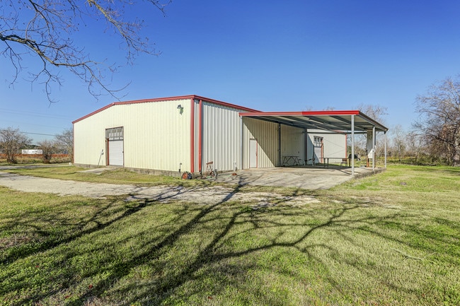
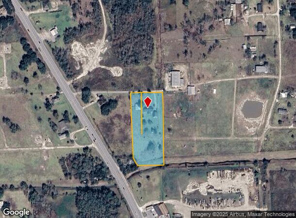
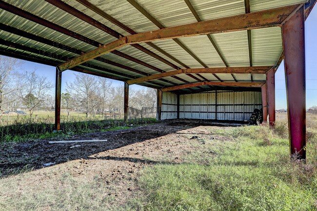
Property Record
1945 Avitts Dr, Alvin, TX 77511
NEARBY LISTINGS FOR SALE OR LEASE
-
-
View all Alvin listings for sale on LoopNet.com
Property Detail
1945 Avitts Dr
0292-0005-110
H T & B R R
Farms
A0292 H T & B R R TRACT 51B-51C ACRES 2.51
AE
Brazoria
48039C0065K
Texas
2024
2.51 AC
2025
South Hwy 35
660200
Houston
1,444 SF
Houston-The Woodlands-Sugar Land, TX
DEMOGRAPHICS near 1945 Avitts Dr
1 Mile
3 Mile
5 Mile
2024 Total Population
414
32,541
116,616
2029 Population
461
35,185
124,681
Pop Growth 2024-2029
+ 11.35%
+ 8.13%
+ 6.92%
Average Age
40
38
38
2024 Total Households
139
10,840
39,435
HH Growth 2024-2029
+ 11.51%
+ 8.19%
+ 7.00%
Median Household Inc
$86,000
$106,581
$103,635
Avg Household Size
2.80
2.90
2.90
2024 Avg HH Vehicles
2.00
2.00
2.00
Median Home Value
$422,826
$288,365
$290,707
Median Year Built
1991
1993
1995
Nearby Places
Map Layers
Map Styles
 Street
 Aerial
- Restaurants
- Banks
- Shops
- Fitness
- Groceries
PUBLIC TRANSPORTATION
AIRPORT
William P Hobby
DRIVE
WALK
Distance
William P Hobby
26 min
10.9 mi
Freight Ports
Port of Houston
DRIVE
WALK
Distance
Port of Houston
1 min
15.6 mi
SALE & LEASE HISTORY
LISTING DATE
SALE/LEASE

Sep 24, 2016
For Sale
May 08, 2017
For Sale
Jan 03, 2020
For Sale
Nearby Properties
Address
Land Use
TOTAL SIZE
Lot Size
Zoning
Address
Land Use
TOTAL SIZE
Lot Size
Zoning
40.52 AC
0017
Address
Land Use
TOTAL SIZE
Lot Size
Zoning
83.37 AC
0004
Address
Land Use
TOTAL SIZE
Lot Size
Zoning
142,155 SF
19.16 AC
SP
Address
Land Use
TOTAL SIZE
Lot Size
Zoning
65,935 SF
81.27 AC
Address
Land Use
TOTAL SIZE
Lot Size
Zoning
161,803 SF
54.82 AC
Address
Land Use
TOTAL SIZE
Lot Size
Zoning
84,272 SF
16.93 AC
Address
Land Use
TOTAL SIZE
Lot Size
Zoning
113,376 SF
9.80 AC
Address
Land Use
TOTAL SIZE
Lot Size
Zoning
83,995 SF
21.74 AC
CSC
Address
Land Use
TOTAL SIZE
Lot Size
Zoning
54,802 SF
12.63 AC
0014
Address
Land Use
TOTAL SIZE
Lot Size
Zoning
6,948 SF
54.94 AC
2080
Address
Land Use
TOTAL SIZE
Lot Size
Zoning
110,923 SF
6.97 AC
Address
Land Use
TOTAL SIZE
Lot Size
Zoning
112,720 SF
8.21 AC
Address
Land Use
TOTAL SIZE
Lot Size
Zoning
108,250 SF
9.89 AC
Address
Land Use
TOTAL SIZE
Lot Size
Zoning
77,997 SF
19 AC
0065
Address
Land Use
TOTAL SIZE
Lot Size
Zoning
56,905 SF
7 AC
Address
Land Use
TOTAL SIZE
Lot Size
Zoning
Address
Land Use
TOTAL SIZE
Lot Size
Zoning
98,005 SF
4.64 AC
Address
Land Use
TOTAL SIZE
Lot Size
Zoning
22,144 SF
9.27 AC
Address
Land Use
TOTAL SIZE
Lot Size
Zoning
83,221 SF
5.96 AC
Address
Land Use
TOTAL SIZE
Lot Size
Zoning
15.68 AC
Address
Land Use
TOTAL SIZE
Lot Size
Zoning
1,920 SF
14.94 AC
Address
Land Use
TOTAL SIZE
Lot Size
Zoning
18,800 SF
1.08 AC
Address
Land Use
TOTAL SIZE
Lot Size
Zoning
24,000 SF
3.53 AC
0001
Address
Land Use
TOTAL SIZE
Lot Size
Zoning
39,208 SF
8.03 AC
0060
Address
Land Use
TOTAL SIZE
Lot Size
Zoning
14.09 AC
Address
Land Use
TOTAL SIZE
Lot Size
Zoning
12,868 SF
1.65 AC
Address
Land Use
TOTAL SIZE
Lot Size
Zoning
60,440 SF
5 AC
7010
Address
Land Use
TOTAL SIZE
Lot Size
Zoning
94,300 SF
5 AC
Address
Land Use
TOTAL SIZE
Lot Size
Zoning
2,169 SF
9.57 AC
SFR
Address
Land Use
TOTAL SIZE
Lot Size
Zoning
56,290 SF
3.50 AC
3150
The World's #1 Commercial Real Estate Marketplace
Connect with us
© 2025 CoStar Group
The information above has been obtained from sources believed reliable. While we do not doubt its accuracy we have not verified it and make no guarantee, warranty or representation about it. It is your responsibility to independently confirm its accuracy and completeness. Any projections, opinions, assumptions, or estimates used are for example only and do not represent the current or future performance of the property. The value of this transaction to you depends on tax and other factors which should be evaluated by your tax, financial, and legal advisors. You and your advisors should conduct a careful, independent investigation of the property to determine to your satisfaction the suitability of the property for your needs.