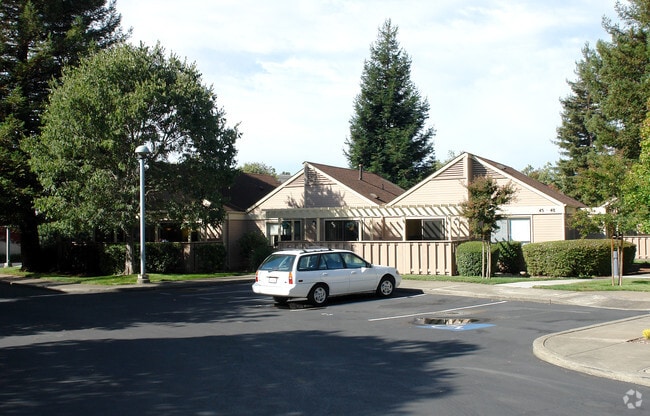
Property Record
1945 Long Dr, Santa Rosa, CA 95405

NEARBY LISTINGS FOR SALE OR LEASE
Property Detail
1945 Long Dr
Santa Rosa-Petaluma, CA
Parcel Map No 359
181-190-001
REMAP FROM 032-042-018-000 - 09/13/97
Apartment
Sonoma
X
California
06097C0729E
3.24 AC
2024
Outer Santa Rosa
2025
North Bay/Santa Rosa
152300
DEMOGRAPHICS near 1945 Long Dr
1 mile
3 mile
5 mile
2024 Total Population
13,868
119,945
195,455
2029 Population
13,711
119,283
194,068
Pop Growth 2024-2029
(1.13%)
(0.55%)
(0.71%)
Average Age
46
42
41
2024 Total Households
6,138
46,115
72,275
HH Growth 2024-2029
(1.12%)
(0.53%)
(0.68%)
Median Household Inc
$91,736
$87,248
$91,166
Avg Household Size
2.20
2.50
2.60
2024 Avg HH Vehicles
2.00
2.00
2.00
Median Home Value
$782,992
$739,680
$725,137
Median Year Built
1960
1976
1980
Nearby Places
Map Layers
Map Styles
 Street
 Aerial
Transit
 Traffic
 Biking
Places
Listings with unknown addresses are not visible on the map
- Restaurants
- Banks
- Shops
- Fitness
- Groceries
PUBLIC TRANSPORTATION
COMMUTER RAIL
Santa Rosa Downtown Smart (Main Line - Sonoma Marin Area Rail Transit)
Drive
Walk
Distance
Santa Rosa Downtown Smart (Main Line - Sonoma Marin Area Rail Transit)
5 min
2.5 mi
Santa Rosa North Smart (Main Line - Sonoma Marin Area Rail Transit)
Drive
Walk
Distance
Santa Rosa North Smart (Main Line - Sonoma Marin Area Rail Transit)
7 min
3.6 mi
AIRPORT
Charles M Schulz - Sonoma County
Drive
Walk
Distance
Charles M Schulz - Sonoma County
16 min
9.6 mi
Freight Ports
Port of Richmond
Drive
Walk
Distance
Port of Richmond
66 min
50.6 mi
Nearby Properties
Address
Land Use
TOTAL SIZE
Lot Size
Zoning
Address
Land Use
TOTAL SIZE
Lot Size
Zoning
695,457 SF
128.68 AC
CITYSR
Address
Land Use
TOTAL SIZE
Lot Size
Zoning
258,134 SF
7.42 AC
CITYSR
Address
Land Use
TOTAL SIZE
Lot Size
Zoning
22.45 AC
MCPD
Address
Land Use
TOTAL SIZE
Lot Size
Zoning
434,911 SF
30.22 AC
Address
Land Use
TOTAL SIZE
Lot Size
Zoning
Address
Land Use
TOTAL SIZE
Lot Size
Zoning
285,160 SF
8.23 AC
Address
Land Use
TOTAL SIZE
Lot Size
Zoning
249,210 SF
22.98 AC
C-2
Address
Land Use
TOTAL SIZE
Lot Size
Zoning
441,698 SF
10.23 AC
C2
Address
Land Use
TOTAL SIZE
Lot Size
Zoning
222,278 SF
13.39 AC
CITYSR
Address
Land Use
TOTAL SIZE
Lot Size
Zoning
92,480 SF
33.80 AC
Address
Land Use
TOTAL SIZE
Lot Size
Zoning
191,385 SF
13.77 AC
C2P
Address
Land Use
TOTAL SIZE
Lot Size
Zoning
447,600 SF
22.01 AC
Address
Land Use
TOTAL SIZE
Lot Size
Zoning
203,119 SF
9.35 AC
Address
Land Use
TOTAL SIZE
Lot Size
Zoning
167,485 SF
7.81 AC
Address
Land Use
TOTAL SIZE
Lot Size
Zoning
260,417 SF
9.13 AC
CITYSR
Address
Land Use
TOTAL SIZE
Lot Size
Zoning
74,000 SF
0.51 AC
Address
Land Use
TOTAL SIZE
Lot Size
Zoning
178,704 SF
10.76 AC
CITYSR
Address
Land Use
TOTAL SIZE
Lot Size
Zoning
131,210 SF
10.41 AC
Address
Land Use
TOTAL SIZE
Lot Size
Zoning
116,188 SF
6.55 AC
CITYSR
Address
Land Use
TOTAL SIZE
Lot Size
Zoning
90,079 SF
3.09 AC
Address
Land Use
TOTAL SIZE
Lot Size
Zoning
227,411 SF
9.23 AC
Address
Land Use
TOTAL SIZE
Lot Size
Zoning
9,450 SF
0.76 AC
Address
Land Use
TOTAL SIZE
Lot Size
Zoning
142,297 SF
4.65 AC
Address
Land Use
TOTAL SIZE
Lot Size
Zoning
107,765 SF
5.70 AC
CITYSR
Address
Land Use
TOTAL SIZE
Lot Size
Zoning
87,750 SF
5.43 AC
Address
Land Use
TOTAL SIZE
Lot Size
Zoning
146,611 SF
9.44 AC
Address
Land Use
TOTAL SIZE
Lot Size
Zoning
119,819 SF
7.37 AC
CITYSR
Address
Land Use
TOTAL SIZE
Lot Size
Zoning
29,397 SF
6.33 AC
Address
Land Use
TOTAL SIZE
Lot Size
Zoning
122,645 SF
9.46 AC
CITYSR
Address
Land Use
TOTAL SIZE
Lot Size
Zoning
58,551 SF
4.24 AC
The World's #1 Commercial Real Estate Marketplace
Connect with us
© 2026 CoStar Group
The information above has been obtained from sources believed reliable. While we do not doubt its accuracy we have not verified it and make no guarantee, warranty or representation about it. It is your responsibility to independently confirm its accuracy and completeness. Any projections, opinions, assumptions, or estimates used are for example only and do not represent the current or future performance of the property. The value of this transaction to you depends on tax and other factors which should be evaluated by your tax, financial, and legal advisors. You and your advisors should conduct a careful, independent investigation of the property to determine to your satisfaction the suitability of the property for your needs.