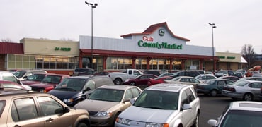
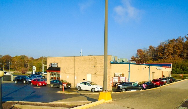
Property Record
1945 W Monroe St, Springfield, IL 62704

NEARBY LISTINGS FOR SALE OR LEASE
Property Detail
1945 W Monroe St
Other Market Areas
Fairhills Mall Sub
Springfield, IL
LOT 1 FAIRHILLS MALL SUB 32-16-5
14-32.0-126-015
Sangamon
Commercialnec
Illinois
2024
1
2024
7.95 AC
001100
Springfield/Decatur
DEMOGRAPHICS near 1945 W Monroe St
1 Mile
3 Mile
5 Mile
2024 Total Population
11,047
72,970
118,540
2029 Population
10,969
72,858
118,108
Pop Growth 2024-2029
(0.71%)
(0.15%)
(0.36%)
Average Age
41
41
41
2024 Total Households
5,413
33,803
53,873
HH Growth 2024-2029
(0.83%)
(0.26%)
(0.47%)
Median Household Inc
$61,224
$57,956
$58,514
Avg Household Size
2.00
2.00
2.10
2024 Avg HH Vehicles
1.00
2.00
2.00
Median Home Value
$143,591
$140,032
$134,804
Median Year Built
1963
1963
1965
Nearby Places
Map Layers
Map Styles
 Street
 Aerial
- Restaurants
- Banks
- Shops
- Fitness
- Groceries
PUBLIC TRANSPORTATION
COMMUTER RAIL
Springfield (Lincoln Service - Amtrak, Lincoln Service Missouri River Runner - Amtrak, Texas Eagle - Amtrak)
DRIVE
WALK
Distance
Springfield (Lincoln Service - Amtrak, Lincoln Service Missouri River Runner - Amtrak, Texas Eagle - Amtrak)
5 min
2.0 mi
AIRPORT
Abraham Lincoln Capital
DRIVE
WALK
Distance
Abraham Lincoln Capital
8 min
4.3 mi
Freight Ports
Port Milwaukee
DRIVE
WALK
Distance
Port Milwaukee
317 min
274.2 mi
SALE & LEASE HISTORY
LISTING DATE
SALE/LEASE

Sep 25, 2016
For Lease
Nov 22, 2017
For Lease
Nov 18, 2016
For Lease
Jun 20, 2017
For Lease
Nearby Properties
Address
Land Use
TOTAL SIZE
Lot Size
Zoning
Address
Land Use
TOTAL SIZE
Lot Size
Zoning
24.91 AC
Address
Land Use
TOTAL SIZE
Lot Size
Zoning
2.36 AC
Address
Land Use
TOTAL SIZE
Lot Size
Zoning
4.50 AC
Address
Land Use
TOTAL SIZE
Lot Size
Zoning
1.90 AC
Address
Land Use
TOTAL SIZE
Lot Size
Zoning
3.17 AC
Address
Land Use
TOTAL SIZE
Lot Size
Zoning
21.61 AC
Address
Land Use
TOTAL SIZE
Lot Size
Zoning
13.91 AC
Address
Land Use
TOTAL SIZE
Lot Size
Zoning
1.16 AC
Address
Land Use
TOTAL SIZE
Lot Size
Zoning
Address
Land Use
TOTAL SIZE
Lot Size
Zoning
Address
Land Use
TOTAL SIZE
Lot Size
Zoning
Address
Land Use
TOTAL SIZE
Lot Size
Zoning
Address
Land Use
TOTAL SIZE
Lot Size
Zoning
Address
Land Use
TOTAL SIZE
Lot Size
Zoning
Address
Land Use
TOTAL SIZE
Lot Size
Zoning
Address
Land Use
TOTAL SIZE
Lot Size
Zoning
Address
Land Use
TOTAL SIZE
Lot Size
Zoning
15.99 AC
Address
Land Use
TOTAL SIZE
Lot Size
Zoning
1.22 AC
Address
Land Use
TOTAL SIZE
Lot Size
Zoning
Address
Land Use
TOTAL SIZE
Lot Size
Zoning
10.08 AC
Address
Land Use
TOTAL SIZE
Lot Size
Zoning
Address
Land Use
TOTAL SIZE
Lot Size
Zoning
0.29 AC
Address
Land Use
TOTAL SIZE
Lot Size
Zoning
10.52 AC
Address
Land Use
TOTAL SIZE
Lot Size
Zoning
10.13 AC
Address
Land Use
TOTAL SIZE
Lot Size
Zoning
Address
Land Use
TOTAL SIZE
Lot Size
Zoning
Address
Land Use
TOTAL SIZE
Lot Size
Zoning
Address
Land Use
TOTAL SIZE
Lot Size
Zoning
15.24 AC
Address
Land Use
TOTAL SIZE
Lot Size
Zoning
Address
Land Use
TOTAL SIZE
Lot Size
Zoning
7.80 AC
The World's #1 Commercial Real Estate Marketplace
Connect with us
© 2025 CoStar Group
The information above has been obtained from sources believed reliable. While we do not doubt its accuracy we have not verified it and make no guarantee, warranty or representation about it. It is your responsibility to independently confirm its accuracy and completeness. Any projections, opinions, assumptions, or estimates used are for example only and do not represent the current or future performance of the property. The value of this transaction to you depends on tax and other factors which should be evaluated by your tax, financial, and legal advisors. You and your advisors should conduct a careful, independent investigation of the property to determine to your satisfaction the suitability of the property for your needs.