Property Record
1946 Sandy Ridge Rd, Colfax, NC 27235

Property Detail
1946 Sandy Ridge Rd
Greensboro-High Point, NC
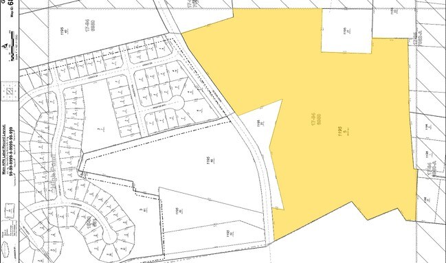
SEE DEED
0169206
Guilford
Vacantlandnec
North Carolina
AG
5
B and X Area of moderate flood hazard, usually the area between the limits of the 100-year and 500-year floods.
67.21 AC
0
Airport/W Guilford County
2025
Greensboro/Winston-Salem
013700
NEARBY LISTINGS FOR SALE OR LEASE
DEMOGRAPHICS near 1946 Sandy Ridge Rd
1 mile
3 mile
5 mile
2025 Total Population
4,030
26,630
74,872
2030 Population
4,250
27,601
77,444
Pop Growth 2025-2030
+ 5.46%
+ 3.65%
+ 3.44%
Average Age
46
42
41
2025 Total Households
1,583
10,229
31,559
HH Growth 2025-2030
+ 5.81%
+ 3.80%
+ 3.56%
Median Household Inc
$100,936
$101,168
$76,127
Avg Household Size
2.50
2.60
2.30
2025 Avg HH Vehicles
2.00
2.00
2.00
Median Home Value
$337,061
$311,358
$280,608
Median Year Built
2006
1999
1996
Nearby Places
Map Layers
Map Styles
 Street
 Aerial
Layers
 Traffic
 Biking
Places
Listings with unknown addresses are not visible on the map
- Restaurants
- Banks
- Shops
- Fitness
- Groceries
PUBLIC TRANSPORTATION
COMMUTER RAIL
High Point Station (Piedmont - North Carolina by Train (NC Train))
Drive
Walk
Distance
High Point Station (Piedmont - North Carolina by Train (NC Train))
16 min
8.3 mi
AIRPORT
Piedmont Triad International
Drive
Walk
Distance
Piedmont Triad International
21 min
8.8 mi
Freight Ports
Virginia Port Authority - Richmond
Drive
Walk
Distance
Virginia Port Authority - Richmond
248 min
212.4 mi
Nearby Properties
Address
Land Use
TOTAL SIZE
Lot Size
Zoning
Address
Land Use
TOTAL SIZE
Lot Size
Zoning
274,486 SF
30.31 AC
MBP
Address
Land Use
TOTAL SIZE
Lot Size
Zoning
1,057,283 SF
104.31 AC
PDP
Address
Land Use
TOTAL SIZE
Lot Size
Zoning
256,051 SF
37.69 AC
LI
Address
Land Use
TOTAL SIZE
Lot Size
Zoning
1,045,775 SF
114.96 AC
CZ-LI-HP
Address
Land Use
TOTAL SIZE
Lot Size
Zoning
181,444 SF
126.42 AC
PD-P
Address
Land Use
TOTAL SIZE
Lot Size
Zoning
667,440 SF
53.44 AC
BI
Address
Land Use
TOTAL SIZE
Lot Size
Zoning
186,200 SF
10.58 AC
LI
Address
Land Use
TOTAL SIZE
Lot Size
Zoning
342,765 SF
20.98 AC
PUD
Address
Land Use
TOTAL SIZE
Lot Size
Zoning
229,103 SF
18.76 AC
CZ-I
Address
Land Use
TOTAL SIZE
Lot Size
Zoning
254,290 SF
21.12 AC
RM-12
Address
Land Use
TOTAL SIZE
Lot Size
Zoning
299,786 SF
24.49 AC
PDP
Address
Land Use
TOTAL SIZE
Lot Size
Zoning
75,588 SF
6.49 AC
LI
Address
Land Use
TOTAL SIZE
Lot Size
Zoning
176,000 SF
12.95 AC
CZ-I
Address
Land Use
TOTAL SIZE
Lot Size
Zoning
361,412 SF
35.81 AC
LI
Address
Land Use
TOTAL SIZE
Lot Size
Zoning
311,785 SF
107.44 AC
PI
Address
Land Use
TOTAL SIZE
Lot Size
Zoning
66,780 SF
16.64 AC
LI
Address
Land Use
TOTAL SIZE
Lot Size
Zoning
266,881 SF
29.68 AC
AG
Address
Land Use
TOTAL SIZE
Lot Size
Zoning
185,310 SF
14.37 AC
LI
Address
Land Use
TOTAL SIZE
Lot Size
Zoning
109,169 SF
40.18 AC
RS30
Address
Land Use
TOTAL SIZE
Lot Size
Zoning
142,296 SF
4.25 AC
PDP
Address
Land Use
TOTAL SIZE
Lot Size
Zoning
179,174 SF
17.27 AC
AG
Address
Land Use
TOTAL SIZE
Lot Size
Zoning
120,272 SF
6.94 AC
CU LI
Address
Land Use
TOTAL SIZE
Lot Size
Zoning
62,688 SF
69.72 AC
HB
Address
Land Use
TOTAL SIZE
Lot Size
Zoning
91,147 SF
18.31 AC
LI
Address
Land Use
TOTAL SIZE
Lot Size
Zoning
147,705 SF
10.77 AC
BP
Address
Land Use
TOTAL SIZE
Lot Size
Zoning
195,056 SF
9.64 AC
LI
Address
Land Use
TOTAL SIZE
Lot Size
Zoning
207,745 SF
49.58 AC
LI
Address
Land Use
TOTAL SIZE
Lot Size
Zoning
230,106 SF
28.27 AC
LI
Address
Land Use
TOTAL SIZE
Lot Size
Zoning
249,166 SF
33.42 AC
LI
Address
Land Use
TOTAL SIZE
Lot Size
Zoning
219,900 SF
13.78 AC
CU-CP
The World's #1 Commercial Real Estate Marketplace
Connect with us
© 2026 CoStar Group
The information above has been obtained from sources believed reliable. While we do not doubt its accuracy we have not verified it and make no guarantee, warranty or representation about it. It is your responsibility to independently confirm its accuracy and completeness. Any projections, opinions, assumptions, or estimates used are for example only and do not represent the current or future performance of the property. The value of this transaction to you depends on tax and other factors which should be evaluated by your tax, financial, and legal advisors. You and your advisors should conduct a careful, independent investigation of the property to determine to your satisfaction the suitability of the property for your needs.