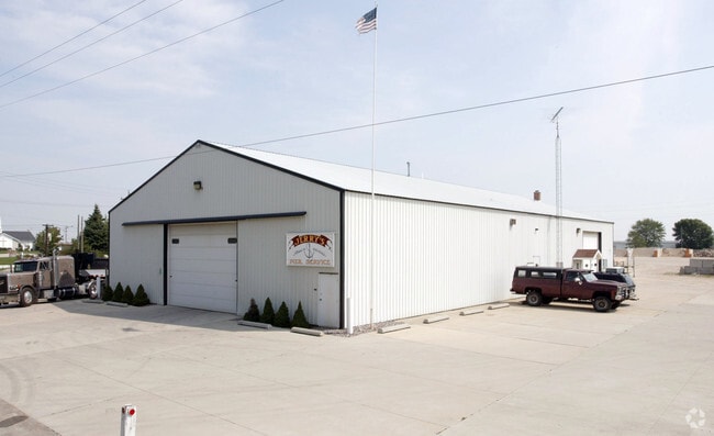
Property Record
1948 Byrnes St, East Troy, WI 53120

NEARBY LISTINGS FOR SALE OR LEASE
Property Detail
1948 Byrnes St
RXUP00138
PT SW 1/4 SEC 20 T4N R18E DESC AS: COM S 1/4 COR SEC 20, N0D08'E 1574.04' TO C/L HWY ES, N0D08'E 214' TO POB, S89D57'W 165', S0D30'W 163.40', S89D42' W 313.99' TO C/L BYRNES DR, N0D08'E 377.02', NELY ALG RR R/W TO N & S 1/4 SEC LN SEC 20 S0D08'W 491.
Commercialnec
Walworth
X
Wisconsin
55133C0425G
5.03 AC
2024
Walworth East
2024
Milwaukee/Madison
000103
Whitewater-Elkhorn, WI
DEMOGRAPHICS near 1948 Byrnes St
1 mile
3 mile
5 mile
2024 Total Population
3,500
6,516
9,289
2029 Population
3,441
6,398
9,145
Pop Growth 2024-2029
(1.69%)
(1.81%)
(1.55%)
Average Age
41
42
43
2024 Total Households
1,407
2,664
3,733
HH Growth 2024-2029
(1.99%)
(2.18%)
(1.88%)
Median Household Inc
$79,207
$82,593
$86,709
Avg Household Size
2.50
2.40
2.40
2024 Avg HH Vehicles
2.00
2.00
2.00
Median Home Value
$245,833
$270,120
$282,237
Median Year Built
1977
1978
1976
Nearby Places
Map Layers
Map Styles
 Street
 Aerial
Transit
 Traffic
 Biking
Places
Listings with unknown addresses are not visible on the map
- Restaurants
- Banks
- Shops
- Fitness
- Groceries
PUBLIC TRANSPORTATION
AIRPORT
General Mitchell International
Drive
Walk
Distance
General Mitchell International
41 min
31.0 mi
Freight Ports
Port Milwaukee
Drive
Walk
Distance
Port Milwaukee
41 min
32.8 mi
Nearby Properties
Address
Land Use
TOTAL SIZE
Lot Size
Zoning
Address
Land Use
TOTAL SIZE
Lot Size
Zoning
17.94 AC
Address
Land Use
TOTAL SIZE
Lot Size
Zoning
Address
Land Use
TOTAL SIZE
Lot Size
Zoning
48.90 AC
Address
Land Use
TOTAL SIZE
Lot Size
Zoning
6.14 AC
Address
Land Use
TOTAL SIZE
Lot Size
Zoning
55.74 AC
Address
Land Use
TOTAL SIZE
Lot Size
Zoning
0.97 AC
R1
Address
Land Use
TOTAL SIZE
Lot Size
Zoning
6.28 AC
Address
Land Use
TOTAL SIZE
Lot Size
Zoning
Address
Land Use
TOTAL SIZE
Lot Size
Zoning
17.19 AC
Address
Land Use
TOTAL SIZE
Lot Size
Zoning
0.66 AC
R1
Address
Land Use
TOTAL SIZE
Lot Size
Zoning
23.46 AC
Address
Land Use
TOTAL SIZE
Lot Size
Zoning
1.87 AC
Address
Land Use
TOTAL SIZE
Lot Size
Zoning
73.72 AC
Address
Land Use
TOTAL SIZE
Lot Size
Zoning
1.29 AC
Address
Land Use
TOTAL SIZE
Lot Size
Zoning
1.72 AC
R1
Address
Land Use
TOTAL SIZE
Lot Size
Zoning
1.75 AC
R1
Address
Land Use
TOTAL SIZE
Lot Size
Zoning
Address
Land Use
TOTAL SIZE
Lot Size
Zoning
Address
Land Use
TOTAL SIZE
Lot Size
Zoning
3.12 AC
R1
Address
Land Use
TOTAL SIZE
Lot Size
Zoning
1.38 AC
R1
Address
Land Use
TOTAL SIZE
Lot Size
Zoning
1.53 AC
R1
Address
Land Use
TOTAL SIZE
Lot Size
Zoning
1.66 AC
R1
Address
Land Use
TOTAL SIZE
Lot Size
Zoning
0.93 AC
R1
Address
Land Use
TOTAL SIZE
Lot Size
Zoning
2.44 AC
R1
Address
Land Use
TOTAL SIZE
Lot Size
Zoning
3.13 AC
Address
Land Use
TOTAL SIZE
Lot Size
Zoning
Address
Land Use
TOTAL SIZE
Lot Size
Zoning
1.26 AC
R1
Address
Land Use
TOTAL SIZE
Lot Size
Zoning
9.66 AC
Address
Land Use
TOTAL SIZE
Lot Size
Zoning
Address
Land Use
TOTAL SIZE
Lot Size
Zoning
0.88 AC
R1
The World's #1 Commercial Real Estate Marketplace
Connect with us
© 2026 CoStar Group
The information above has been obtained from sources believed reliable. While we do not doubt its accuracy we have not verified it and make no guarantee, warranty or representation about it. It is your responsibility to independently confirm its accuracy and completeness. Any projections, opinions, assumptions, or estimates used are for example only and do not represent the current or future performance of the property. The value of this transaction to you depends on tax and other factors which should be evaluated by your tax, financial, and legal advisors. You and your advisors should conduct a careful, independent investigation of the property to determine to your satisfaction the suitability of the property for your needs.