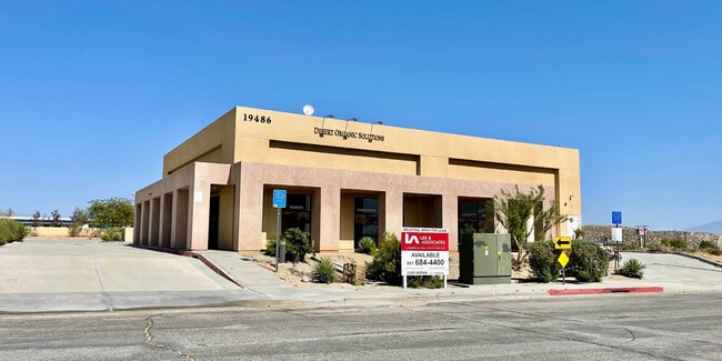
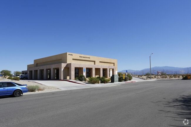
Property Record
19486 Newhall St, Palm Springs, CA 92262

NEARBY LISTINGS FOR SALE OR LEASE
Property Detail
19486 Newhall St
Riverside-San Bernardino-Ontario, CA
Pm 20820
666-423-004
.55 ACRES NET IN PAR 61 PM 166/070 PM 20820
Lightindustrial
Riverside
X
California
06065C0895G
61
2024
0.55 AC
2025
Coachella Valley
044602
Inland Empire (California)
7,924 SF
DEMOGRAPHICS near 19486 Newhall St
1 Mile
3 Mile
5 Mile
2024 Total Population
120
2,717
56,836
2029 Population
123
2,972
61,594
Pop Growth 2024-2029
+ 2.50%
+ 9.39%
+ 8.37%
Average Age
37
39
40
2024 Total Households
35
1,012
21,662
HH Growth 2024-2029
+ 2.86%
+ 9.19%
+ 8.49%
Median Household Inc
$42,500
$56,027
$52,173
Avg Household Size
3.40
2.50
2.50
2024 Avg HH Vehicles
2.00
2.00
2.00
Median Home Value
$86,363
$438,281
$456,493
Median Year Built
1983
2001
1985
Nearby Places
Map Layers
Map Styles
 Street
 Aerial
- Restaurants
- Banks
- Shops
- Fitness
- Groceries
PUBLIC TRANSPORTATION
COMMUTER RAIL
DRIVE
WALK
Distance
6 min
1.7 mi
AIRPORT
Palm Springs International
DRIVE
WALK
Distance
Palm Springs International
13 min
7.3 mi
SALE & LEASE HISTORY
LISTING DATE
SALE/LEASE

Sep 18, 2024
For Sale
Mar 27, 2023
For Lease
Nearby Properties
Address
Land Use
TOTAL SIZE
Lot Size
Zoning
Address
Land Use
TOTAL SIZE
Lot Size
Zoning
200,720 SF
10.49 AC
Address
Land Use
TOTAL SIZE
Lot Size
Zoning
64.91 AC
MSC
Address
Land Use
TOTAL SIZE
Lot Size
Zoning
650,865 SF
94.91 AC
Address
Land Use
TOTAL SIZE
Lot Size
Zoning
16,460 SF
3.98 AC
Address
Land Use
TOTAL SIZE
Lot Size
Zoning
53,897 SF
6.63 AC
IP
Address
Land Use
TOTAL SIZE
Lot Size
Zoning
82,900 SF
19.43 AC
W2
Address
Land Use
TOTAL SIZE
Lot Size
Zoning
57,585 SF
4 AC
Address
Land Use
TOTAL SIZE
Lot Size
Zoning
48,148 SF
2.11 AC
LI
Address
Land Use
TOTAL SIZE
Lot Size
Zoning
48,223 SF
2.11 AC
LI
Address
Land Use
TOTAL SIZE
Lot Size
Zoning
29,244 SF
7.65 AC
Address
Land Use
TOTAL SIZE
Lot Size
Zoning
173,602 SF
23.92 AC
MSC
Address
Land Use
TOTAL SIZE
Lot Size
Zoning
Address
Land Use
TOTAL SIZE
Lot Size
Zoning
34,188 SF
16.06 AC
W2
Address
Land Use
TOTAL SIZE
Lot Size
Zoning
105,548 SF
4.34 AC
W2
Address
Land Use
TOTAL SIZE
Lot Size
Zoning
31,410 SF
0.41 AC
Address
Land Use
TOTAL SIZE
Lot Size
Zoning
21,000 SF
2.27 AC
CPS
Address
Land Use
TOTAL SIZE
Lot Size
Zoning
27,066 SF
2.11 AC
LI
Address
Land Use
TOTAL SIZE
Lot Size
Zoning
27,748 SF
0.35 AC
Address
Land Use
TOTAL SIZE
Lot Size
Zoning
27,748 SF
0.34 AC
Address
Land Use
TOTAL SIZE
Lot Size
Zoning
95.11 AC
Address
Land Use
TOTAL SIZE
Lot Size
Zoning
16,460 SF
0.22 AC
Address
Land Use
TOTAL SIZE
Lot Size
Zoning
16,460 SF
0.23 AC
Address
Land Use
TOTAL SIZE
Lot Size
Zoning
27,748 SF
0.35 AC
Address
Land Use
TOTAL SIZE
Lot Size
Zoning
16,460 SF
0.22 AC
Address
Land Use
TOTAL SIZE
Lot Size
Zoning
16,460 SF
0.23 AC
Address
Land Use
TOTAL SIZE
Lot Size
Zoning
15,400 SF
3.78 AC
M
Address
Land Use
TOTAL SIZE
Lot Size
Zoning
16,460 SF
0.22 AC
Address
Land Use
TOTAL SIZE
Lot Size
Zoning
11,763 SF
0.16 AC
The World's #1 Commercial Real Estate Marketplace
Connect with us
© 2026 CoStar Group
The information above has been obtained from sources believed reliable. While we do not doubt its accuracy we have not verified it and make no guarantee, warranty or representation about it. It is your responsibility to independently confirm its accuracy and completeness. Any projections, opinions, assumptions, or estimates used are for example only and do not represent the current or future performance of the property. The value of this transaction to you depends on tax and other factors which should be evaluated by your tax, financial, and legal advisors. You and your advisors should conduct a careful, independent investigation of the property to determine to your satisfaction the suitability of the property for your needs.