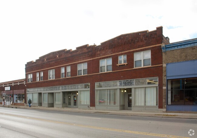
Property Record
1949 Parsons Ave, Columbus, OH 43207


NEARBY LISTINGS FOR SALE OR LEASE
Property Detail
1949 Parsons Ave
Columbus, OH
Twentieth Century Add
010-051632
1951 PARSONS AVE 20TH CENTURY ADD LOTS 114-116
Commercialnec
Franklin
X
Ohio
39049C0336K
114-1
2024
0.31 AC
2025
Southeast
006100
Columbus
17,662 SF
DEMOGRAPHICS near 1949 Parsons Ave
1 mile
3 mile
5 mile
2024 Total Population
11,282
87,895
262,516
2029 Population
11,455
89,461
265,856
Pop Growth 2024-2029
+ 1.53%
+ 1.78%
+ 1.27%
Average Age
38
38
37
2024 Total Households
4,861
39,916
114,531
HH Growth 2024-2029
+ 1.52%
+ 1.90%
+ 1.33%
Median Household Inc
$48,640
$51,321
$56,434
Avg Household Size
2.20
2.10
2.20
2024 Avg HH Vehicles
2.00
1.00
2.00
Median Home Value
$179,552
$205,094
$205,674
Median Year Built
1947
1956
1962
Nearby Places
Map Layers
Map Styles
 Street
 Aerial
Transit
 Traffic
 Biking
Places
Listings with unknown addresses are not visible on the map
- Restaurants
- Banks
- Shops
- Fitness
- Groceries
PUBLIC TRANSPORTATION
AIRPORT
Rickenbacker International
Drive
Walk
Distance
Rickenbacker International
17 min
8.6 mi
John Glenn Columbus International
Drive
Walk
Distance
John Glenn Columbus International
19 min
9.7 mi
Freight Ports
Port of Toledo
Drive
Walk
Distance
Port of Toledo
191 min
149.5 mi
Nearby Properties
Address
Land Use
TOTAL SIZE
Lot Size
Zoning
Address
Land Use
TOTAL SIZE
Lot Size
Zoning
1,949,795 SF
20.56 AC
Address
Land Use
TOTAL SIZE
Lot Size
Zoning
1,467,891 SF
10.49 AC
Address
Land Use
TOTAL SIZE
Lot Size
Zoning
382.42 AC
Address
Land Use
TOTAL SIZE
Lot Size
Zoning
717,666 SF
17.99 AC
Address
Land Use
TOTAL SIZE
Lot Size
Zoning
304,340 SF
3.86 AC
Address
Land Use
TOTAL SIZE
Lot Size
Zoning
477,854 SF
0.72 AC
Address
Land Use
TOTAL SIZE
Lot Size
Zoning
798,272 SF
9.94 AC
Address
Land Use
TOTAL SIZE
Lot Size
Zoning
832,673 SF
2.87 AC
Address
Land Use
TOTAL SIZE
Lot Size
Zoning
481,704 SF
0.92 AC
Address
Land Use
TOTAL SIZE
Lot Size
Zoning
1,113,919 SF
1.63 AC
Address
Land Use
TOTAL SIZE
Lot Size
Zoning
1,462,053 SF
0.21 AC
Address
Land Use
TOTAL SIZE
Lot Size
Zoning
484,662 SF
2.28 AC
Address
Land Use
TOTAL SIZE
Lot Size
Zoning
339,231 SF
0.73 AC
Address
Land Use
TOTAL SIZE
Lot Size
Zoning
1,013,906 SF
1 AC
Address
Land Use
TOTAL SIZE
Lot Size
Zoning
669,626 SF
0.97 AC
Address
Land Use
TOTAL SIZE
Lot Size
Zoning
459,012 SF
3.71 AC
Address
Land Use
TOTAL SIZE
Lot Size
Zoning
697,192 SF
2.72 AC
Address
Land Use
TOTAL SIZE
Lot Size
Zoning
595,932 SF
2.74 AC
Address
Land Use
TOTAL SIZE
Lot Size
Zoning
597,600 SF
68.91 AC
Address
Land Use
TOTAL SIZE
Lot Size
Zoning
513,391 SF
4.32 AC
Address
Land Use
TOTAL SIZE
Lot Size
Zoning
180,636 SF
4.33 AC
Address
Land Use
TOTAL SIZE
Lot Size
Zoning
85,000 SF
7.22 AC
Address
Land Use
TOTAL SIZE
Lot Size
Zoning
122,019 SF
0.92 AC
Address
Land Use
TOTAL SIZE
Lot Size
Zoning
472,650 SF
1.65 AC
Address
Land Use
TOTAL SIZE
Lot Size
Zoning
496,729 SF
3.47 AC
Address
Land Use
TOTAL SIZE
Lot Size
Zoning
160,696 SF
2.09 AC
Address
Land Use
TOTAL SIZE
Lot Size
Zoning
243,888 SF
0.88 AC
Address
Land Use
TOTAL SIZE
Lot Size
Zoning
360,962 SF
33.91 AC
Address
Land Use
TOTAL SIZE
Lot Size
Zoning
234,528 SF
0.80 AC
Address
Land Use
TOTAL SIZE
Lot Size
Zoning
440,454 SF
3.92 AC
The World's #1 Commercial Real Estate Marketplace
Connect with us
© 2026 CoStar Group
The information above has been obtained from sources believed reliable. While we do not doubt its accuracy we have not verified it and make no guarantee, warranty or representation about it. It is your responsibility to independently confirm its accuracy and completeness. Any projections, opinions, assumptions, or estimates used are for example only and do not represent the current or future performance of the property. The value of this transaction to you depends on tax and other factors which should be evaluated by your tax, financial, and legal advisors. You and your advisors should conduct a careful, independent investigation of the property to determine to your satisfaction the suitability of the property for your needs.