Property Record
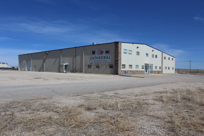
1949 Pyrite Rd, Casper, WY 82604


Property Detail
1949 Pyrite Rd
Casper, WY
AIR-RAIL IND PK (RPLT) LOT 56 COMMERCIAL
34-80-35-2-0-100700
NATRONA
Warehouse
Wyoming
B and X Area of moderate flood hazard, usually the area between the limits of the 100-year and 500-year floods.
56
2025
4.17 AC
2025
I-25 Corridor/Casper
001802
Other Market Areas
25,400 SF
NEARBY LISTINGS FOR SALE OR LEASE
DEMOGRAPHICS near 1949 Pyrite Rd
1 mile
3 mile
5 mile
2025 Total Population
76
5,304
30,175
2030 Population
78
5,412
30,542
Pop Growth 2025-2030
+ 2.63%
+ 2.04%
+ 1.22%
Average Age
46
42
40
2025 Total Households
29
2,186
12,352
HH Growth 2025-2030
+ 3.45%
+ 2.10%
+ 1.31%
Median Household Inc
$104,167
$69,556
$70,236
Avg Household Size
2.40
2.30
2.40
2025 Avg HH Vehicles
3.00
2.00
2.00
Median Home Value
$408,333
$252,226
$256,003
Median Year Built
1979
1981
1975
Nearby Places
Map Layers
Map Styles
 Street
 Aerial
Layers
 Traffic
 Biking
Places
Listings with unknown addresses are not visible on the map
- Restaurants
- Banks
- Shops
- Fitness
- Groceries
SALE & LEASE HISTORY
LISTING DATE
SALE/LEASE

Apr 05, 2021
For Lease
Nearby Properties
Address
Land Use
TOTAL SIZE
Lot Size
Zoning
Address
Land Use
TOTAL SIZE
Lot Size
Zoning
73,903 SF
31.44 AC
Address
Land Use
TOTAL SIZE
Lot Size
Zoning
88,739 SF
13.39 AC
Address
Land Use
TOTAL SIZE
Lot Size
Zoning
66,679 SF
5.50 AC
Address
Land Use
TOTAL SIZE
Lot Size
Zoning
25,200 SF
9.68 AC
Address
Land Use
TOTAL SIZE
Lot Size
Zoning
7,500 SF
6.15 AC
Address
Land Use
TOTAL SIZE
Lot Size
Zoning
4,000 SF
12.65 AC
Address
Land Use
TOTAL SIZE
Lot Size
Zoning
59,690 SF
14.68 AC
Address
Land Use
TOTAL SIZE
Lot Size
Zoning
36,000 SF
2.62 AC
Address
Land Use
TOTAL SIZE
Lot Size
Zoning
13,423 SF
28.24 AC
Address
Land Use
TOTAL SIZE
Lot Size
Zoning
800 SF
6.95 AC
Address
Land Use
TOTAL SIZE
Lot Size
Zoning
66,872 SF
9.89 AC
Address
Land Use
TOTAL SIZE
Lot Size
Zoning
28,219 SF
13.96 AC
Address
Land Use
TOTAL SIZE
Lot Size
Zoning
37,635 SF
1.78 AC
Address
Land Use
TOTAL SIZE
Lot Size
Zoning
5,880 SF
25 AC
Address
Land Use
TOTAL SIZE
Lot Size
Zoning
20,600 SF
4.38 AC
Address
Land Use
TOTAL SIZE
Lot Size
Zoning
49,626 SF
8.43 AC
Address
Land Use
TOTAL SIZE
Lot Size
Zoning
16,000 SF
1.39 AC
Address
Land Use
TOTAL SIZE
Lot Size
Zoning
54,696 SF
9.50 AC
Address
Land Use
TOTAL SIZE
Lot Size
Zoning
9,000 SF
13.59 AC
Address
Land Use
TOTAL SIZE
Lot Size
Zoning
5,028 SF
5.36 AC
Address
Land Use
TOTAL SIZE
Lot Size
Zoning
40,272 SF
10.17 AC
Address
Land Use
TOTAL SIZE
Lot Size
Zoning
14,000 SF
3.21 AC
Address
Land Use
TOTAL SIZE
Lot Size
Zoning
15,090 SF
3.25 AC
Address
Land Use
TOTAL SIZE
Lot Size
Zoning
30,320 SF
3.25 AC
Address
Land Use
TOTAL SIZE
Lot Size
Zoning
28,000 SF
2.50 AC
Address
Land Use
TOTAL SIZE
Lot Size
Zoning
27,922 SF
4.52 AC
Address
Land Use
TOTAL SIZE
Lot Size
Zoning
24,765 SF
2.76 AC
Address
Land Use
TOTAL SIZE
Lot Size
Zoning
10,680 SF
3.53 AC
Address
Land Use
TOTAL SIZE
Lot Size
Zoning
22,400 SF
4.07 AC
Address
Land Use
TOTAL SIZE
Lot Size
Zoning
13,730 SF
3.32 AC
The World's #1 Commercial Real Estate Marketplace
Connect with us
© 2026 CoStar Group
The information above has been obtained from sources believed reliable. While we do not doubt its accuracy we have not verified it and make no guarantee, warranty or representation about it. It is your responsibility to independently confirm its accuracy and completeness. Any projections, opinions, assumptions, or estimates used are for example only and do not represent the current or future performance of the property. The value of this transaction to you depends on tax and other factors which should be evaluated by your tax, financial, and legal advisors. You and your advisors should conduct a careful, independent investigation of the property to determine to your satisfaction the suitability of the property for your needs.