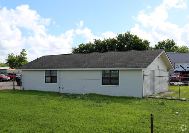
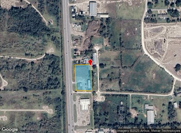
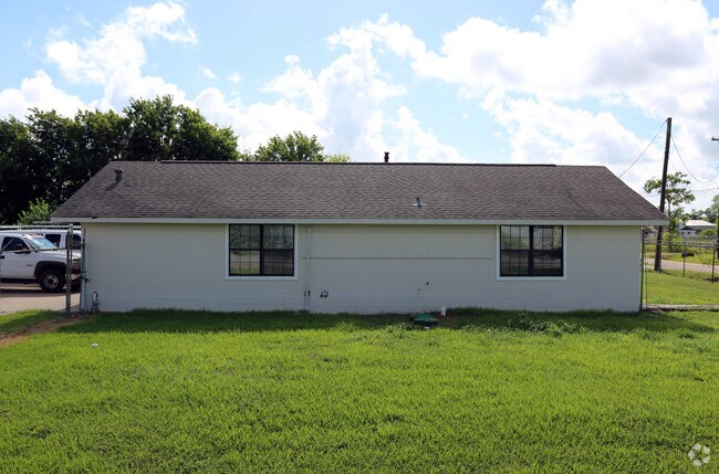
Property Record
19491 Highway 35, Alvin, TX 77511
NEARBY LISTINGS FOR SALE OR LEASE
-
-
View all Alvin listings for lease on LoopNet.com
Property Detail
19491 Highway 35
Houston-The Woodlands-Sugar Land, TX
Ryan (A0462 A C H & B)
7375-0002-000
RYAN (A0462 A C H & B) BLK B LOT 16A3 ACRES 1.29
Commercialnec
Brazoria
AE
Texas
48039C0155K
16a3
2024
1.29 AC
2025
NASA/Clear Lake
660200
Houston
3,095 SF
DEMOGRAPHICS near 19491 Highway 35
1 Mile
3 Mile
5 Mile
2024 Total Population
396
23,665
96,026
2029 Population
439
25,629
103,321
Pop Growth 2024-2029
+ 10.86%
+ 8.30%
+ 7.60%
Average Age
40
38
38
2024 Total Households
136
7,675
32,766
HH Growth 2024-2029
+ 11.03%
+ 8.36%
+ 7.70%
Median Household Inc
$86,111
$104,329
$101,557
Avg Household Size
2.80
3.00
2.90
2024 Avg HH Vehicles
2.00
2.00
2.00
Median Home Value
$403,659
$287,938
$297,295
Median Year Built
1992
1994
1993
Nearby Places
Map Layers
Map Styles
 Street
 Aerial
- Restaurants
- Banks
- Shops
- Fitness
- Groceries
PUBLIC TRANSPORTATION
AIRPORT
William P Hobby
DRIVE
WALK
Distance
William P Hobby
23 min
11.6 mi
Freight Ports
Port of Houston
DRIVE
WALK
Distance
Port of Houston
34 min
19.8 mi
SALE & LEASE HISTORY
LISTING DATE
SALE/LEASE

Jul 28, 2017
For Lease
Nearby Properties
Address
Land Use
TOTAL SIZE
Lot Size
Zoning
Address
Land Use
TOTAL SIZE
Lot Size
Zoning
40.52 AC
0017
Address
Land Use
TOTAL SIZE
Lot Size
Zoning
65,935 SF
81.27 AC
Address
Land Use
TOTAL SIZE
Lot Size
Zoning
161,803 SF
54.82 AC
Address
Land Use
TOTAL SIZE
Lot Size
Zoning
84,272 SF
16.93 AC
Address
Land Use
TOTAL SIZE
Lot Size
Zoning
113,376 SF
9.80 AC
Address
Land Use
TOTAL SIZE
Lot Size
Zoning
6,948 SF
54.94 AC
2080
Address
Land Use
TOTAL SIZE
Lot Size
Zoning
68,435 SF
5.62 AC
0041
Address
Land Use
TOTAL SIZE
Lot Size
Zoning
56,905 SF
7 AC
Address
Land Use
TOTAL SIZE
Lot Size
Zoning
Address
Land Use
TOTAL SIZE
Lot Size
Zoning
98,005 SF
4.64 AC
Address
Land Use
TOTAL SIZE
Lot Size
Zoning
36,596 SF
14.75 AC
Address
Land Use
TOTAL SIZE
Lot Size
Zoning
22,144 SF
9.27 AC
Address
Land Use
TOTAL SIZE
Lot Size
Zoning
15.68 AC
Address
Land Use
TOTAL SIZE
Lot Size
Zoning
1,920 SF
14.94 AC
Address
Land Use
TOTAL SIZE
Lot Size
Zoning
74,002 SF
9.58 AC
Address
Land Use
TOTAL SIZE
Lot Size
Zoning
94,809 SF
49.01 AC
0103
Address
Land Use
TOTAL SIZE
Lot Size
Zoning
145 SF
20.24 AC
0037
Address
Land Use
TOTAL SIZE
Lot Size
Zoning
18,800 SF
1.08 AC
Address
Land Use
TOTAL SIZE
Lot Size
Zoning
29,200 SF
3.19 AC
Address
Land Use
TOTAL SIZE
Lot Size
Zoning
140 SF
25.06 AC
0008
Address
Land Use
TOTAL SIZE
Lot Size
Zoning
63,250 SF
6.51 AC
0101
Address
Land Use
TOTAL SIZE
Lot Size
Zoning
24,000 SF
3.53 AC
0001
Address
Land Use
TOTAL SIZE
Lot Size
Zoning
22,625 SF
7 AC
Address
Land Use
TOTAL SIZE
Lot Size
Zoning
14.09 AC
Address
Land Use
TOTAL SIZE
Lot Size
Zoning
12,868 SF
1.65 AC
Address
Land Use
TOTAL SIZE
Lot Size
Zoning
60,440 SF
5 AC
7010
Address
Land Use
TOTAL SIZE
Lot Size
Zoning
94,300 SF
5 AC
Address
Land Use
TOTAL SIZE
Lot Size
Zoning
2,169 SF
9.57 AC
SFR
Address
Land Use
TOTAL SIZE
Lot Size
Zoning
56,290 SF
3.50 AC
3150
Address
Land Use
TOTAL SIZE
Lot Size
Zoning
44,241 SF
9.69 AC
The World's #1 Commercial Real Estate Marketplace
Connect with us
© 2025 CoStar Group
The information above has been obtained from sources believed reliable. While we do not doubt its accuracy we have not verified it and make no guarantee, warranty or representation about it. It is your responsibility to independently confirm its accuracy and completeness. Any projections, opinions, assumptions, or estimates used are for example only and do not represent the current or future performance of the property. The value of this transaction to you depends on tax and other factors which should be evaluated by your tax, financial, and legal advisors. You and your advisors should conduct a careful, independent investigation of the property to determine to your satisfaction the suitability of the property for your needs.