Property Record
195 Lorraine Ave, Montclair, NJ 07043


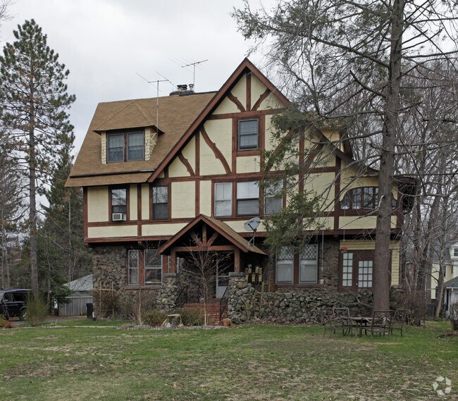
Property Detail
195 Lorraine Ave
13-01809-0000-00015
100X200
Apartment
Essex
R2
New Jersey
B and X Area of moderate flood hazard, usually the area between the limits of the 100-year and 500-year floods.
15
2025
0.46 AC
2026
Upper Essex County
016100
Northern New Jersey
4,756 SF
Newark, NJ
NEARBY LISTINGS FOR SALE OR LEASE
DEMOGRAPHICS near 195 Lorraine Ave
1 mile
3 mile
5 mile
2025 Total Population
15,884
162,960
571,746
2030 Population
16,679
170,621
589,680
Pop Growth 2025-2030
+ 5.01%
+ 4.70%
+ 3.14%
Average Age
41
42
40
2025 Total Households
5,485
62,041
207,308
HH Growth 2025-2030
+ 5.29%
+ 4.86%
+ 3.34%
Median Household Inc
$235,513
$139,776
$98,010
Avg Household Size
2.80
2.50
2.70
2025 Avg HH Vehicles
2.00
2.00
2.00
Median Home Value
$905,308
$616,917
$498,973
Median Year Built
1947
1954
1953
Nearby Places
Map Layers
Map Styles
 Street
 Aerial
Layers
 Traffic
 Biking
Places
Listings with unknown addresses are not visible on the map
- Restaurants
- Banks
- Shops
- Fitness
- Groceries
PUBLIC TRANSPORTATION
TRANSIT/SUBWAY
Upper Montclair (Montclair-Boonton Line - NJ Transit Commuter Rail (NJ Transit))
Drive
Walk
Distance
Upper Montclair (Montclair-Boonton Line - NJ Transit Commuter Rail (NJ Transit))
2 min
7 min
0.4 mi
Mountain Avenue (Montclair-Boonton Line - NJ Transit Commuter Rail (NJ Transit))
Drive
Walk
Distance
Mountain Avenue (Montclair-Boonton Line - NJ Transit Commuter Rail (NJ Transit))
2 min
13 min
0.7 mi
COMMUTER RAIL
Upper Montclair (Montclair-Boonton Line - NJ Transit Commuter Rail (NJ Transit))
Drive
Walk
Distance
Upper Montclair (Montclair-Boonton Line - NJ Transit Commuter Rail (NJ Transit))
2 min
7 min
0.4 mi
Mountain Avenue (Montclair-Boonton Line - NJ Transit Commuter Rail (NJ Transit))
Drive
Walk
Distance
Mountain Avenue (Montclair-Boonton Line - NJ Transit Commuter Rail (NJ Transit))
2 min
13 min
0.7 mi
AIRPORT
Newark Liberty International
Drive
Walk
Distance
Newark Liberty International
23 min
17.5 mi
LaGuardia
Drive
Walk
Distance
LaGuardia
43 min
24.0 mi
John F Kennedy International
Drive
Walk
Distance
John F Kennedy International
52 min
32.0 mi
Freight Ports
Maher Terminal
Drive
Walk
Distance
Maher Terminal
29 min
14.4 mi
Nearby Properties
Address
Land Use
TOTAL SIZE
Lot Size
Zoning
Address
Land Use
TOTAL SIZE
Lot Size
Zoning
5 AC
H
Address
Land Use
TOTAL SIZE
Lot Size
Zoning
28.33 AC
Address
Land Use
TOTAL SIZE
Lot Size
Zoning
1,589 SF
0.22 AC
R4
Address
Land Use
TOTAL SIZE
Lot Size
Zoning
12.54 AC
OPRP
Address
Land Use
TOTAL SIZE
Lot Size
Zoning
0.24 AC
R4
Address
Land Use
TOTAL SIZE
Lot Size
Zoning
1.12 AC
M-O
Address
Land Use
TOTAL SIZE
Lot Size
Zoning
20.43 AC
Address
Land Use
TOTAL SIZE
Lot Size
Zoning
Address
Land Use
TOTAL SIZE
Lot Size
Zoning
3.26 AC
PR
Address
Land Use
TOTAL SIZE
Lot Size
Zoning
25.88 AC
Address
Land Use
TOTAL SIZE
Lot Size
Zoning
14.54 AC
R-MF
Address
Land Use
TOTAL SIZE
Lot Size
Zoning
137,286 SF
9.30 AC
M-2
Address
Land Use
TOTAL SIZE
Lot Size
Zoning
1.50 AC
RA
Address
Land Use
TOTAL SIZE
Lot Size
Zoning
1.95 AC
RA
Address
Land Use
TOTAL SIZE
Lot Size
Zoning
3.55 AC
Address
Land Use
TOTAL SIZE
Lot Size
Zoning
9.98 AC
R-1
Address
Land Use
TOTAL SIZE
Lot Size
Zoning
6.30 AC
B
Address
Land Use
TOTAL SIZE
Lot Size
Zoning
13.82 AC
O
Address
Land Use
TOTAL SIZE
Lot Size
Zoning
7.22 AC
M-3
Address
Land Use
TOTAL SIZE
Lot Size
Zoning
4.08 AC
Address
Land Use
TOTAL SIZE
Lot Size
Zoning
25.80 AC
P
Address
Land Use
TOTAL SIZE
Lot Size
Zoning
4.09 AC
M-O
Address
Land Use
TOTAL SIZE
Lot Size
Zoning
103.46 AC
R-40
Address
Land Use
TOTAL SIZE
Lot Size
Zoning
73,436 SF
189.03 AC
R-2
Address
Land Use
TOTAL SIZE
Lot Size
Zoning
1,063 SF
14.08 AC
C-1
Address
Land Use
TOTAL SIZE
Lot Size
Zoning
21.80 AC
R-A3
Address
Land Use
TOTAL SIZE
Lot Size
Zoning
Address
Land Use
TOTAL SIZE
Lot Size
Zoning
5.06 AC
Address
Land Use
TOTAL SIZE
Lot Size
Zoning
10.72 AC
Address
Land Use
TOTAL SIZE
Lot Size
Zoning
The World's #1 Commercial Real Estate Marketplace
Connect with us
© 2026 CoStar Group
The information above has been obtained from sources believed reliable. While we do not doubt its accuracy we have not verified it and make no guarantee, warranty or representation about it. It is your responsibility to independently confirm its accuracy and completeness. Any projections, opinions, assumptions, or estimates used are for example only and do not represent the current or future performance of the property. The value of this transaction to you depends on tax and other factors which should be evaluated by your tax, financial, and legal advisors. You and your advisors should conduct a careful, independent investigation of the property to determine to your satisfaction the suitability of the property for your needs.