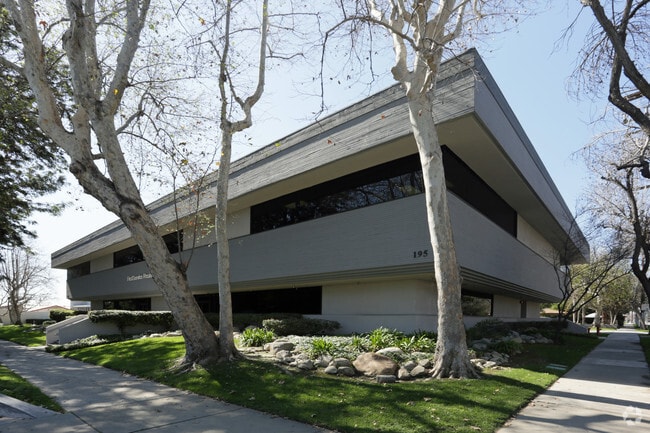
Property Record
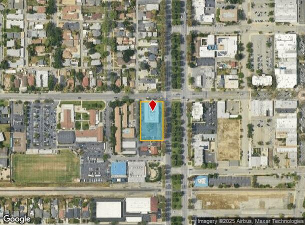
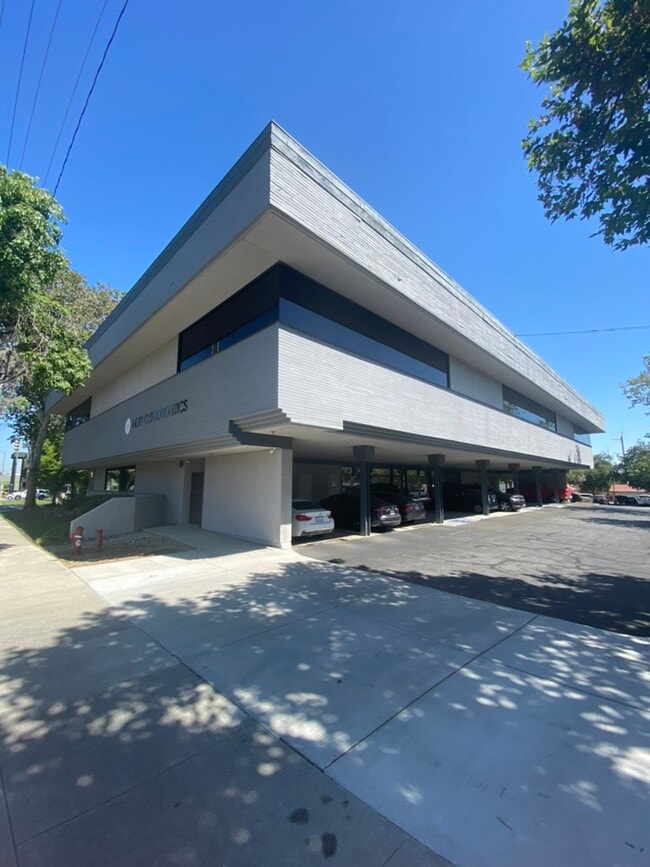
195 N Euclid Ave, Upland, CA 91786
Current Lease Availabilities
NEARBY LISTINGS FOR SALE OR LEASE
Property Detail
195 N Euclid Ave
1046-622-09
Parcel Map No 7993
Officebuilding
PARCEL MAP 7993 PARCEL 1
X
San Bernardino
06037C1750F
California
2024
0.83 AC
2025
Upland/Montclair
000826
Inland Empire (California)
17,490 SF
Riverside-San Bernardino-Ontario, CA
DEMOGRAPHICS near 195 N Euclid Ave
1 Mile
3 Mile
5 Mile
2024 Total Population
22,165
187,233
406,988
2029 Population
22,489
190,327
410,857
Pop Growth 2024-2029
+ 1.46%
+ 1.65%
+ 0.95%
Average Age
37
37
38
2024 Total Households
7,583
59,364
129,241
HH Growth 2024-2029
+ 1.53%
+ 1.75%
+ 0.99%
Median Household Inc
$73,087
$78,960
$83,428
Avg Household Size
2.80
3.10
3.00
2024 Avg HH Vehicles
2.00
2.00
2.00
Median Home Value
$580,414
$561,366
$607,948
Median Year Built
1965
1973
1976
Nearby Places
Map Layers
Map Styles
 Street
 Aerial
- Restaurants
- Banks
- Shops
- Fitness
- Groceries
PUBLIC TRANSPORTATION
TRANSIT/SUBWAY
Upland (San Bernardino Line - Southern California Regional Rail Authority (Metrolink))
DRIVE
WALK
Distance
Upland (San Bernardino Line - Southern California Regional Rail Authority (Metrolink))
1 min
11 min
0.4 mi
COMMUTER RAIL
Upland (San Bernardino Line - Southern California Regional Rail Authority (Metrolink))
DRIVE
WALK
Distance
Upland (San Bernardino Line - Southern California Regional Rail Authority (Metrolink))
1 min
10 min
0.4 mi
DRIVE
WALK
Distance
5 min
2.5 mi
AIRPORT
Ontario International
DRIVE
WALK
Distance
Ontario International
9 min
4.7 mi
John Wayne/Orange County
DRIVE
WALK
Distance
John Wayne/Orange County
50 min
40.9 mi
Long Beach (Daugherty Field)
DRIVE
WALK
Distance
Long Beach (Daugherty Field)
57 min
44.9 mi
Nearby Properties
Address
Land Use
TOTAL SIZE
Lot Size
Zoning
Address
Land Use
TOTAL SIZE
Lot Size
Zoning
376,610 SF
25.22 AC
Address
Land Use
TOTAL SIZE
Lot Size
Zoning
539,128 SF
10.24 AC
Address
Land Use
TOTAL SIZE
Lot Size
Zoning
788,560 SF
36.86 AC
Address
Land Use
TOTAL SIZE
Lot Size
Zoning
167,512 SF
8.35 AC
Address
Land Use
TOTAL SIZE
Lot Size
Zoning
251,645 SF
4.50 AC
Address
Land Use
TOTAL SIZE
Lot Size
Zoning
553,882 SF
24.59 AC
Address
Land Use
TOTAL SIZE
Lot Size
Zoning
538,944 SF
20.73 AC
Address
Land Use
TOTAL SIZE
Lot Size
Zoning
125,663 SF
7.04 AC
Address
Land Use
TOTAL SIZE
Lot Size
Zoning
218,376 SF
12.50 AC
Address
Land Use
TOTAL SIZE
Lot Size
Zoning
340,104 SF
8.95 AC
Address
Land Use
TOTAL SIZE
Lot Size
Zoning
250,200 SF
15.06 AC
Address
Land Use
TOTAL SIZE
Lot Size
Zoning
83,562 SF
10.06 AC
Address
Land Use
TOTAL SIZE
Lot Size
Zoning
249,672 SF
13.80 AC
Address
Land Use
TOTAL SIZE
Lot Size
Zoning
1.86 AC
Address
Land Use
TOTAL SIZE
Lot Size
Zoning
175,000 SF
15.24 AC
Address
Land Use
TOTAL SIZE
Lot Size
Zoning
173,531 SF
2.52 AC
Address
Land Use
TOTAL SIZE
Lot Size
Zoning
120,939 SF
3.87 AC
Address
Land Use
TOTAL SIZE
Lot Size
Zoning
180,868 SF
8.24 AC
Address
Land Use
TOTAL SIZE
Lot Size
Zoning
73,190 SF
5.43 AC
Address
Land Use
TOTAL SIZE
Lot Size
Zoning
106,212 SF
5.33 AC
Address
Land Use
TOTAL SIZE
Lot Size
Zoning
129,480 SF
6.39 AC
Address
Land Use
TOTAL SIZE
Lot Size
Zoning
112,960 SF
6.30 AC
Address
Land Use
TOTAL SIZE
Lot Size
Zoning
81,786 SF
4.05 AC
Address
Land Use
TOTAL SIZE
Lot Size
Zoning
99,345 SF
5.15 AC
Address
Land Use
TOTAL SIZE
Lot Size
Zoning
203,092 SF
10 AC
Address
Land Use
TOTAL SIZE
Lot Size
Zoning
63,862 SF
4.77 AC
Address
Land Use
TOTAL SIZE
Lot Size
Zoning
455,226 SF
18.15 AC
Address
Land Use
TOTAL SIZE
Lot Size
Zoning
240,226 SF
10.10 AC
Address
Land Use
TOTAL SIZE
Lot Size
Zoning
239,400 SF
10.69 AC
Address
Land Use
TOTAL SIZE
Lot Size
Zoning
171,446 SF
10.88 AC
The World's #1 Commercial Real Estate Marketplace
Connect with us
© 2025 CoStar Group
The information above has been obtained from sources believed reliable. While we do not doubt its accuracy we have not verified it and make no guarantee, warranty or representation about it. It is your responsibility to independently confirm its accuracy and completeness. Any projections, opinions, assumptions, or estimates used are for example only and do not represent the current or future performance of the property. The value of this transaction to you depends on tax and other factors which should be evaluated by your tax, financial, and legal advisors. You and your advisors should conduct a careful, independent investigation of the property to determine to your satisfaction the suitability of the property for your needs.