Property Record
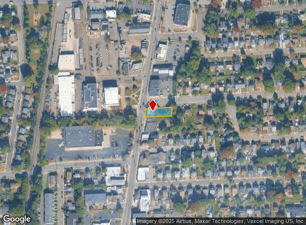
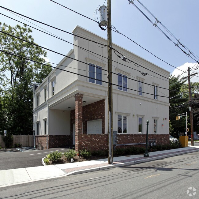
195 N Washington Ave, Bergenfield, NJ 07621

NEARBY LISTINGS FOR SALE OR LEASE
Property Detail
195 N Washington Ave
03-00027-0000-00004
51X153
Commercialnec
Bergen
AE
New Jersey
34003C0211H
4
2024
0.18 AC
2025
Palisades
003200
Northern New Jersey
1,120 SF
New York-Jersey City-White Plains, NY-NJ
DEMOGRAPHICS near 195 N Washington Ave
1 Mile
3 Mile
5 Mile
2024 Total Population
30,508
160,483
355,764
2029 Population
30,128
160,184
354,601
Pop Growth 2024-2029
(1.25%)
(0.19%)
(0.33%)
Average Age
42
41
42
2024 Total Households
10,318
54,389
126,275
HH Growth 2024-2029
(1.32%)
(0.20%)
(0.35%)
Median Household Inc
$110,033
$119,064
$110,765
Avg Household Size
2.90
2.90
2.70
2024 Avg HH Vehicles
2.00
2.00
2.00
Median Home Value
$424,070
$530,252
$538,701
Median Year Built
1953
1954
1957
Nearby Places
Map Layers
Map Styles
 Street
 Aerial
- Restaurants
- Banks
- Shops
- Fitness
- Groceries
PUBLIC TRANSPORTATION
COMMUTER RAIL
River Edge (Pascack Valley Line - NJ Transit Commuter Rail (NJ Transit))
DRIVE
WALK
Distance
River Edge (Pascack Valley Line - NJ Transit Commuter Rail (NJ Transit))
4 min
2.6 mi
Oradell (Pascack Valley Line - NJ Transit Commuter Rail (NJ Transit))
DRIVE
WALK
Distance
Oradell (Pascack Valley Line - NJ Transit Commuter Rail (NJ Transit))
5 min
3.3 mi
AIRPORT
LaGuardia
DRIVE
WALK
Distance
LaGuardia
29 min
18.0 mi
Newark Liberty International
DRIVE
WALK
Distance
Newark Liberty International
25 min
20.6 mi
Westchester County
DRIVE
WALK
Distance
Westchester County
45 min
29.9 mi
Freight Ports
NY - Red Hook Container Terminal
DRIVE
WALK
Distance
NY - Red Hook Container Terminal
39 min
22.8 mi
Nearby Properties
Address
Land Use
TOTAL SIZE
Lot Size
Zoning
Address
Land Use
TOTAL SIZE
Lot Size
Zoning
512,862 SF
14.16 AC
Address
Land Use
TOTAL SIZE
Lot Size
Zoning
572,137 SF
14.11 AC
R-D
Address
Land Use
TOTAL SIZE
Lot Size
Zoning
25,620 SF
21.37 AC
Address
Land Use
TOTAL SIZE
Lot Size
Zoning
5.22 AC
APT
Address
Land Use
TOTAL SIZE
Lot Size
Zoning
4.54 AC
R-M3
Address
Land Use
TOTAL SIZE
Lot Size
Zoning
303,434 SF
13.34 AC
Address
Land Use
TOTAL SIZE
Lot Size
Zoning
Address
Land Use
TOTAL SIZE
Lot Size
Zoning
185,878 SF
33.44 AC
B
Address
Land Use
TOTAL SIZE
Lot Size
Zoning
65,087 SF
4 AC
Address
Land Use
TOTAL SIZE
Lot Size
Zoning
343,036 SF
8.50 AC
Address
Land Use
TOTAL SIZE
Lot Size
Zoning
Address
Land Use
TOTAL SIZE
Lot Size
Zoning
1.12 AC
Address
Land Use
TOTAL SIZE
Lot Size
Zoning
47,623 SF
88.60 AC
B
Address
Land Use
TOTAL SIZE
Lot Size
Zoning
68,824 SF
34.75 AC
R-D
Address
Land Use
TOTAL SIZE
Lot Size
Zoning
7.34 AC
Address
Land Use
TOTAL SIZE
Lot Size
Zoning
16.76 AC
R3
Address
Land Use
TOTAL SIZE
Lot Size
Zoning
163.19 AC
Address
Land Use
TOTAL SIZE
Lot Size
Zoning
173,890 SF
23.80 AC
O
Address
Land Use
TOTAL SIZE
Lot Size
Zoning
21,250 SF
2.37 AC
SBD
Address
Land Use
TOTAL SIZE
Lot Size
Zoning
36.90 AC
MU
Address
Land Use
TOTAL SIZE
Lot Size
Zoning
254,512 SF
3 AC
HRO
Address
Land Use
TOTAL SIZE
Lot Size
Zoning
12.31 AC
R3
Address
Land Use
TOTAL SIZE
Lot Size
Zoning
1.78 AC
L1
Address
Land Use
TOTAL SIZE
Lot Size
Zoning
4,000 SF
27.90 AC
B3
Address
Land Use
TOTAL SIZE
Lot Size
Zoning
Address
Land Use
TOTAL SIZE
Lot Size
Zoning
82,969 SF
9.99 AC
R1
Address
Land Use
TOTAL SIZE
Lot Size
Zoning
10.76 AC
A
Address
Land Use
TOTAL SIZE
Lot Size
Zoning
Address
Land Use
TOTAL SIZE
Lot Size
Zoning
0.78 AC
B
Address
Land Use
TOTAL SIZE
Lot Size
Zoning
11.90 AC
A
The World's #1 Commercial Real Estate Marketplace
Connect with us
© 2025 CoStar Group
The information above has been obtained from sources believed reliable. While we do not doubt its accuracy we have not verified it and make no guarantee, warranty or representation about it. It is your responsibility to independently confirm its accuracy and completeness. Any projections, opinions, assumptions, or estimates used are for example only and do not represent the current or future performance of the property. The value of this transaction to you depends on tax and other factors which should be evaluated by your tax, financial, and legal advisors. You and your advisors should conduct a careful, independent investigation of the property to determine to your satisfaction the suitability of the property for your needs.