Property Record
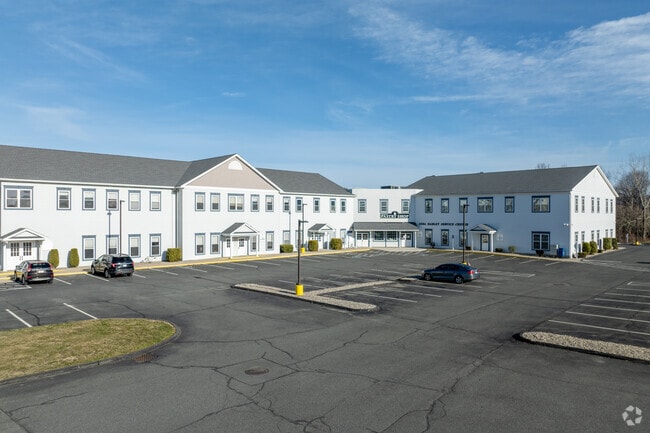
195 Russell St, Hadley, MA 01035


NEARBY LISTINGS FOR SALE OR LEASE
Property Detail
195 Russell St
HADL-000004J-000022A
Hampshire
Commercialnec
Massachusetts
2025
4.98 AC
2025
Hampshire County
821400
Hartford
31,406 SF
Springfield, MA
DEMOGRAPHICS near 195 Russell St
1 Mile
3 Mile
5 Mile
2024 Total Population
1,168
12,089
60,974
2029 Population
903
9,407
51,524
Pop Growth 2024-2029
(22.69%)
(22.19%)
(15.50%)
Average Age
44
42
36
2024 Total Households
496
5,316
19,385
HH Growth 2024-2029
(22.98%)
(22.33%)
(21.60%)
Median Household Inc
$103,409
$88,069
$73,638
Avg Household Size
2.30
2.20
2.10
2024 Avg HH Vehicles
2.00
2.00
2.00
Median Home Value
$397,092
$365,462
$394,937
Median Year Built
1960
1965
1961
Nearby Places
Map Layers
Map Styles
 Street
 Aerial
- Restaurants
- Banks
- Shops
- Fitness
- Groceries
PUBLIC TRANSPORTATION
COMMUTER RAIL
DRIVE
WALK
Distance
11 min
3.8 mi
AIRPORT
Bradley International
DRIVE
WALK
Distance
Bradley International
59 min
33.2 mi
SALE & LEASE HISTORY
LISTING DATE
SALE/LEASE

Sep 25, 2016
For Lease
May 07, 2020
For Lease
Feb 19, 2025
For Lease
Nearby Properties
Address
Land Use
TOTAL SIZE
Lot Size
Zoning
Address
Land Use
TOTAL SIZE
Lot Size
Zoning
185,998 SF
32.09 AC
I
Address
Land Use
TOTAL SIZE
Lot Size
Zoning
9,424 SF
17.24 AC
AR
Address
Land Use
TOTAL SIZE
Lot Size
Zoning
45,220 SF
31.01 AC
Address
Land Use
TOTAL SIZE
Lot Size
Zoning
141,603 SF
35.70 AC
B
Address
Land Use
TOTAL SIZE
Lot Size
Zoning
84,480 SF
6.15 AC
I
Address
Land Use
TOTAL SIZE
Lot Size
Zoning
373,881 SF
46.52 AC
B
Address
Land Use
TOTAL SIZE
Lot Size
Zoning
61,650 SF
12.37 AC
B
Address
Land Use
TOTAL SIZE
Lot Size
Zoning
14,517 SF
34.82 AC
Address
Land Use
TOTAL SIZE
Lot Size
Zoning
94,415 SF
3.83 AC
Address
Land Use
TOTAL SIZE
Lot Size
Zoning
32,231 SF
7.75 AC
Address
Land Use
TOTAL SIZE
Lot Size
Zoning
6,064 SF
19.39 AC
Address
Land Use
TOTAL SIZE
Lot Size
Zoning
94,035 SF
4.20 AC
I
Address
Land Use
TOTAL SIZE
Lot Size
Zoning
21.77 AC
GI
Address
Land Use
TOTAL SIZE
Lot Size
Zoning
127,994 SF
8.46 AC
B
Address
Land Use
TOTAL SIZE
Lot Size
Zoning
139,648 SF
13.09 AC
B
Address
Land Use
TOTAL SIZE
Lot Size
Zoning
115,090 SF
14.09 AC
B
Address
Land Use
TOTAL SIZE
Lot Size
Zoning
77,103 SF
11.45 AC
B
Address
Land Use
TOTAL SIZE
Lot Size
Zoning
98,482 SF
1.03 AC
CB
Address
Land Use
TOTAL SIZE
Lot Size
Zoning
59,471 SF
35 AC
LGT
Address
Land Use
TOTAL SIZE
Lot Size
Zoning
4.19 AC
HB
Address
Land Use
TOTAL SIZE
Lot Size
Zoning
43.55 AC
Address
Land Use
TOTAL SIZE
Lot Size
Zoning
15,130 SF
2.60 AC
B
Address
Land Use
TOTAL SIZE
Lot Size
Zoning
5.36 AC
HB
Address
Land Use
TOTAL SIZE
Lot Size
Zoning
15,140 SF
8.18 AC
Address
Land Use
TOTAL SIZE
Lot Size
Zoning
53,344 SF
9.07 AC
TC
Address
Land Use
TOTAL SIZE
Lot Size
Zoning
38,607 SF
2.39 AC
Address
Land Use
TOTAL SIZE
Lot Size
Zoning
36,258 SF
25.08 AC
B
Address
Land Use
TOTAL SIZE
Lot Size
Zoning
65,856 SF
8.34 AC
B
Address
Land Use
TOTAL SIZE
Lot Size
Zoning
85,210 SF
13.01 AC
I
Address
Land Use
TOTAL SIZE
Lot Size
Zoning
67,730 SF
4.10 AC
The World's #1 Commercial Real Estate Marketplace
Connect with us
© 2025 CoStar Group
The information above has been obtained from sources believed reliable. While we do not doubt its accuracy we have not verified it and make no guarantee, warranty or representation about it. It is your responsibility to independently confirm its accuracy and completeness. Any projections, opinions, assumptions, or estimates used are for example only and do not represent the current or future performance of the property. The value of this transaction to you depends on tax and other factors which should be evaluated by your tax, financial, and legal advisors. You and your advisors should conduct a careful, independent investigation of the property to determine to your satisfaction the suitability of the property for your needs.