Property Record
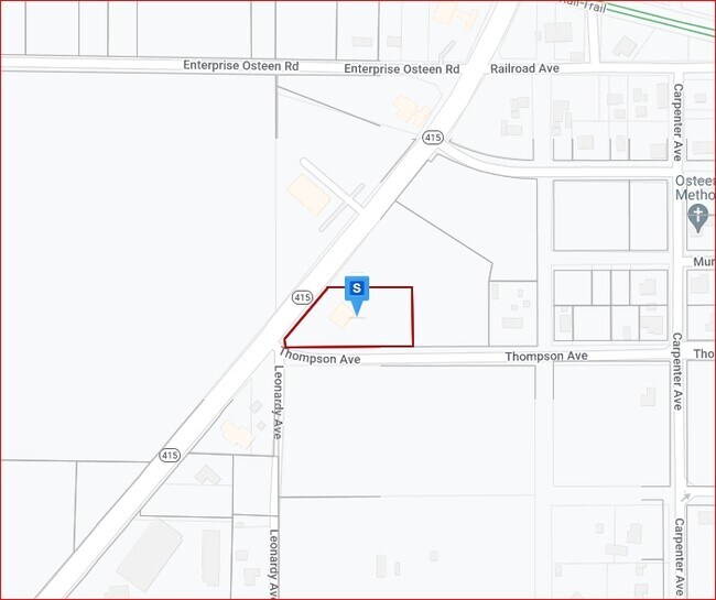
195 S State Road 415, Osteen, FL 32764


NEARBY LISTINGS FOR SALE OR LEASE
Property Detail
195 S State Road 415
Deltona-Daytona Beach-Ormond Beach, FL
Osteen Mb
9218-06-12-0014
S 200 FT LOT 2 LYING E OF SR 415 BLK 12 OSTEEN MB 12 PG 93 EXC TRIANGLE FOR NEW R/W IN S 32.41 FT ON W/L OF W 21.87 FT ON S/L PER OR 4293 PG 4215 PER OR 5846 PG 1051 PER OR 6161 PGS 4800-4802 INC PER OR 8253 PG 1046
Restaurantbuilding
Volusia
X
Florida
12127C0760K
2
2025
1.50 AC
2026
SE Volusia County
091005
Deltona/Daytona Beach
3,348 SF
DEMOGRAPHICS near 195 S State Road 415
1 Mile
3 Mile
5 Mile
2024 Total Population
1,407
9,763
33,971
2029 Population
1,566
10,913
37,334
Pop Growth 2024-2029
+ 11.30%
+ 11.78%
+ 9.90%
Average Age
46
41
41
2024 Total Households
554
3,421
12,030
HH Growth 2024-2029
+ 11.55%
+ 11.90%
+ 10.06%
Median Household Inc
$71,886
$71,720
$68,674
Avg Household Size
2.40
2.80
2.80
2024 Avg HH Vehicles
2.00
2.00
2.00
Median Home Value
$336,785
$237,694
$232,334
Median Year Built
1989
1991
1989
Nearby Places
Map Layers
Map Styles
 Street
 Aerial
- Restaurants
- Banks
- Shops
- Fitness
- Groceries
PUBLIC TRANSPORTATION
COMMUTER RAIL
Sanford Amtrak Auto Train Station (Auto Train - Amtrak)
DRIVE
WALK
Distance
Sanford Amtrak Auto Train Station (Auto Train - Amtrak)
18 min
9.9 mi
AIRPORT
Orlando Sanford International
DRIVE
WALK
Distance
Orlando Sanford International
16 min
10.1 mi
Daytona Beach International
DRIVE
WALK
Distance
Daytona Beach International
43 min
26.4 mi
Freight Ports
Port Canaveral
DRIVE
WALK
Distance
Port Canaveral
87 min
61.5 mi
Nearby Properties
Address
Land Use
TOTAL SIZE
Lot Size
Zoning
Address
Land Use
TOTAL SIZE
Lot Size
Zoning
224,577 SF
24.64 AC
RR
Address
Land Use
TOTAL SIZE
Lot Size
Zoning
104,514 SF
33.32 AC
P
Address
Land Use
TOTAL SIZE
Lot Size
Zoning
105,535 SF
13.05 AC
P
Address
Land Use
TOTAL SIZE
Lot Size
Zoning
56,243 SF
7.57 AC
C1
Address
Land Use
TOTAL SIZE
Lot Size
Zoning
8,046 SF
269.35 AC
A1
Address
Land Use
TOTAL SIZE
Lot Size
Zoning
38,144 SF
52 AC
A3
Address
Land Use
TOTAL SIZE
Lot Size
Zoning
25,531 SF
14.76 AC
01A3
Address
Land Use
TOTAL SIZE
Lot Size
Zoning
48 AC
A2
Address
Land Use
TOTAL SIZE
Lot Size
Zoning
641 AC
RC
Address
Land Use
TOTAL SIZE
Lot Size
Zoning
640 AC
C
Address
Land Use
TOTAL SIZE
Lot Size
Zoning
578.80 AC
RC
Address
Land Use
TOTAL SIZE
Lot Size
Zoning
516 AC
FR
Address
Land Use
TOTAL SIZE
Lot Size
Zoning
546.75 AC
C
Address
Land Use
TOTAL SIZE
Lot Size
Zoning
545 AC
C
Address
Land Use
TOTAL SIZE
Lot Size
Zoning
5,000 SF
481.25 AC
MH3
Address
Land Use
TOTAL SIZE
Lot Size
Zoning
12,136 SF
118.54 AC
RR
Address
Land Use
TOTAL SIZE
Lot Size
Zoning
19,846 SF
5.07 AC
Address
Land Use
TOTAL SIZE
Lot Size
Zoning
13,581 SF
5.41 AC
01A1
Address
Land Use
TOTAL SIZE
Lot Size
Zoning
31,970 SF
7.58 AC
A3
Address
Land Use
TOTAL SIZE
Lot Size
Zoning
362.30 AC
A1
Address
Land Use
TOTAL SIZE
Lot Size
Zoning
358.56 AC
A1
Address
Land Use
TOTAL SIZE
Lot Size
Zoning
11.59 AC
01A1
Address
Land Use
TOTAL SIZE
Lot Size
Zoning
16,162 SF
1.76 AC
C1
Address
Land Use
TOTAL SIZE
Lot Size
Zoning
6,272 SF
1.64 AC
C1
Address
Land Use
TOTAL SIZE
Lot Size
Zoning
45 AC
C
Address
Land Use
TOTAL SIZE
Lot Size
Zoning
8,866 SF
0.98 AC
BPUD
Address
Land Use
TOTAL SIZE
Lot Size
Zoning
14,762 SF
1.80 AC
R5
Address
Land Use
TOTAL SIZE
Lot Size
Zoning
16,562 SF
6.59 AC
01B5
Address
Land Use
TOTAL SIZE
Lot Size
Zoning
58,728 SF
13.12 AC
C1
Address
Land Use
TOTAL SIZE
Lot Size
Zoning
7,684 SF
1.52 AC
The World's #1 Commercial Real Estate Marketplace
Connect with us
© 2026 CoStar Group
The information above has been obtained from sources believed reliable. While we do not doubt its accuracy we have not verified it and make no guarantee, warranty or representation about it. It is your responsibility to independently confirm its accuracy and completeness. Any projections, opinions, assumptions, or estimates used are for example only and do not represent the current or future performance of the property. The value of this transaction to you depends on tax and other factors which should be evaluated by your tax, financial, and legal advisors. You and your advisors should conduct a careful, independent investigation of the property to determine to your satisfaction the suitability of the property for your needs.