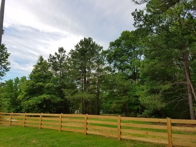
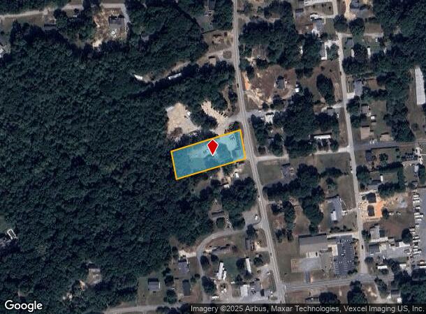
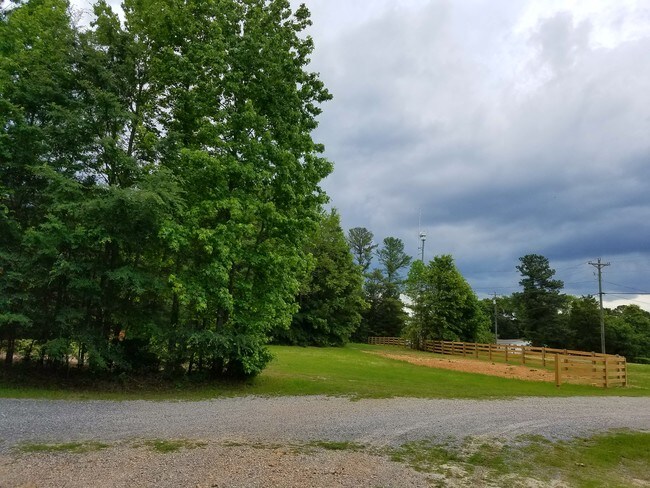
Property Record
195 Sutton Rd S, Fort Mill, SC 29708
NEARBY LISTINGS FOR SALE OR LEASE
Property Detail
195 Sutton Rd S
6580000044
SUTTON RD (1AC)
Residentialnec
York
X
South Carolina
45091C0213F
1 AC
2025
York County
2025
Charlotte
061004
Charlotte-Concord-Gastonia, NC-SC
1,029 SF
DEMOGRAPHICS near 195 Sutton Rd S
1 mile
3 mile
5 mile
2024 Total Population
6,017
43,428
118,914
2029 Population
6,877
48,996
133,965
Pop Growth 2024-2029
+ 14.29%
+ 12.82%
+ 12.66%
Average Age
36
38
39
2024 Total Households
2,142
17,026
45,813
HH Growth 2024-2029
+ 14.66%
+ 13.09%
+ 12.92%
Median Household Inc
$107,855
$88,448
$91,762
Avg Household Size
2.80
2.50
2.60
2024 Avg HH Vehicles
2.00
2.00
2.00
Median Home Value
$444,007
$352,480
$353,604
Median Year Built
2004
2001
2002
Nearby Places
Map Layers
Map Styles
 Street
 Aerial
Transit
 Traffic
 Biking
Places
Listings with unknown addresses are not visible on the map
- Restaurants
- Banks
- Shops
- Fitness
- Groceries
PUBLIC TRANSPORTATION
AIRPORT
Charlotte/Douglas International
Drive
Walk
Distance
Charlotte/Douglas International
31 min
17.9 mi
Freight Ports
North Charleston Terminal
Drive
Walk
Distance
North Charleston Terminal
203 min
181.6 mi
SALE & LEASE HISTORY
LISTING DATE
SALE/LEASE

May 30, 2017
For Sale
May 21, 2018
For Sale
Apr 06, 2018
For Sale
Nearby Properties
Address
Land Use
TOTAL SIZE
Lot Size
Zoning
Address
Land Use
TOTAL SIZE
Lot Size
Zoning
18,192 SF
17.98 AC
MF15
Address
Land Use
TOTAL SIZE
Lot Size
Zoning
13,486 SF
14.27 AC
GC
Address
Land Use
TOTAL SIZE
Lot Size
Zoning
216,000 SF
23.16 AC
Address
Land Use
TOTAL SIZE
Lot Size
Zoning
24,164 SF
9.50 AC
GC
Address
Land Use
TOTAL SIZE
Lot Size
Zoning
64,338 SF
0.83 AC
Address
Land Use
TOTAL SIZE
Lot Size
Zoning
178,585 SF
17.44 AC
Address
Land Use
TOTAL SIZE
Lot Size
Zoning
167.49 AC
MULTIPLEZ
Address
Land Use
TOTAL SIZE
Lot Size
Zoning
108,597 SF
14.55 AC
Address
Land Use
TOTAL SIZE
Lot Size
Zoning
64,113 SF
6.69 AC
Address
Land Use
TOTAL SIZE
Lot Size
Zoning
197,864 SF
39.37 AC
Address
Land Use
TOTAL SIZE
Lot Size
Zoning
79,600 SF
9.58 AC
Address
Land Use
TOTAL SIZE
Lot Size
Zoning
40,532 SF
9.96 AC
SF5
Address
Land Use
TOTAL SIZE
Lot Size
Zoning
598,425 SF
102 AC
ID
Address
Land Use
TOTAL SIZE
Lot Size
Zoning
26,733 SF
34.66 AC
PD
Address
Land Use
TOTAL SIZE
Lot Size
Zoning
28,569 SF
0.39 AC
Address
Land Use
TOTAL SIZE
Lot Size
Zoning
Address
Land Use
TOTAL SIZE
Lot Size
Zoning
25,554 SF
14.18 AC
PD
Address
Land Use
TOTAL SIZE
Lot Size
Zoning
18,990 SF
0.23 AC
Address
Land Use
TOTAL SIZE
Lot Size
Zoning
131,716 SF
13.89 AC
Address
Land Use
TOTAL SIZE
Lot Size
Zoning
48,912 SF
14.66 AC
Address
Land Use
TOTAL SIZE
Lot Size
Zoning
16,872 SF
19.80 AC
PUD
Address
Land Use
TOTAL SIZE
Lot Size
Zoning
19,426 SF
16.39 AC
PUD
Address
Land Use
TOTAL SIZE
Lot Size
Zoning
280,000 SF
35.63 AC
ID
Address
Land Use
TOTAL SIZE
Lot Size
Zoning
10.57 AC
Address
Land Use
TOTAL SIZE
Lot Size
Zoning
47,896 SF
10.66 AC
Address
Land Use
TOTAL SIZE
Lot Size
Zoning
162,218 SF
4.83 AC
Address
Land Use
TOTAL SIZE
Lot Size
Zoning
18.96 AC
TND
Address
Land Use
TOTAL SIZE
Lot Size
Zoning
77,363 SF
11.05 AC
Address
Land Use
TOTAL SIZE
Lot Size
Zoning
12,960 SF
16.25 AC
GC
Address
Land Use
TOTAL SIZE
Lot Size
Zoning
9,727 SF
7.33 AC
RDI
The World's #1 Commercial Real Estate Marketplace
Connect with us
© 2026 CoStar Group
The information above has been obtained from sources believed reliable. While we do not doubt its accuracy we have not verified it and make no guarantee, warranty or representation about it. It is your responsibility to independently confirm its accuracy and completeness. Any projections, opinions, assumptions, or estimates used are for example only and do not represent the current or future performance of the property. The value of this transaction to you depends on tax and other factors which should be evaluated by your tax, financial, and legal advisors. You and your advisors should conduct a careful, independent investigation of the property to determine to your satisfaction the suitability of the property for your needs.