Property Record
1950 Post Rd, Darien, CT 06820

Property Detail
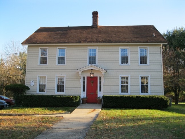
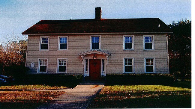
1950 Post Rd
Storebuilding
Fairfield
X
Connecticut
09001C0536G
0.73 AC
2025
Darien
2025
Westchester/So Connecticut
030300
Bridgeport-Stamford-Danbury, CT
13,744 SF
DARI-000051-000000-000040
NEARBY LISTINGS FOR SALE OR LEASE
DEMOGRAPHICS near 1950 Post Rd
1 mile
3 mile
5 mile
2024 Total Population
6,096
94,477
202,398
2029 Population
6,112
95,367
203,394
Pop Growth 2024-2029
+ 0.26%
+ 0.94%
+ 0.49%
Average Age
38
38
39
2024 Total Households
1,978
37,695
77,764
HH Growth 2024-2029
+ 0.20%
+ 1.21%
+ 0.68%
Median Household Inc
$226,772
$107,332
$103,669
Avg Household Size
3.10
2.40
2.50
2024 Avg HH Vehicles
2.00
2.00
2.00
Median Home Value
$1,071,933
$678,273
$661,738
Median Year Built
1955
1970
1970
Nearby Places
Map Layers
Map Styles
 Street
 Aerial
Transit
 Traffic
 Biking
Places
Listings with unknown addresses are not visible on the map
- Restaurants
- Banks
- Shops
- Fitness
- Groceries
PUBLIC TRANSPORTATION
COMMUTER RAIL
Noroton Heights Station (New Haven Line - Metro-North Commuter Railroad Company (Metro-North))
Drive
Walk
Distance
Noroton Heights Station (New Haven Line - Metro-North Commuter Railroad Company (Metro-North))
3 min
1.2 mi
Darien Station (New Haven Line - Metro-North Commuter Railroad Company (Metro-North))
Drive
Walk
Distance
Darien Station (New Haven Line - Metro-North Commuter Railroad Company (Metro-North))
4 min
1.6 mi
AIRPORT
Westchester County
Drive
Walk
Distance
Westchester County
27 min
15.8 mi
LaGuardia
Drive
Walk
Distance
LaGuardia
54 min
35.0 mi
Freight Ports
Port of New Haven
Drive
Walk
Distance
Port of New Haven
56 min
38.5 mi
Nearby Properties
Address
Land Use
TOTAL SIZE
Lot Size
Zoning
Address
Land Use
TOTAL SIZE
Lot Size
Zoning
8.91 AC
DC
Address
Land Use
TOTAL SIZE
Lot Size
Zoning
336,000 SF
40 AC
MU
Address
Land Use
TOTAL SIZE
Lot Size
Zoning
5.10 AC
MXD
Address
Land Use
TOTAL SIZE
Lot Size
Zoning
Address
Land Use
TOTAL SIZE
Lot Size
Zoning
352,296 SF
CC
Address
Land Use
TOTAL SIZE
Lot Size
Zoning
344,483 SF
CC
Address
Land Use
TOTAL SIZE
Lot Size
Zoning
543,005 SF
2.23 AC
RHD
Address
Land Use
TOTAL SIZE
Lot Size
Zoning
4.13 AC
CC
Address
Land Use
TOTAL SIZE
Lot Size
Zoning
358,662 SF
CC
Address
Land Use
TOTAL SIZE
Lot Size
Zoning
46,302 SF
23.50 AC
MG
Address
Land Use
TOTAL SIZE
Lot Size
Zoning
9.62 AC
MZN
Address
Land Use
TOTAL SIZE
Lot Size
Zoning
359,686 SF
1.67 AC
CCN
Address
Land Use
TOTAL SIZE
Lot Size
Zoning
377,754 SF
2.06 AC
PD
Address
Land Use
TOTAL SIZE
Lot Size
Zoning
79.29 AC
P
Address
Land Use
TOTAL SIZE
Lot Size
Zoning
32.68 AC
MD
Address
Land Use
TOTAL SIZE
Lot Size
Zoning
8.21 AC
CWD
Address
Land Use
TOTAL SIZE
Lot Size
Zoning
369,364 SF
2.50 AC
SRDN
Address
Land Use
TOTAL SIZE
Lot Size
Zoning
304,617 SF
CI
Address
Land Use
TOTAL SIZE
Lot Size
Zoning
0.49 AC
CC
Address
Land Use
TOTAL SIZE
Lot Size
Zoning
304,345 SF
1.15 AC
PD
Address
Land Use
TOTAL SIZE
Lot Size
Zoning
308,621 SF
CI
Address
Land Use
TOTAL SIZE
Lot Size
Zoning
32.06 AC
DMR
Address
Land Use
TOTAL SIZE
Lot Size
Zoning
235,186 SF
1.29 AC
CG
Address
Land Use
TOTAL SIZE
Lot Size
Zoning
3.14 AC
RH
Address
Land Use
TOTAL SIZE
Lot Size
Zoning
243,000 SF
3.02 AC
CG
Address
Land Use
TOTAL SIZE
Lot Size
Zoning
334,905 SF
2.52 AC
MXD
Address
Land Use
TOTAL SIZE
Lot Size
Zoning
223,502 SF
0.50 AC
CC
Address
Land Use
TOTAL SIZE
Lot Size
Zoning
1.44 AC
SRDN
Address
Land Use
TOTAL SIZE
Lot Size
Zoning
4.53 AC
RH
Address
Land Use
TOTAL SIZE
Lot Size
Zoning
5.18 AC
CC
The World's #1 Commercial Real Estate Marketplace
Connect with us
© 2026 CoStar Group
The information above has been obtained from sources believed reliable. While we do not doubt its accuracy we have not verified it and make no guarantee, warranty or representation about it. It is your responsibility to independently confirm its accuracy and completeness. Any projections, opinions, assumptions, or estimates used are for example only and do not represent the current or future performance of the property. The value of this transaction to you depends on tax and other factors which should be evaluated by your tax, financial, and legal advisors. You and your advisors should conduct a careful, independent investigation of the property to determine to your satisfaction the suitability of the property for your needs.