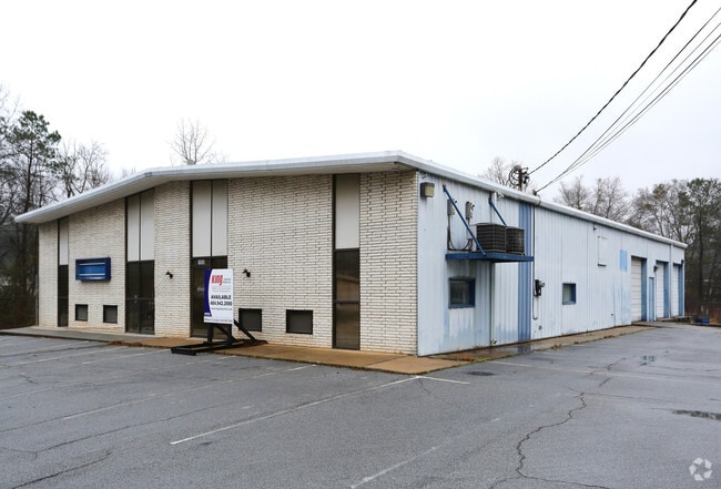
Property Record
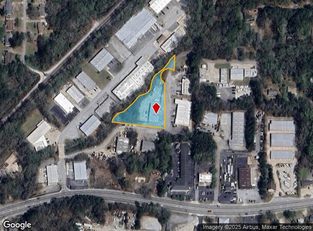
1950 Royal Industrial Blvd, Austell, GA 30106
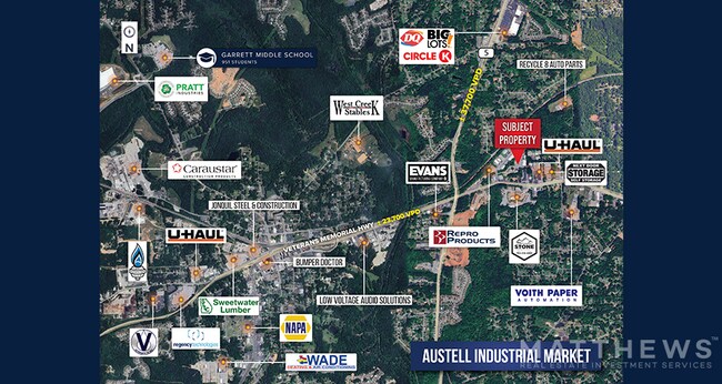

NEARBY LISTINGS FOR SALE OR LEASE
Property Detail
1950 Royal Industrial Blvd
Warehouse
Cobb
AE
Georgia
13067C0203H
1.44 AC
2025
I-20 W/Douglasville
2025
Atlanta
031306
Atlanta-Sandy Springs-Roswell, GA
6,300 SF
19-1303-0-016-0
DEMOGRAPHICS near 1950 Royal Industrial Blvd
1 Mile
3 Mile
5 Mile
2024 Total Population
5,770
56,183
148,338
2029 Population
5,888
57,319
151,593
Pop Growth 2024-2029
+ 2.05%
+ 2.02%
+ 2.19%
Average Age
38
38
38
2024 Total Households
2,046
21,108
54,623
HH Growth 2024-2029
+ 2.05%
+ 2.03%
+ 2.18%
Median Household Inc
$73,672
$64,354
$67,326
Avg Household Size
2.80
2.60
2.60
2024 Avg HH Vehicles
2.00
2.00
2.00
Median Home Value
$226,194
$220,413
$242,703
Median Year Built
1973
1984
1987
Nearby Places
Map Layers
Map Styles
 Street
 Aerial
- Restaurants
- Banks
- Shops
- Fitness
- Groceries
PUBLIC TRANSPORTATION
AIRPORT
Hartsfield - Jackson Atlanta International
DRIVE
WALK
Distance
Hartsfield - Jackson Atlanta International
39 min
25.2 mi
SALE & LEASE HISTORY
LISTING DATE
SALE/LEASE

Jun 19, 2024
For Sale
Dec 05, 2017
For Lease
Apr 26, 2021
For Lease
Apr 26, 2021
For Sale
Nearby Properties
Address
Land Use
TOTAL SIZE
Lot Size
Zoning
Address
Land Use
TOTAL SIZE
Lot Size
Zoning
494,972 SF
25.60 AC
CF
Address
Land Use
TOTAL SIZE
Lot Size
Zoning
403,898 SF
37.53 AC
RM-12
Address
Land Use
TOTAL SIZE
Lot Size
Zoning
840,110 SF
53.36 AC
PUD
Address
Land Use
TOTAL SIZE
Lot Size
Zoning
25,956 SF
12.78 AC
PVC
Address
Land Use
TOTAL SIZE
Lot Size
Zoning
320,073 SF
38.78 AC
R-MF
Address
Land Use
TOTAL SIZE
Lot Size
Zoning
272,170 SF
26.40 AC
RM-12
Address
Land Use
TOTAL SIZE
Lot Size
Zoning
318,456 SF
30.91 AC
R-MF
Address
Land Use
TOTAL SIZE
Lot Size
Zoning
307,169 SF
30.13 AC
LI
Address
Land Use
TOTAL SIZE
Lot Size
Zoning
285,933 SF
46.22 AC
R-MF
Address
Land Use
TOTAL SIZE
Lot Size
Zoning
238,984 SF
17.51 AC
RM-12
Address
Land Use
TOTAL SIZE
Lot Size
Zoning
Address
Land Use
TOTAL SIZE
Lot Size
Zoning
209,649 SF
13.51 AC
RM-12
Address
Land Use
TOTAL SIZE
Lot Size
Zoning
240,612 SF
23.22 AC
R-6
Address
Land Use
TOTAL SIZE
Lot Size
Zoning
219,402 SF
10.33 AC
RM-12
Address
Land Use
TOTAL SIZE
Lot Size
Zoning
380,000 SF
33.97 AC
IL
Address
Land Use
TOTAL SIZE
Lot Size
Zoning
151,436 SF
11.42 AC
RM-12
Address
Land Use
TOTAL SIZE
Lot Size
Zoning
179,048 SF
25.97 AC
RM-12
Address
Land Use
TOTAL SIZE
Lot Size
Zoning
280,670 SF
23 AC
PVC
Address
Land Use
TOTAL SIZE
Lot Size
Zoning
118,069 SF
0.38 AC
OI
Address
Land Use
TOTAL SIZE
Lot Size
Zoning
312,093 SF
19.79 AC
PUD
Address
Land Use
TOTAL SIZE
Lot Size
Zoning
3.46 AC
RM-12
Address
Land Use
TOTAL SIZE
Lot Size
Zoning
312,240 SF
24.58 AC
PUD
Address
Land Use
TOTAL SIZE
Lot Size
Zoning
225,600 SF
50.68 AC
LI-R
Address
Land Use
TOTAL SIZE
Lot Size
Zoning
122,697 SF
13.02 AC
PUD
Address
Land Use
TOTAL SIZE
Lot Size
Zoning
284,307 SF
15.75 AC
LI-R
Address
Land Use
TOTAL SIZE
Lot Size
Zoning
198,052 SF
24.52 AC
NRC/CRC
Address
Land Use
TOTAL SIZE
Lot Size
Zoning
109,072 SF
15.23 AC
NRC
Address
Land Use
TOTAL SIZE
Lot Size
Zoning
92,468 SF
13.69 AC
RM-8
Address
Land Use
TOTAL SIZE
Lot Size
Zoning
78.60 AC
R20
Address
Land Use
TOTAL SIZE
Lot Size
Zoning
83,314 SF
15.74 AC
NRC
The World's #1 Commercial Real Estate Marketplace
Connect with us
© 2025 CoStar Group
The information above has been obtained from sources believed reliable. While we do not doubt its accuracy we have not verified it and make no guarantee, warranty or representation about it. It is your responsibility to independently confirm its accuracy and completeness. Any projections, opinions, assumptions, or estimates used are for example only and do not represent the current or future performance of the property. The value of this transaction to you depends on tax and other factors which should be evaluated by your tax, financial, and legal advisors. You and your advisors should conduct a careful, independent investigation of the property to determine to your satisfaction the suitability of the property for your needs.