Property Record
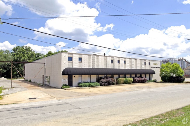
1950 Walton Rd, Saint Louis, MO 63114


NEARBY LISTINGS FOR SALE OR LEASE
Property Detail
1950 Walton Rd
Industrialgeneral
St. Louis
X
Missouri
29189C0203K
1.23 AC
2024
Innerbelt E of 170
2025
St. Louis
214300
St. Louis, MO-IL
18,360 SF
15K-21-0256
DEMOGRAPHICS near 1950 Walton Rd
1 mile
3 mile
5 mile
2024 Total Population
10,075
103,399
265,943
2029 Population
9,919
102,429
263,667
Pop Growth 2024-2029
(1.55%)
(0.94%)
(0.86%)
Average Age
40
40
39
2024 Total Households
4,354
44,263
113,653
HH Growth 2024-2029
(1.63%)
(0.90%)
(0.94%)
Median Household Inc
$44,559
$54,975
$54,416
Avg Household Size
2.20
2.20
2.20
2024 Avg HH Vehicles
2.00
2.00
2.00
Median Home Value
$110,789
$150,209
$180,074
Median Year Built
1949
1953
1954
Nearby Places
Map Layers
Map Styles
 Street
 Aerial
Transit
 Traffic
 Biking
Places
Listings with unknown addresses are not visible on the map
- Restaurants
- Banks
- Shops
- Fitness
- Groceries
PUBLIC TRANSPORTATION
COMMUTER RAIL
Rock Road (Lambert Airport Shiloh-Scott - St. Louis MetroLink (MetroLink))
Drive
Walk
Distance
Rock Road (Lambert Airport Shiloh-Scott - St. Louis MetroLink (MetroLink))
8 min
3.5 mi
Um St. Louis South (Lambert Airport Shiloh-Scott - St. Louis MetroLink (MetroLink))
Drive
Walk
Distance
Um St. Louis South (Lambert Airport Shiloh-Scott - St. Louis MetroLink (MetroLink))
8 min
3.8 mi
AIRPORT
St Louis Lambert International
Drive
Walk
Distance
St Louis Lambert International
11 min
6.4 mi
Scott AFB/Midamerica St Louis
Drive
Walk
Distance
Scott AFB/Midamerica St Louis
56 min
38.6 mi
Freight Ports
Port Milwaukee
Drive
Walk
Distance
Port Milwaukee
433 min
380.9 mi
SALE & LEASE HISTORY
LISTING DATE
SALE/LEASE

Sep 25, 2016
For Lease
Nearby Properties
Address
Land Use
TOTAL SIZE
Lot Size
Zoning
Address
Land Use
TOTAL SIZE
Lot Size
Zoning
1,053,686 SF
31.40 AC
43M-1
Address
Land Use
TOTAL SIZE
Lot Size
Zoning
5,898 SF
21.62 AC
R2
Address
Land Use
TOTAL SIZE
Lot Size
Zoning
72,612 SF
118.34 AC
3INSTU
Address
Land Use
TOTAL SIZE
Lot Size
Zoning
516,414 SF
2.61 AC
14C-2
Address
Land Use
TOTAL SIZE
Lot Size
Zoning
52.13 AC
42PA
Address
Land Use
TOTAL SIZE
Lot Size
Zoning
5,551 SF
0.72 AC
14HDC
Address
Land Use
TOTAL SIZE
Lot Size
Zoning
385,676 SF
3.04 AC
C4
Address
Land Use
TOTAL SIZE
Lot Size
Zoning
201,879 SF
29.52 AC
82RO
Address
Land Use
TOTAL SIZE
Lot Size
Zoning
272,933 SF
0.82 AC
14PUD
Address
Land Use
TOTAL SIZE
Lot Size
Zoning
476,403 SF
1.40 AC
14HDC
Address
Land Use
TOTAL SIZE
Lot Size
Zoning
330,896 SF
2.68 AC
14HDC
Address
Land Use
TOTAL SIZE
Lot Size
Zoning
272,940 SF
0.87 AC
14PUD
Address
Land Use
TOTAL SIZE
Lot Size
Zoning
1.33 AC
C4
Address
Land Use
TOTAL SIZE
Lot Size
Zoning
33,004 SF
1.53 AC
14HDC
Address
Land Use
TOTAL SIZE
Lot Size
Zoning
262,446 SF
1.97 AC
14S-1
Address
Land Use
TOTAL SIZE
Lot Size
Zoning
235,785 SF
1.95 AC
C4
Address
Land Use
TOTAL SIZE
Lot Size
Zoning
233,748 SF
0.67 AC
14PUD
Address
Land Use
TOTAL SIZE
Lot Size
Zoning
642,298 SF
1.78 AC
14PUD
Address
Land Use
TOTAL SIZE
Lot Size
Zoning
212,613 SF
1 AC
C4
Address
Land Use
TOTAL SIZE
Lot Size
Zoning
479,457 SF
1.20 AC
14SDD
Address
Land Use
TOTAL SIZE
Lot Size
Zoning
222,517 SF
6.77 AC
C2
Address
Land Use
TOTAL SIZE
Lot Size
Zoning
134,716 SF
15.56 AC
33G
Address
Land Use
TOTAL SIZE
Lot Size
Zoning
19.40 AC
57PA
Address
Land Use
TOTAL SIZE
Lot Size
Zoning
348,233 SF
23.68 AC
Address
Land Use
TOTAL SIZE
Lot Size
Zoning
128,798 SF
0.73 AC
C4
Address
Land Use
TOTAL SIZE
Lot Size
Zoning
386,784 SF
6.50 AC
57HDR/O
Address
Land Use
TOTAL SIZE
Lot Size
Zoning
249,369 SF
6 AC
57HDR/O
Address
Land Use
TOTAL SIZE
Lot Size
Zoning
160,628 SF
1.47 AC
82R0
Address
Land Use
TOTAL SIZE
Lot Size
Zoning
57,010 SF
2.42 AC
57GC
Address
Land Use
TOTAL SIZE
Lot Size
Zoning
42.40 AC
M2
The World's #1 Commercial Real Estate Marketplace
Connect with us
© 2026 CoStar Group
The information above has been obtained from sources believed reliable. While we do not doubt its accuracy we have not verified it and make no guarantee, warranty or representation about it. It is your responsibility to independently confirm its accuracy and completeness. Any projections, opinions, assumptions, or estimates used are for example only and do not represent the current or future performance of the property. The value of this transaction to you depends on tax and other factors which should be evaluated by your tax, financial, and legal advisors. You and your advisors should conduct a careful, independent investigation of the property to determine to your satisfaction the suitability of the property for your needs.