Property Record
19501 Chaparral Rd, Canyon, TX 79015
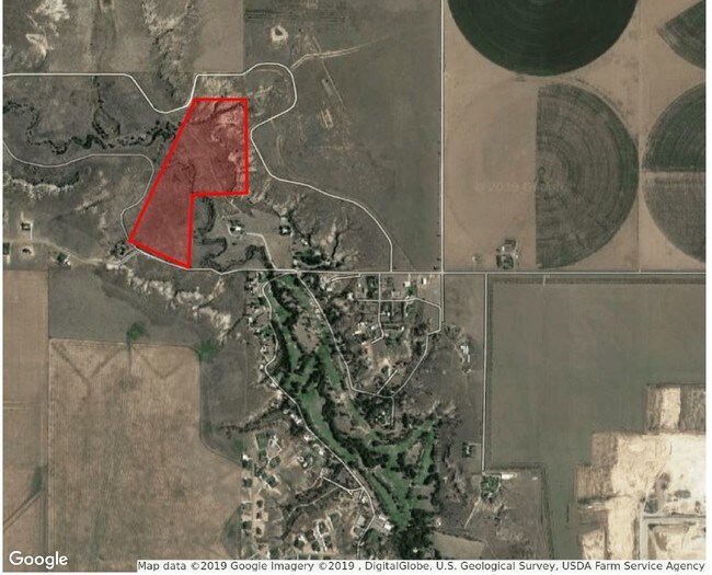

Property Detail
19501 Chaparral Rd
R-645-0050-0001-0
SECT 5 H & G N BLK B5, CANYON CITY CLUB IN E/2 OF SECT LYING S & E OF CHAPARRAL RD LESS SOLD TRS, 95.0900 ACRES
Countryclub
RANDALL
AE The base floodplain where base flood elevations are provided. AE Zones are now used on new format FIRMs instead of A1-A30 Zones.
Texas
2024
95.09 AC
2025
Amarillo
021708
Other Market Areas
7,260 SF
Amarillo, TX
NEARBY LISTINGS FOR SALE OR LEASE
DEMOGRAPHICS near 19501 Chaparral Rd
1 mile
3 mile
5 mile
2025 Total Population
414
4,682
24,685
2030 Population
444
5,054
26,326
Pop Growth 2025-2030
+ 7.25%
+ 7.95%
+ 6.65%
Average Age
39
39
36
2025 Total Households
152
1,656
9,185
HH Growth 2025-2030
+ 7.24%
+ 7.67%
+ 6.57%
Median Household Inc
$83,333
$114,361
$77,074
Avg Household Size
2.70
2.80
2.50
2025 Avg HH Vehicles
3.00
3.00
2.00
Median Home Value
$398,437
$382,250
$295,294
Median Year Built
1996
2002
1986
Nearby Places
Map Layers
Map Styles
 Street
 Aerial
Transit
 Traffic
 Biking
Places
Listings with unknown addresses are not visible on the map
- Restaurants
- Banks
- Shops
- Fitness
- Groceries
PUBLIC TRANSPORTATION
AIRPORT
Rick Husband Amarillo International
Drive
Walk
Distance
Rick Husband Amarillo International
41 min
29.4 mi
Freight Ports
Tulsa Port Of Catoosa
Drive
Walk
Distance
Tulsa Port Of Catoosa
423 min
397.4 mi
SALE & LEASE HISTORY
LISTING DATE
SALE/LEASE

Jul 24, 2019
For Sale
Nearby Properties
Address
Land Use
TOTAL SIZE
Lot Size
Zoning
Address
Land Use
TOTAL SIZE
Lot Size
Zoning
83,276 SF
12.08 AC
Address
Land Use
TOTAL SIZE
Lot Size
Zoning
86,149 SF
15 AC
Address
Land Use
TOTAL SIZE
Lot Size
Zoning
127,080 SF
6.30 AC
2F
Address
Land Use
TOTAL SIZE
Lot Size
Zoning
157,836 SF
22.06 AC
RC2
Address
Land Use
TOTAL SIZE
Lot Size
Zoning
56,927 SF
9.81 AC
SFS
Address
Land Use
TOTAL SIZE
Lot Size
Zoning
17,514 SF
3.43 AC
Address
Land Use
TOTAL SIZE
Lot Size
Zoning
66,267 SF
3.49 AC
Address
Land Use
TOTAL SIZE
Lot Size
Zoning
93,126 SF
7.86 AC
MF
Address
Land Use
TOTAL SIZE
Lot Size
Zoning
16,515 SF
2.42 AC
Address
Land Use
TOTAL SIZE
Lot Size
Zoning
16,630 SF
1.84 AC
RC2
Address
Land Use
TOTAL SIZE
Lot Size
Zoning
33,408 SF
5 AC
Address
Land Use
TOTAL SIZE
Lot Size
Zoning
8,069 SF
1.69 AC
Address
Land Use
TOTAL SIZE
Lot Size
Zoning
9,413 SF
8.06 AC
I1
Address
Land Use
TOTAL SIZE
Lot Size
Zoning
5,010 SF
2.78 AC
Address
Land Use
TOTAL SIZE
Lot Size
Zoning
18,434 SF
2.16 AC
Address
Land Use
TOTAL SIZE
Lot Size
Zoning
7,829 SF
2 AC
Address
Land Use
TOTAL SIZE
Lot Size
Zoning
37,150 SF
3.38 AC
Address
Land Use
TOTAL SIZE
Lot Size
Zoning
35,820 SF
2.51 AC
Address
Land Use
TOTAL SIZE
Lot Size
Zoning
32,453 SF
3.17 AC
RC2
Address
Land Use
TOTAL SIZE
Lot Size
Zoning
10,185 SF
2.24 AC
RC2
Address
Land Use
TOTAL SIZE
Lot Size
Zoning
11,601 SF
2.33 AC
Address
Land Use
TOTAL SIZE
Lot Size
Zoning
12,360 SF
2.12 AC
Address
Land Use
TOTAL SIZE
Lot Size
Zoning
7,809 SF
10.65 AC
Address
Land Use
TOTAL SIZE
Lot Size
Zoning
17,554 SF
2.36 AC
I1
Address
Land Use
TOTAL SIZE
Lot Size
Zoning
6,120 SF
1.18 AC
RC2
Address
Land Use
TOTAL SIZE
Lot Size
Zoning
5,022 SF
1.18 AC
Address
Land Use
TOTAL SIZE
Lot Size
Zoning
7,704 SF
1.95 AC
Address
Land Use
TOTAL SIZE
Lot Size
Zoning
17,400 SF
31.10 AC
Address
Land Use
TOTAL SIZE
Lot Size
Zoning
5,173 SF
116.81 AC
Address
Land Use
TOTAL SIZE
Lot Size
Zoning
17,000 SF
11.82 AC
The World's #1 Commercial Real Estate Marketplace
Connect with us
© 2026 CoStar Group
The information above has been obtained from sources believed reliable. While we do not doubt its accuracy we have not verified it and make no guarantee, warranty or representation about it. It is your responsibility to independently confirm its accuracy and completeness. Any projections, opinions, assumptions, or estimates used are for example only and do not represent the current or future performance of the property. The value of this transaction to you depends on tax and other factors which should be evaluated by your tax, financial, and legal advisors. You and your advisors should conduct a careful, independent investigation of the property to determine to your satisfaction the suitability of the property for your needs.