Property Record
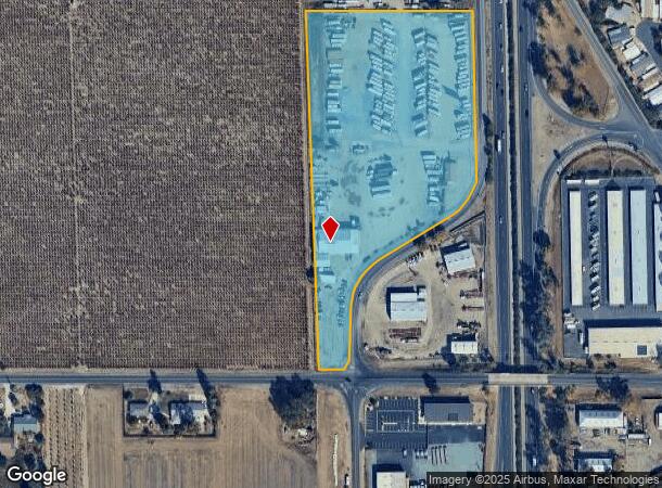
19501 N St Rt 99 West Frontage Rd, Acampo, CA 95220
NEARBY LISTINGS FOR SALE OR LEASE
Property Detail
19501 N St Rt 99 West Frontage Rd
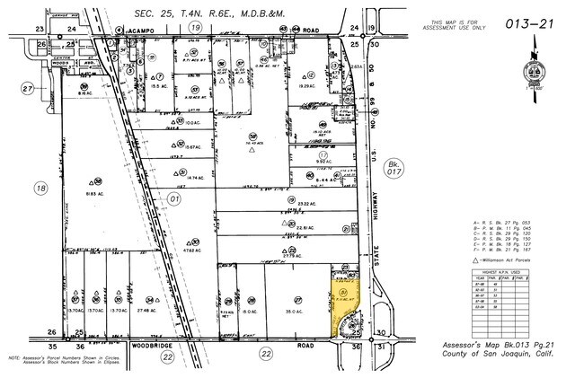
013-210-51
OFFICIAL RECS 1669 PG 318
Vehiclerentalsvehiclesales
San Joaquin
X
California
06077C0170F
7.55 AC
2025
Lodi
2025
Stockton/Modesto
004600
Stockton-Lodi, CA
7,680 SF
DEMOGRAPHICS near 19501 N St Rt 99 West Frontage Rd
1 Mile
3 Mile
5 Mile
2024 Total Population
1,117
41,177
81,142
2029 Population
1,155
43,041
85,305
Pop Growth 2024-2029
+ 3.40%
+ 4.53%
+ 5.13%
Average Age
42
39
39
2024 Total Households
395
14,891
29,110
HH Growth 2024-2029
+ 3.29%
+ 4.61%
+ 5.17%
Median Household Inc
$61,250
$69,860
$81,406
Avg Household Size
2.80
2.70
2.70
2024 Avg HH Vehicles
2.00
2.00
2.00
Median Home Value
$953,007
$439,775
$475,744
Median Year Built
1977
1968
1977
Nearby Places
Map Layers
Map Styles
 Street
 Aerial
- Restaurants
- Banks
- Shops
- Fitness
- Groceries
PUBLIC TRANSPORTATION
COMMUTER RAIL
Lodi Amtrak Station (San Joaquins - Amtrak)
DRIVE
WALK
Distance
Lodi Amtrak Station (San Joaquins - Amtrak)
6 min
2.8 mi
AIRPORT
Stockton Metro
DRIVE
WALK
Distance
Stockton Metro
28 min
21.2 mi
Freight Ports
Port of Stockton
DRIVE
WALK
Distance
Port of Stockton
27 min
19.7 mi
Nearby Properties
Address
Land Use
TOTAL SIZE
Lot Size
Zoning
Address
Land Use
TOTAL SIZE
Lot Size
Zoning
4,800 SF
101.66 AC
AG40
Address
Land Use
TOTAL SIZE
Lot Size
Zoning
172,680 SF
7 AC
M
Address
Land Use
TOTAL SIZE
Lot Size
Zoning
580,500 SF
43.38 AC
Address
Land Use
TOTAL SIZE
Lot Size
Zoning
400,340 SF
20.94 AC
Address
Land Use
TOTAL SIZE
Lot Size
Zoning
1,044,011 SF
20.24 AC
Address
Land Use
TOTAL SIZE
Lot Size
Zoning
3,706 SF
10.81 AC
Address
Land Use
TOTAL SIZE
Lot Size
Zoning
10,100 SF
9.98 AC
IL
Address
Land Use
TOTAL SIZE
Lot Size
Zoning
180,180 SF
16.23 AC
Address
Land Use
TOTAL SIZE
Lot Size
Zoning
473,000 SF
17.85 AC
Address
Land Use
TOTAL SIZE
Lot Size
Zoning
400,000 SF
17.81 AC
Address
Land Use
TOTAL SIZE
Lot Size
Zoning
0.69 AC
Address
Land Use
TOTAL SIZE
Lot Size
Zoning
334,515 SF
27.13 AC
Address
Land Use
TOTAL SIZE
Lot Size
Zoning
324,800 SF
17.15 AC
Address
Land Use
TOTAL SIZE
Lot Size
Zoning
5,000 SF
6.69 AC
Address
Land Use
TOTAL SIZE
Lot Size
Zoning
12,167 SF
16.71 AC
IL
Address
Land Use
TOTAL SIZE
Lot Size
Zoning
55,632 SF
4.69 AC
Address
Land Use
TOTAL SIZE
Lot Size
Zoning
22,239 SF
1.32 AC
M
Address
Land Use
TOTAL SIZE
Lot Size
Zoning
21.73 AC
Address
Land Use
TOTAL SIZE
Lot Size
Zoning
261,100 SF
9.54 AC
Address
Land Use
TOTAL SIZE
Lot Size
Zoning
8,771 SF
6.17 AC
Address
Land Use
TOTAL SIZE
Lot Size
Zoning
76,532 SF
3 AC
Address
Land Use
TOTAL SIZE
Lot Size
Zoning
49,560 SF
5.87 AC
Address
Land Use
TOTAL SIZE
Lot Size
Zoning
41,946 SF
3.73 AC
Address
Land Use
TOTAL SIZE
Lot Size
Zoning
21.24 AC
Address
Land Use
TOTAL SIZE
Lot Size
Zoning
41,480 SF
5.71 AC
Address
Land Use
TOTAL SIZE
Lot Size
Zoning
1,280 SF
19.63 AC
Address
Land Use
TOTAL SIZE
Lot Size
Zoning
78.99 AC
AG40
Address
Land Use
TOTAL SIZE
Lot Size
Zoning
138,000 SF
19.03 AC
Address
Land Use
TOTAL SIZE
Lot Size
Zoning
13.89 AC
Address
Land Use
TOTAL SIZE
Lot Size
Zoning
49,573 SF
3.45 AC
CMU
The World's #1 Commercial Real Estate Marketplace
Connect with us
© 2025 CoStar Group
The information above has been obtained from sources believed reliable. While we do not doubt its accuracy we have not verified it and make no guarantee, warranty or representation about it. It is your responsibility to independently confirm its accuracy and completeness. Any projections, opinions, assumptions, or estimates used are for example only and do not represent the current or future performance of the property. The value of this transaction to you depends on tax and other factors which should be evaluated by your tax, financial, and legal advisors. You and your advisors should conduct a careful, independent investigation of the property to determine to your satisfaction the suitability of the property for your needs.