Property Record
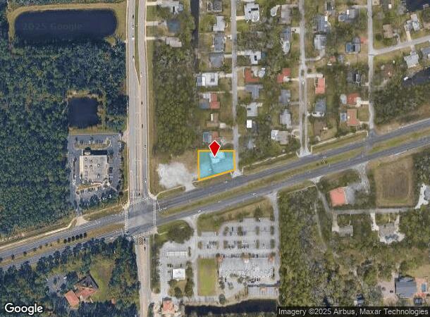
1951 W Granada Blvd, Ormond Beach, FL 32174

Current Lease Availabilities
NEARBY LISTINGS FOR SALE OR LEASE
Property Detail
1951 W Granada Blvd
4125-00-00-0127
25-14-31 PART OF E 1/2 OF SW 1/4 BEING S 100 FT N OF N/L SR 40 OF E 182.14 FT MEAS ON S/L W OF TWIN RIVER DR PER OR 1605 PG 0219 PER OR 7717 PG 0610 PER OR 8615 PG 3645
Officebuilding
Volusia
X
Florida
12035C0345E
0.42 AC
2025
Ormond Beach
2026
Deltona/Daytona Beach
083203
Deltona-Daytona Beach-Ormond Beach, FL
3,072 SF
DEMOGRAPHICS near 1951 W Granada Blvd
1 mile
3 mile
5 mile
2024 Total Population
4,442
31,281
80,086
2029 Population
5,007
35,679
89,682
Pop Growth 2024-2029
+ 12.72%
+ 14.06%
+ 11.98%
Average Age
45
48
45
2024 Total Households
1,834
13,548
34,734
HH Growth 2024-2029
+ 12.98%
+ 14.25%
+ 12.27%
Median Household Inc
$78,420
$65,987
$57,211
Avg Household Size
2.40
2.20
2.20
2024 Avg HH Vehicles
2.00
2.00
2.00
Median Home Value
$333,105
$296,980
$247,354
Median Year Built
1994
1999
1988
Nearby Places
Map Layers
Map Styles
 Street
 Aerial
Transit
 Traffic
 Biking
Places
Listings with unknown addresses are not visible on the map
- Restaurants
- Banks
- Shops
- Fitness
- Groceries
PUBLIC TRANSPORTATION
AIRPORT
Daytona Beach International
Drive
Walk
Distance
Daytona Beach International
16 min
9.5 mi
Orlando Sanford International
Drive
Walk
Distance
Orlando Sanford International
61 min
45.6 mi
Nearby Properties
Address
Land Use
TOTAL SIZE
Lot Size
Zoning
Address
Land Use
TOTAL SIZE
Lot Size
Zoning
849,735 SF
140.62 AC
01A2
Address
Land Use
TOTAL SIZE
Lot Size
Zoning
293,850 SF
29.38 AC
Address
Land Use
TOTAL SIZE
Lot Size
Zoning
12,394 SF
139.59 AC
Address
Land Use
TOTAL SIZE
Lot Size
Zoning
135,122 SF
78 AC
Address
Land Use
TOTAL SIZE
Lot Size
Zoning
470,843 SF
1.78 AC
RC
Address
Land Use
TOTAL SIZE
Lot Size
Zoning
10,637 SF
0.15 AC
R2
Address
Land Use
TOTAL SIZE
Lot Size
Zoning
375,572 SF
0.13 AC
R2
Address
Land Use
TOTAL SIZE
Lot Size
Zoning
409,718 SF
12.86 AC
Address
Land Use
TOTAL SIZE
Lot Size
Zoning
359,180 SF
29.73 AC
01A2
Address
Land Use
TOTAL SIZE
Lot Size
Zoning
333,708 SF
0.24 AC
01A2
Address
Land Use
TOTAL SIZE
Lot Size
Zoning
346,734 SF
14 AC
Address
Land Use
TOTAL SIZE
Lot Size
Zoning
158,299 SF
22 AC
Address
Land Use
TOTAL SIZE
Lot Size
Zoning
180,767 SF
27.05 AC
13R6
Address
Land Use
TOTAL SIZE
Lot Size
Zoning
209,513 SF
31 AC
Address
Land Use
TOTAL SIZE
Lot Size
Zoning
184,301 SF
50.28 AC
Address
Land Use
TOTAL SIZE
Lot Size
Zoning
56,220 SF
13.13 AC
Address
Land Use
TOTAL SIZE
Lot Size
Zoning
184,829 SF
9.71 AC
01A2
Address
Land Use
TOTAL SIZE
Lot Size
Zoning
Address
Land Use
TOTAL SIZE
Lot Size
Zoning
4,182 SF
0.16 AC
MH1
Address
Land Use
TOTAL SIZE
Lot Size
Zoning
149,551 SF
18.10 AC
Address
Land Use
TOTAL SIZE
Lot Size
Zoning
162,450 SF
1.42 AC
13B9
Address
Land Use
TOTAL SIZE
Lot Size
Zoning
152,621 SF
18.26 AC
C
Address
Land Use
TOTAL SIZE
Lot Size
Zoning
219,381 SF
25.44 AC
13B8
Address
Land Use
TOTAL SIZE
Lot Size
Zoning
82,156 SF
39.74 AC
MH4
Address
Land Use
TOTAL SIZE
Lot Size
Zoning
61,570 SF
23.04 AC
Address
Land Use
TOTAL SIZE
Lot Size
Zoning
89,392 SF
17.23 AC
Address
Land Use
TOTAL SIZE
Lot Size
Zoning
148,966 SF
5.54 AC
13B10
Address
Land Use
TOTAL SIZE
Lot Size
Zoning
74,977 SF
3.48 AC
Address
Land Use
TOTAL SIZE
Lot Size
Zoning
112,170 SF
3.58 AC
Address
Land Use
TOTAL SIZE
Lot Size
Zoning
173,757 SF
11.64 AC
The World's #1 Commercial Real Estate Marketplace
Connect with us
© 2026 CoStar Group
The information above has been obtained from sources believed reliable. While we do not doubt its accuracy we have not verified it and make no guarantee, warranty or representation about it. It is your responsibility to independently confirm its accuracy and completeness. Any projections, opinions, assumptions, or estimates used are for example only and do not represent the current or future performance of the property. The value of this transaction to you depends on tax and other factors which should be evaluated by your tax, financial, and legal advisors. You and your advisors should conduct a careful, independent investigation of the property to determine to your satisfaction the suitability of the property for your needs.