Property Record
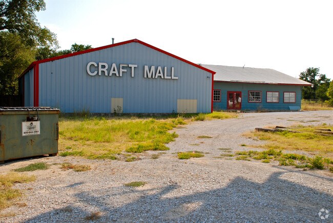
1951 W Highway 199 Pkwy, Azle, TX 76020


Property Detail
1951 W Highway 199 Pkwy
Dallas-Fort Worth-Arlington, TX
ACRES: 1.164 LOT: 2 BLK: 2 SUBD: ASH CREEK ESTATES AZLE ANTIQUES, ANTIQUE MALL
R000000548
PARKER
Commercialnec
Texas
B and X Area of moderate flood hazard, usually the area between the limits of the 100-year and 500-year floods.
2
2024
1.16 AC
2025
Parker County
140412
Dallas/Ft Worth
16,147 SF
NEARBY LISTINGS FOR SALE OR LEASE
DEMOGRAPHICS near 1951 W Highway 199 Pkwy
1 mile
3 mile
5 mile
2024 Total Population
1,531
18,021
44,966
2029 Population
1,789
20,674
50,760
Pop Growth 2024-2029
+ 16.85%
+ 14.72%
+ 12.89%
Average Age
40
39
41
2024 Total Households
554
6,523
16,449
HH Growth 2024-2029
+ 16.06%
+ 14.03%
+ 12.37%
Median Household Inc
$87,500
$87,112
$86,990
Avg Household Size
2.60
2.70
2.70
2024 Avg HH Vehicles
2.00
2.00
2.00
Median Home Value
$334,513
$298,306
$326,677
Median Year Built
2000
1996
1995
Nearby Places
Map Layers
Map Styles
 Street
 Aerial
Transit
 Traffic
 Biking
Places
Listings with unknown addresses are not visible on the map
- Restaurants
- Banks
- Shops
- Fitness
- Groceries
Nearby Properties
Address
Land Use
TOTAL SIZE
Lot Size
Zoning
Address
Land Use
TOTAL SIZE
Lot Size
Zoning
208,984 SF
14.42 AC
Address
Land Use
TOTAL SIZE
Lot Size
Zoning
262,793 SF
67.85 AC
Address
Land Use
TOTAL SIZE
Lot Size
Zoning
185,807 SF
14.03 AC
Address
Land Use
TOTAL SIZE
Lot Size
Zoning
28,901 SF
14.03 AC
Address
Land Use
TOTAL SIZE
Lot Size
Zoning
62,068 SF
18.93 AC
Address
Land Use
TOTAL SIZE
Lot Size
Zoning
119.88 AC
Address
Land Use
TOTAL SIZE
Lot Size
Zoning
36,452 SF
10 AC
Address
Land Use
TOTAL SIZE
Lot Size
Zoning
32,334 SF
3.52 AC
Address
Land Use
TOTAL SIZE
Lot Size
Zoning
69,227 SF
19.02 AC
Address
Land Use
TOTAL SIZE
Lot Size
Zoning
62,538 SF
9.19 AC
Address
Land Use
TOTAL SIZE
Lot Size
Zoning
21,141 SF
4.14 AC
Address
Land Use
TOTAL SIZE
Lot Size
Zoning
71,740 SF
1.75 AC
Address
Land Use
TOTAL SIZE
Lot Size
Zoning
42,206 SF
2.67 AC
Address
Land Use
TOTAL SIZE
Lot Size
Zoning
42,008 SF
4.13 AC
Address
Land Use
TOTAL SIZE
Lot Size
Zoning
56,296 SF
4.83 AC
Address
Land Use
TOTAL SIZE
Lot Size
Zoning
59.11 AC
Address
Land Use
TOTAL SIZE
Lot Size
Zoning
18,200 SF
4.39 AC
Address
Land Use
TOTAL SIZE
Lot Size
Zoning
36,760 SF
2.79 AC
Address
Land Use
TOTAL SIZE
Lot Size
Zoning
15,520 SF
5.46 AC
Address
Land Use
TOTAL SIZE
Lot Size
Zoning
56,317 SF
4.10 AC
Address
Land Use
TOTAL SIZE
Lot Size
Zoning
56.08 AC
Address
Land Use
TOTAL SIZE
Lot Size
Zoning
30,824 SF
2.70 AC
Address
Land Use
TOTAL SIZE
Lot Size
Zoning
54,292 SF
6.26 AC
Address
Land Use
TOTAL SIZE
Lot Size
Zoning
27,800 SF
9 AC
Address
Land Use
TOTAL SIZE
Lot Size
Zoning
25,232 SF
1.84 AC
Address
Land Use
TOTAL SIZE
Lot Size
Zoning
28,540 SF
2.22 AC
Address
Land Use
TOTAL SIZE
Lot Size
Zoning
5,175 SF
4.39 AC
Address
Land Use
TOTAL SIZE
Lot Size
Zoning
14,981 SF
1.67 AC
Address
Land Use
TOTAL SIZE
Lot Size
Zoning
13,816 SF
1.55 AC
Address
Land Use
TOTAL SIZE
Lot Size
Zoning
13,281 SF
1 AC
The World's #1 Commercial Real Estate Marketplace
Connect with us
© 2026 CoStar Group
The information above has been obtained from sources believed reliable. While we do not doubt its accuracy we have not verified it and make no guarantee, warranty or representation about it. It is your responsibility to independently confirm its accuracy and completeness. Any projections, opinions, assumptions, or estimates used are for example only and do not represent the current or future performance of the property. The value of this transaction to you depends on tax and other factors which should be evaluated by your tax, financial, and legal advisors. You and your advisors should conduct a careful, independent investigation of the property to determine to your satisfaction the suitability of the property for your needs.