Property Record
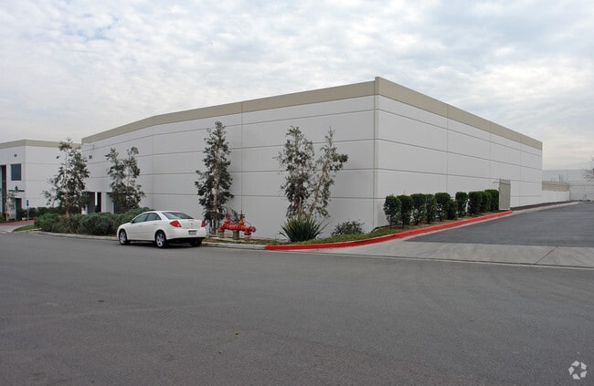
1954 Tandem, Norco, CA 92860


NEARBY LISTINGS FOR SALE OR LEASE
Property Detail
1954 Tandem
Riverside-San Bernardino-Ontario, CA
City Of Norco
129-220-046
.63 ACRES NET IN PAR 7 PM 204/041 PM 28883-1
Lightindustrial
Riverside
X
California
06071C9375J
7
2024
0.63 AC
2025
Corona/Eastvale
040812
Inland Empire (California)
11,506 SF
DEMOGRAPHICS near 1954 Tandem
1 Mile
3 Mile
5 Mile
2024 Total Population
6,050
94,196
279,145
2029 Population
6,297
98,571
293,350
Pop Growth 2024-2029
+ 4.08%
+ 4.64%
+ 5.09%
Average Age
41
37
36
2024 Total Households
1,446
24,495
76,414
HH Growth 2024-2029
+ 3.73%
+ 4.06%
+ 4.71%
Median Household Inc
$117,804
$125,291
$100,052
Avg Household Size
3.10
3.50
3.40
2024 Avg HH Vehicles
3.00
3.00
3.00
Median Home Value
$682,417
$703,779
$633,159
Median Year Built
1971
2000
1992
Nearby Places
Map Layers
Map Styles
 Street
 Aerial
- Restaurants
- Banks
- Shops
- Fitness
- Groceries
PUBLIC TRANSPORTATION
COMMUTER RAIL
North Main Corona (91 Line - Southern California Regional Rail Authority (Metrolink), Inland Empire-Orange County Line - Southern California Regional Rail Authority (Metrolink))
DRIVE
WALK
Distance
North Main Corona (91 Line - Southern California Regional Rail Authority (Metrolink), Inland Empire-Orange County Line - Southern California Regional Rail Authority (Metrolink))
9 min
4.1 mi
West Corona (91 Line - Southern California Regional Rail Authority (Metrolink), Inland Empire-Orange County Line - Southern California Regional Rail Authority (Metrolink))
DRIVE
WALK
Distance
West Corona (91 Line - Southern California Regional Rail Authority (Metrolink), Inland Empire-Orange County Line - Southern California Regional Rail Authority (Metrolink))
13 min
7.1 mi
AIRPORT
Ontario International
DRIVE
WALK
Distance
Ontario International
18 min
11.2 mi
John Wayne/Orange County
DRIVE
WALK
Distance
John Wayne/Orange County
42 min
32.1 mi
Long Beach (Daugherty Field)
DRIVE
WALK
Distance
Long Beach (Daugherty Field)
59 min
46.6 mi
Freight Ports
Port of Long Beach
DRIVE
WALK
Distance
Port of Long Beach
65 min
46.2 mi
Nearby Properties
Address
Land Use
TOTAL SIZE
Lot Size
Zoning
Address
Land Use
TOTAL SIZE
Lot Size
Zoning
165,463 SF
17.43 AC
Address
Land Use
TOTAL SIZE
Lot Size
Zoning
12.69 AC
Address
Land Use
TOTAL SIZE
Lot Size
Zoning
364,193 SF
23.77 AC
Address
Land Use
TOTAL SIZE
Lot Size
Zoning
24,144 SF
13.34 AC
R3
Address
Land Use
TOTAL SIZE
Lot Size
Zoning
182,066 SF
9.31 AC
Address
Land Use
TOTAL SIZE
Lot Size
Zoning
154,581 SF
8.30 AC
Address
Land Use
TOTAL SIZE
Lot Size
Zoning
159,517 SF
7.81 AC
Address
Land Use
TOTAL SIZE
Lot Size
Zoning
160,264 SF
9.21 AC
M1
Address
Land Use
TOTAL SIZE
Lot Size
Zoning
140,216 SF
6.43 AC
Address
Land Use
TOTAL SIZE
Lot Size
Zoning
145,424 SF
7.23 AC
Address
Land Use
TOTAL SIZE
Lot Size
Zoning
311,297 SF
13.39 AC
Address
Land Use
TOTAL SIZE
Lot Size
Zoning
105,813 SF
3.54 AC
Address
Land Use
TOTAL SIZE
Lot Size
Zoning
105,813 SF
3.50 AC
A144
Address
Land Use
TOTAL SIZE
Lot Size
Zoning
128,674 SF
6.71 AC
M1
Address
Land Use
TOTAL SIZE
Lot Size
Zoning
116,654 SF
6.03 AC
Address
Land Use
TOTAL SIZE
Lot Size
Zoning
96,961 SF
4.95 AC
Address
Land Use
TOTAL SIZE
Lot Size
Zoning
100,122 SF
5.25 AC
Address
Land Use
TOTAL SIZE
Lot Size
Zoning
163,546 SF
4.13 AC
A1
Address
Land Use
TOTAL SIZE
Lot Size
Zoning
188,875 SF
9.37 AC
Address
Land Use
TOTAL SIZE
Lot Size
Zoning
88,830 SF
4 AC
Address
Land Use
TOTAL SIZE
Lot Size
Zoning
77,787 SF
4.43 AC
Address
Land Use
TOTAL SIZE
Lot Size
Zoning
64,631 SF
2.67 AC
Address
Land Use
TOTAL SIZE
Lot Size
Zoning
103,540 SF
9.60 AC
MU
Address
Land Use
TOTAL SIZE
Lot Size
Zoning
67,400 SF
2.96 AC
Address
Land Use
TOTAL SIZE
Lot Size
Zoning
68,266 SF
2.33 AC
Address
Land Use
TOTAL SIZE
Lot Size
Zoning
75,237 SF
3.45 AC
Address
Land Use
TOTAL SIZE
Lot Size
Zoning
36,820 SF
2.82 AC
Address
Land Use
TOTAL SIZE
Lot Size
Zoning
48,560 SF
9.74 AC
Address
Land Use
TOTAL SIZE
Lot Size
Zoning
64,800 SF
2.99 AC
The World's #1 Commercial Real Estate Marketplace
Connect with us
© 2026 CoStar Group
The information above has been obtained from sources believed reliable. While we do not doubt its accuracy we have not verified it and make no guarantee, warranty or representation about it. It is your responsibility to independently confirm its accuracy and completeness. Any projections, opinions, assumptions, or estimates used are for example only and do not represent the current or future performance of the property. The value of this transaction to you depends on tax and other factors which should be evaluated by your tax, financial, and legal advisors. You and your advisors should conduct a careful, independent investigation of the property to determine to your satisfaction the suitability of the property for your needs.