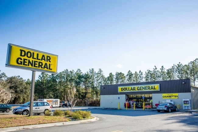
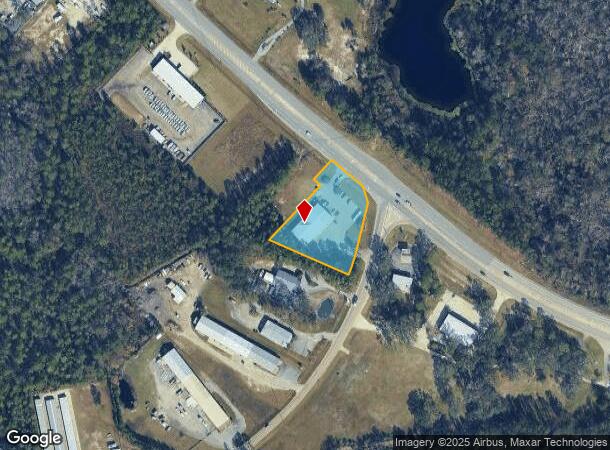
Property Record
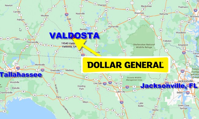
19540 Valdosta Hwy, Valdosta, GA 31602
NEARBY LISTINGS FOR SALE OR LEASE
Property Detail
19540 Valdosta Hwy
Valdosta, GA
Teramore Dev Llc
146-0011B
PB 21-52 TR 1 DOLLAR GENERAL
Storebuilding
Brooks
X
Georgia
13027C0280D
60
2024
1.56 AC
2025
Valdosta/Lake Park
960302
Other Market Areas
9,100 SF
DEMOGRAPHICS near 19540 Valdosta Hwy
1 Mile
3 Mile
5 Mile
2024 Total Population
653
8,996
46,092
2029 Population
644
9,207
47,602
Pop Growth 2024-2029
(1.38%)
+ 2.35%
+ 3.28%
Average Age
42
38
36
2024 Total Households
277
3,680
17,965
HH Growth 2024-2029
(1.44%)
+ 2.42%
+ 3.50%
Median Household Inc
$39,999
$47,069
$40,774
Avg Household Size
2.30
2.30
2.30
2024 Avg HH Vehicles
2.00
2.00
2.00
Median Home Value
$102,439
$167,244
$190,357
Median Year Built
1992
1987
1987
Nearby Places
Map Layers
Map Styles
 Street
 Aerial
- Restaurants
- Banks
- Shops
- Fitness
- Groceries
PUBLIC TRANSPORTATION
AIRPORT
Valdosta Regional
DRIVE
WALK
Distance
Valdosta Regional
14 min
8.1 mi
Freight Ports
Jacksonville Port
DRIVE
WALK
Distance
Jacksonville Port
144 min
127.4 mi
SALE & LEASE HISTORY
LISTING DATE
SALE/LEASE

Sep 23, 2024
For Sale
Nearby Properties
Address
Land Use
TOTAL SIZE
Lot Size
Zoning
Address
Land Use
TOTAL SIZE
Lot Size
Zoning
459,770 SF
31.50 AC
C-H
Address
Land Use
TOTAL SIZE
Lot Size
Zoning
115,460 SF
13.09 AC
R-M
Address
Land Use
TOTAL SIZE
Lot Size
Zoning
1,686 SF
18.88 AC
R-M
Address
Land Use
TOTAL SIZE
Lot Size
Zoning
163,083 SF
17.16 AC
C-H
Address
Land Use
TOTAL SIZE
Lot Size
Zoning
203,741 SF
22.55 AC
C-H
Address
Land Use
TOTAL SIZE
Lot Size
Zoning
120,720 SF
11.31 AC
C-H
Address
Land Use
TOTAL SIZE
Lot Size
Zoning
32,886 SF
5.45 AC
C-C
Address
Land Use
TOTAL SIZE
Lot Size
Zoning
104,423 SF
2.62 AC
C-H
Address
Land Use
TOTAL SIZE
Lot Size
Zoning
101,792 SF
14.09 AC
C-H
Address
Land Use
TOTAL SIZE
Lot Size
Zoning
89,977 SF
11.16 AC
C-H
Address
Land Use
TOTAL SIZE
Lot Size
Zoning
3,845 SF
14.13 AC
C-H
Address
Land Use
TOTAL SIZE
Lot Size
Zoning
88,545 SF
9.09 AC
C-H
Address
Land Use
TOTAL SIZE
Lot Size
Zoning
80,062 SF
3 AC
C-H
Address
Land Use
TOTAL SIZE
Lot Size
Zoning
55,599 SF
4.14 AC
C-H
Address
Land Use
TOTAL SIZE
Lot Size
Zoning
59,044 SF
8.35 AC
C-C
Address
Land Use
TOTAL SIZE
Lot Size
Zoning
70,358 SF
8.41 AC
R-10
Address
Land Use
TOTAL SIZE
Lot Size
Zoning
56,759 SF
5.74 AC
C-H
Address
Land Use
TOTAL SIZE
Lot Size
Zoning
50,340 SF
9.89 AC
C-H
Address
Land Use
TOTAL SIZE
Lot Size
Zoning
83,052 SF
6.81 AC
R-M
Address
Land Use
TOTAL SIZE
Lot Size
Zoning
140,398 SF
13.96 AC
C-H
Address
Land Use
TOTAL SIZE
Lot Size
Zoning
69,200 SF
7.22 AC
C-H
Address
Land Use
TOTAL SIZE
Lot Size
Zoning
63,676 SF
3.25 AC
C-H
Address
Land Use
TOTAL SIZE
Lot Size
Zoning
50,192 SF
2.48 AC
C-H
Address
Land Use
TOTAL SIZE
Lot Size
Zoning
53,360 SF
2.39 AC
C-H
Address
Land Use
TOTAL SIZE
Lot Size
Zoning
54,914 SF
2.16 AC
C-H
Address
Land Use
TOTAL SIZE
Lot Size
Zoning
1,920 SF
26.99 AC
R-M
Address
Land Use
TOTAL SIZE
Lot Size
Zoning
37.28 AC
PMD
Address
Land Use
TOTAL SIZE
Lot Size
Zoning
8,750 SF
8 AC
C-H
Address
Land Use
TOTAL SIZE
Lot Size
Zoning
72,557 SF
12.75 AC
C-H
Address
Land Use
TOTAL SIZE
Lot Size
Zoning
44,045 SF
1.38 AC
C-H
The World's #1 Commercial Real Estate Marketplace
Connect with us
© 2025 CoStar Group
The information above has been obtained from sources believed reliable. While we do not doubt its accuracy we have not verified it and make no guarantee, warranty or representation about it. It is your responsibility to independently confirm its accuracy and completeness. Any projections, opinions, assumptions, or estimates used are for example only and do not represent the current or future performance of the property. The value of this transaction to you depends on tax and other factors which should be evaluated by your tax, financial, and legal advisors. You and your advisors should conduct a careful, independent investigation of the property to determine to your satisfaction the suitability of the property for your needs.