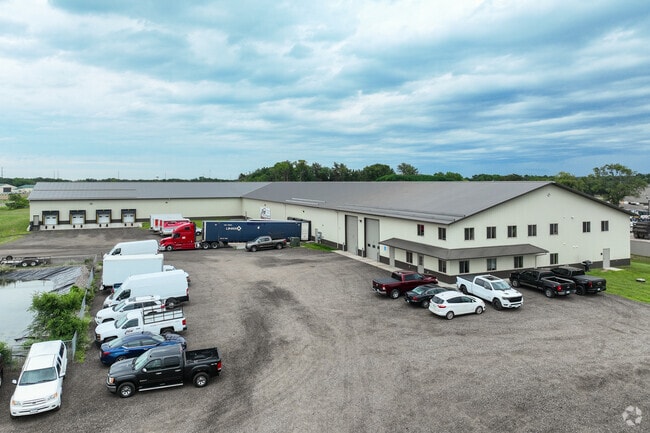
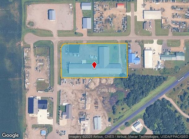
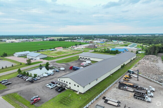
Property Record
1955 196Th St E, Clearwater, MN 55320
NEARBY LISTINGS FOR SALE OR LEASE
Property Detail
1955 196Th St E
St. Cloud, MN
Lynden Valley Industrial Park
19.10748.0120
LOT 004 BLK 004 LYNDEN VALLEY INDUSTRIAL PARK SECTION 03 TOWNSHIP 122 RANGE 027 SECTION 03 TOWNSHIP 122 RANGE 027
Officebuilding
Stearns
X
Minnesota
27145C0890E
4
2025
4.08 AC
2025
Stearns County
011202
Minneapolis/St Paul
52,140 SF
DEMOGRAPHICS near 1955 196Th St E
1 Mile
3 Mile
5 Mile
2024 Total Population
300
4,134
7,613
2029 Population
328
4,819
8,806
Pop Growth 2024-2029
+ 9.33%
+ 16.57%
+ 15.67%
Average Age
43
40
41
2024 Total Households
119
1,662
2,966
HH Growth 2024-2029
+ 9.24%
+ 16.97%
+ 15.98%
Median Household Inc
$103,750
$98,415
$102,412
Avg Household Size
2.50
2.50
2.60
2024 Avg HH Vehicles
3.00
2.00
2.00
Median Home Value
$363,792
$306,725
$346,984
Median Year Built
1989
1993
1991
Nearby Places
Map Layers
Map Styles
 Street
 Aerial
- Restaurants
- Banks
- Shops
- Fitness
- Groceries
Nearby Properties
Address
Land Use
TOTAL SIZE
Lot Size
Zoning
Address
Land Use
TOTAL SIZE
Lot Size
Zoning
69,751 SF
4.61 AC
Address
Land Use
TOTAL SIZE
Lot Size
Zoning
38,844 SF
4.37 AC
Address
Land Use
TOTAL SIZE
Lot Size
Zoning
13,700 SF
46.75 AC
Address
Land Use
TOTAL SIZE
Lot Size
Zoning
Address
Land Use
TOTAL SIZE
Lot Size
Zoning
57,634 SF
6.78 AC
Address
Land Use
TOTAL SIZE
Lot Size
Zoning
33,688 SF
15.83 AC
Address
Land Use
TOTAL SIZE
Lot Size
Zoning
12.55 AC
Address
Land Use
TOTAL SIZE
Lot Size
Zoning
10,933 SF
49.57 AC
Address
Land Use
TOTAL SIZE
Lot Size
Zoning
Address
Land Use
TOTAL SIZE
Lot Size
Zoning
Address
Land Use
TOTAL SIZE
Lot Size
Zoning
Address
Land Use
TOTAL SIZE
Lot Size
Zoning
Address
Land Use
TOTAL SIZE
Lot Size
Zoning
12,400 SF
4.61 AC
Address
Land Use
TOTAL SIZE
Lot Size
Zoning
3,294 SF
24.94 AC
Address
Land Use
TOTAL SIZE
Lot Size
Zoning
12,459 SF
8.12 AC
Address
Land Use
TOTAL SIZE
Lot Size
Zoning
23,112 SF
1.81 AC
Address
Land Use
TOTAL SIZE
Lot Size
Zoning
25,920 SF
7.06 AC
PL20B1
Address
Land Use
TOTAL SIZE
Lot Size
Zoning
Address
Land Use
TOTAL SIZE
Lot Size
Zoning
7,118 SF
9 AC
Address
Land Use
TOTAL SIZE
Lot Size
Zoning
10,432 SF
1.15 AC
Address
Land Use
TOTAL SIZE
Lot Size
Zoning
28,432 SF
2.69 AC
Address
Land Use
TOTAL SIZE
Lot Size
Zoning
19,020 SF
1.81 AC
Address
Land Use
TOTAL SIZE
Lot Size
Zoning
15,680 SF
4.84 AC
Address
Land Use
TOTAL SIZE
Lot Size
Zoning
4,449 SF
44.01 AC
Address
Land Use
TOTAL SIZE
Lot Size
Zoning
Address
Land Use
TOTAL SIZE
Lot Size
Zoning
9,940 SF
1.14 AC
The World's #1 Commercial Real Estate Marketplace
Connect with us
© 2026 CoStar Group
The information above has been obtained from sources believed reliable. While we do not doubt its accuracy we have not verified it and make no guarantee, warranty or representation about it. It is your responsibility to independently confirm its accuracy and completeness. Any projections, opinions, assumptions, or estimates used are for example only and do not represent the current or future performance of the property. The value of this transaction to you depends on tax and other factors which should be evaluated by your tax, financial, and legal advisors. You and your advisors should conduct a careful, independent investigation of the property to determine to your satisfaction the suitability of the property for your needs.