Property Record
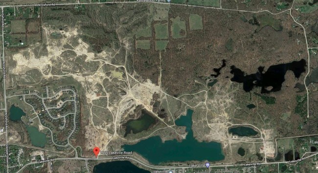
1955 E Lakeville Rd, Oxford, MI 48371


NEARBY LISTINGS FOR SALE OR LEASE
Property Detail
1955 E Lakeville Rd
04-24-451-001
T5N, R10E, SEC 24 THAT PART OF SW 1/4 LYING SLY OF GTRR R/W EXC BEG AT SW SEC COR, TH N 595 FT, TH N 85-26-00 E 606.75 FT ALG
Officebuilding
Oakland
X
Michigan
26125C0230F
71.58 AC
2024
St Clair & Lapeer Counties
2025
Detroit
121000
Detroit-Warren-Dearborn, MI
1,165 SF
DEMOGRAPHICS near 1955 E Lakeville Rd
1 Mile
3 Mile
5 Mile
2024 Total Population
3,832
22,665
42,356
2029 Population
3,850
22,541
42,094
Pop Growth 2024-2029
+ 0.47%
(0.55%)
(0.62%)
Average Age
36
40
41
2024 Total Households
1,356
8,579
16,116
HH Growth 2024-2029
+ 0.52%
(0.57%)
(0.64%)
Median Household Inc
$66,500
$91,114
$97,994
Avg Household Size
2.80
2.60
2.60
2024 Avg HH Vehicles
2.00
2.00
2.00
Median Home Value
$303,929
$319,601
$335,601
Median Year Built
1994
1989
1986
Nearby Places
Map Layers
Map Styles
 Street
 Aerial
- Restaurants
- Banks
- Shops
- Fitness
- Groceries
PUBLIC TRANSPORTATION
AIRPORT
Bishop International
DRIVE
WALK
Distance
Bishop International
63 min
43.8 mi
Freight Ports
Port of Toledo
DRIVE
WALK
Distance
Port of Toledo
129 min
102.6 mi
SALE & LEASE HISTORY
LISTING DATE
SALE/LEASE

Sep 24, 2016
For Sale
Nearby Properties
Address
Land Use
TOTAL SIZE
Lot Size
Zoning
Address
Land Use
TOTAL SIZE
Lot Size
Zoning
172,881 SF
16.51 AC
Address
Land Use
TOTAL SIZE
Lot Size
Zoning
188,367 SF
Address
Land Use
TOTAL SIZE
Lot Size
Zoning
188,367 SF
26.37 AC
Address
Land Use
TOTAL SIZE
Lot Size
Zoning
4,670 SF
81.02 AC
MM
Address
Land Use
TOTAL SIZE
Lot Size
Zoning
207,073 SF
19.74 AC
Address
Land Use
TOTAL SIZE
Lot Size
Zoning
65,459 SF
5.65 AC
BI
Address
Land Use
TOTAL SIZE
Lot Size
Zoning
187,506 SF
19.19 AC
AI
Address
Land Use
TOTAL SIZE
Lot Size
Zoning
81,921 SF
9.08 AC
BI
Address
Land Use
TOTAL SIZE
Lot Size
Zoning
4,717 SF
73 AC
MM
Address
Land Use
TOTAL SIZE
Lot Size
Zoning
53,715 SF
4.28 AC
ME
Address
Land Use
TOTAL SIZE
Lot Size
Zoning
187,573 SF
12.29 AC
II
Address
Land Use
TOTAL SIZE
Lot Size
Zoning
10,920 SF
494.26 AC
SV
Address
Land Use
TOTAL SIZE
Lot Size
Zoning
39,217 SF
4.39 AC
BI
Address
Land Use
TOTAL SIZE
Lot Size
Zoning
38,468 SF
5.16 AC
BI
Address
Land Use
TOTAL SIZE
Lot Size
Zoning
29,026 SF
2.66 AC
BI
Address
Land Use
TOTAL SIZE
Lot Size
Zoning
52,208 SF
2.64 AC
II
Address
Land Use
TOTAL SIZE
Lot Size
Zoning
156.03 AC
Address
Land Use
TOTAL SIZE
Lot Size
Zoning
26,073 SF
63.54 AC
MM
Address
Land Use
TOTAL SIZE
Lot Size
Zoning
11,483 SF
10.56 AC
BI
Address
Land Use
TOTAL SIZE
Lot Size
Zoning
504 SF
18.16 AC
MM
Address
Land Use
TOTAL SIZE
Lot Size
Zoning
58,082 SF
2.75 AC
II
Address
Land Use
TOTAL SIZE
Lot Size
Zoning
15,048 SF
2.99 AC
BI
Address
Land Use
TOTAL SIZE
Lot Size
Zoning
8,280 SF
3.07 AC
BI
Address
Land Use
TOTAL SIZE
Lot Size
Zoning
50,200 SF
2.75 AC
II
Address
Land Use
TOTAL SIZE
Lot Size
Zoning
21,844 SF
3.82 AC
Address
Land Use
TOTAL SIZE
Lot Size
Zoning
21,365 SF
4.46 AC
BI
Address
Land Use
TOTAL SIZE
Lot Size
Zoning
20,737 SF
4.02 AC
BI
The World's #1 Commercial Real Estate Marketplace
Connect with us
© 2026 CoStar Group
The information above has been obtained from sources believed reliable. While we do not doubt its accuracy we have not verified it and make no guarantee, warranty or representation about it. It is your responsibility to independently confirm its accuracy and completeness. Any projections, opinions, assumptions, or estimates used are for example only and do not represent the current or future performance of the property. The value of this transaction to you depends on tax and other factors which should be evaluated by your tax, financial, and legal advisors. You and your advisors should conduct a careful, independent investigation of the property to determine to your satisfaction the suitability of the property for your needs.