Property Record
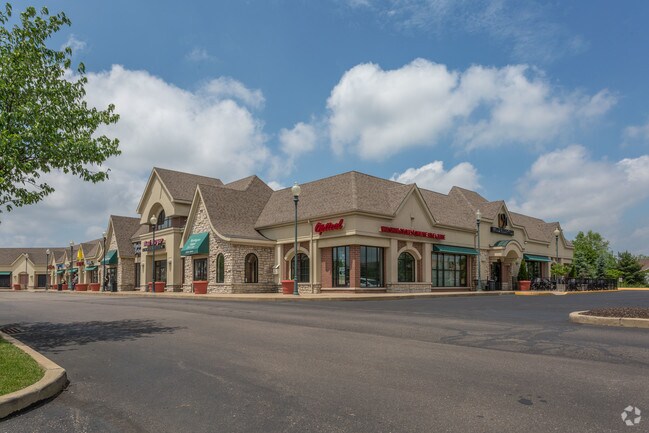
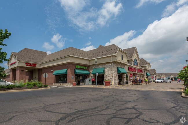
1955 E Maple St, North Canton, OH 44720

Property Detail
1955 E Maple St
10003022
OL 392 - 11.31A
Regionalshoppingcenterormallwithanchorstore
STARK
B and X Area of moderate flood hazard, usually the area between the limits of the 100-year and 500-year floods.
Ohio
0
11.31 AC
2025
Stark County
712112
Cleveland
93,932 SF
Canton-Massillon, OH
NEARBY LISTINGS FOR SALE OR LEASE
DEMOGRAPHICS near 1955 E Maple St
1 mile
3 mile
5 mile
2025 Total Population
5,461
54,653
127,537
2030 Population
5,422
54,382
128,430
Pop Growth 2025-2030
(0.71%)
(0.50%)
+ 0.70%
Average Age
43
43
42
2025 Total Households
1,997
23,387
54,454
HH Growth 2025-2030
(0.75%)
(0.53%)
+ 0.70%
Median Household Inc
$91,042
$72,148
$65,211
Avg Household Size
2.40
2.20
2.20
2025 Avg HH Vehicles
2.00
2.00
2.00
Median Home Value
$273,934
$224,697
$208,165
Median Year Built
1976
1972
1968
Nearby Places
Map Layers
Map Styles
 Street
 Aerial
Layers
 Traffic
 Biking
Places
Listings with unknown addresses are not visible on the map
- Restaurants
- Banks
- Shops
- Fitness
- Groceries
PUBLIC TRANSPORTATION
AIRPORT
Akron-Canton Regional
Drive
Walk
Distance
Akron-Canton Regional
13 min
6.9 mi
Freight Ports
Port of Toledo
Drive
Walk
Distance
Port of Toledo
184 min
154.2 mi
SALE & LEASE HISTORY
LISTING DATE
SALE/LEASE

May 04, 2017
For Lease
Nearby Properties
Address
Land Use
TOTAL SIZE
Lot Size
Zoning
Address
Land Use
TOTAL SIZE
Lot Size
Zoning
730,347 SF
55.42 AC
Address
Land Use
TOTAL SIZE
Lot Size
Zoning
365,452 SF
113.92 AC
Address
Land Use
TOTAL SIZE
Lot Size
Zoning
103,786 SF
8.77 AC
Address
Land Use
TOTAL SIZE
Lot Size
Zoning
356,083 SF
32.10 AC
Address
Land Use
TOTAL SIZE
Lot Size
Zoning
140,060 SF
27.57 AC
Address
Land Use
TOTAL SIZE
Lot Size
Zoning
103,786 SF
8.51 AC
Address
Land Use
TOTAL SIZE
Lot Size
Zoning
171,663 SF
16.77 AC
Address
Land Use
TOTAL SIZE
Lot Size
Zoning
118,889 SF
19.77 AC
Address
Land Use
TOTAL SIZE
Lot Size
Zoning
218,864 SF
11.84 AC
Address
Land Use
TOTAL SIZE
Lot Size
Zoning
160,650 SF
17.26 AC
Address
Land Use
TOTAL SIZE
Lot Size
Zoning
116,904 SF
55.51 AC
Address
Land Use
TOTAL SIZE
Lot Size
Zoning
195,551 SF
37.77 AC
Address
Land Use
TOTAL SIZE
Lot Size
Zoning
50,062 SF
8.51 AC
Address
Land Use
TOTAL SIZE
Lot Size
Zoning
106,416 SF
18.99 AC
Address
Land Use
TOTAL SIZE
Lot Size
Zoning
53,687 SF
14.94 AC
Address
Land Use
TOTAL SIZE
Lot Size
Zoning
465,350 SF
7.95 AC
Address
Land Use
TOTAL SIZE
Lot Size
Zoning
235,290 SF
25.58 AC
Address
Land Use
TOTAL SIZE
Lot Size
Zoning
121,154 SF
9.45 AC
Address
Land Use
TOTAL SIZE
Lot Size
Zoning
145,719 SF
43.60 AC
Address
Land Use
TOTAL SIZE
Lot Size
Zoning
96,386 SF
3.53 AC
Address
Land Use
TOTAL SIZE
Lot Size
Zoning
157,515 SF
16.57 AC
Address
Land Use
TOTAL SIZE
Lot Size
Zoning
121,790 SF
5.94 AC
Address
Land Use
TOTAL SIZE
Lot Size
Zoning
75,085 SF
2.77 AC
Address
Land Use
TOTAL SIZE
Lot Size
Zoning
74,574 SF
4.11 AC
Address
Land Use
TOTAL SIZE
Lot Size
Zoning
155,622 SF
11.05 AC
Address
Land Use
TOTAL SIZE
Lot Size
Zoning
244,719 SF
7.32 AC
Address
Land Use
TOTAL SIZE
Lot Size
Zoning
138,720 SF
Address
Land Use
TOTAL SIZE
Lot Size
Zoning
126,987 SF
9.77 AC
Address
Land Use
TOTAL SIZE
Lot Size
Zoning
48,705 SF
3.78 AC
The World's #1 Commercial Real Estate Marketplace
Connect with us
© 2026 CoStar Group
The information above has been obtained from sources believed reliable. While we do not doubt its accuracy we have not verified it and make no guarantee, warranty or representation about it. It is your responsibility to independently confirm its accuracy and completeness. Any projections, opinions, assumptions, or estimates used are for example only and do not represent the current or future performance of the property. The value of this transaction to you depends on tax and other factors which should be evaluated by your tax, financial, and legal advisors. You and your advisors should conduct a careful, independent investigation of the property to determine to your satisfaction the suitability of the property for your needs.