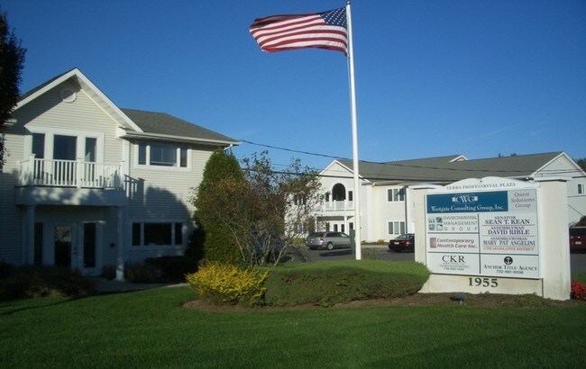
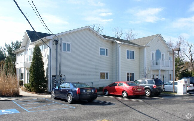
Property Record
1955 State Route 34, Wall Township, NJ 07719

Property Detail
1955 State Route 34
52-00821-0000-00017
Monmouth
Officebuilding
New Jersey
OP-2
17
B and X Area of moderate flood hazard, usually the area between the limits of the 100-year and 500-year floods.
1.32 AC
2024
Southern Monmouth
2025
Northern New Jersey
808702
Lakewood-New Brunswick, NJ
7,272 SF
NEARBY LISTINGS FOR SALE OR LEASE
DEMOGRAPHICS near 1955 State Route 34
1 mile
3 mile
5 mile
2025 Total Population
1,428
24,948
119,060
2030 Population
1,431
25,126
120,895
Pop Growth 2025-2030
+ 0.21%
+ 0.71%
+ 1.54%
Average Age
46
45
44
2025 Total Households
475
9,515
48,082
HH Growth 2025-2030
(0.21%)
+ 0.57%
+ 1.45%
Median Household Inc
$214,118
$138,664
$116,056
Avg Household Size
2.70
2.50
2.40
2025 Avg HH Vehicles
3.00
2.00
2.00
Median Home Value
$719,178
$716,392
$634,159
Median Year Built
1981
1978
1973
Nearby Places
Map Layers
Map Styles
 Street
 Aerial
Layers
 Traffic
 Biking
Places
Listings with unknown addresses are not visible on the map
- Restaurants
- Banks
- Shops
- Fitness
- Groceries
PUBLIC TRANSPORTATION
COMMUTER RAIL
Spring Lake (North Jersey Coast Line - NJ Transit Commuter Rail (NJ Transit))
Drive
Walk
Distance
Spring Lake (North Jersey Coast Line - NJ Transit Commuter Rail (NJ Transit))
9 min
3.8 mi
Manasquan (North Jersey Coast Line - NJ Transit Commuter Rail (NJ Transit))
Drive
Walk
Distance
Manasquan (North Jersey Coast Line - NJ Transit Commuter Rail (NJ Transit))
8 min
4.3 mi
Freight Ports
New York Container Terminal
Drive
Walk
Distance
New York Container Terminal
1 min
33.4 mi
SALE & LEASE HISTORY
LISTING DATE
SALE/LEASE

Sep 25, 2016
For Lease
Oct 17, 2016
For Lease
Nov 02, 2020
For Lease
Mar 28, 2018
For Lease
Nearby Properties
Address
Land Use
TOTAL SIZE
Lot Size
Zoning
Address
Land Use
TOTAL SIZE
Lot Size
Zoning
23,868 SF
137.35 AC
SF40
Address
Land Use
TOTAL SIZE
Lot Size
Zoning
190,893 SF
36.69 AC
POS
Address
Land Use
TOTAL SIZE
Lot Size
Zoning
71,070 SF
11.81 AC
MLHB
Address
Land Use
TOTAL SIZE
Lot Size
Zoning
49,657 SF
11.22 AC
HB80
Address
Land Use
TOTAL SIZE
Lot Size
Zoning
7.79 AC
MLCC
Address
Land Use
TOTAL SIZE
Lot Size
Zoning
19,996 SF
386.01 AC
POS
Address
Land Use
TOTAL SIZE
Lot Size
Zoning
84,297 SF
42.37 AC
CR40
Address
Land Use
TOTAL SIZE
Lot Size
Zoning
145,918 SF
20.31 AC
OR-5
Address
Land Use
TOTAL SIZE
Lot Size
Zoning
49,170 SF
8.38 AC
HB80
Address
Land Use
TOTAL SIZE
Lot Size
Zoning
45,236 SF
48.30 AC
POS
Address
Land Use
TOTAL SIZE
Lot Size
Zoning
86,051 SF
9.41 AC
HB12
Address
Land Use
TOTAL SIZE
Lot Size
Zoning
115,960 SF
17.93 AC
OR-5
Address
Land Use
TOTAL SIZE
Lot Size
Zoning
111,580 SF
25 AC
POS
Address
Land Use
TOTAL SIZE
Lot Size
Zoning
3,400 SF
262.97 AC
AI
Address
Land Use
TOTAL SIZE
Lot Size
Zoning
8.83 AC
R-2
Address
Land Use
TOTAL SIZE
Lot Size
Zoning
8,749 SF
5.73 AC
OPML
Address
Land Use
TOTAL SIZE
Lot Size
Zoning
2,976 SF
336.41 AC
POS
Address
Land Use
TOTAL SIZE
Lot Size
Zoning
13,094 SF
1.43 AC
HB80
Address
Land Use
TOTAL SIZE
Lot Size
Zoning
192 SF
12.50 AC
HD12
Address
Land Use
TOTAL SIZE
Lot Size
Zoning
81,656 SF
8.15 AC
HB80
Address
Land Use
TOTAL SIZE
Lot Size
Zoning
13.21 AC
HD12
Address
Land Use
TOTAL SIZE
Lot Size
Zoning
5.37 AC
R-5
Address
Land Use
TOTAL SIZE
Lot Size
Zoning
93,572 SF
8.04 AC
HB12
Address
Land Use
TOTAL SIZE
Lot Size
Zoning
63,277 SF
3.03 AC
POS
Address
Land Use
TOTAL SIZE
Lot Size
Zoning
1,982 SF
2.47 AC
OR-2
Address
Land Use
TOTAL SIZE
Lot Size
Zoning
6.53 AC
SF05
Address
Land Use
TOTAL SIZE
Lot Size
Zoning
14,874 SF
12.49 AC
OP10
Address
Land Use
TOTAL SIZE
Lot Size
Zoning
2,656 SF
95.46 AC
POS
Address
Land Use
TOTAL SIZE
Lot Size
Zoning
6,838 SF
9.97 AC
HB80
Address
Land Use
TOTAL SIZE
Lot Size
Zoning
296.61 AC
POS
The World's #1 Commercial Real Estate Marketplace
Connect with us
© 2026 CoStar Group
The information above has been obtained from sources believed reliable. While we do not doubt its accuracy we have not verified it and make no guarantee, warranty or representation about it. It is your responsibility to independently confirm its accuracy and completeness. Any projections, opinions, assumptions, or estimates used are for example only and do not represent the current or future performance of the property. The value of this transaction to you depends on tax and other factors which should be evaluated by your tax, financial, and legal advisors. You and your advisors should conduct a careful, independent investigation of the property to determine to your satisfaction the suitability of the property for your needs.