Property Record
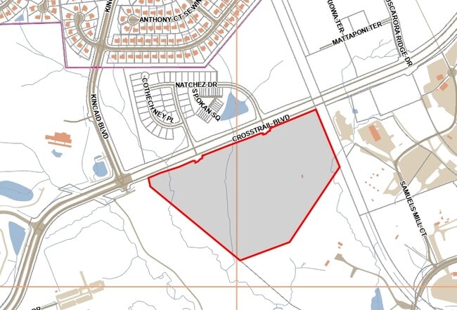
19560 Crosstrail Blvd, Leesburg, VA 20175

NEARBY LISTINGS FOR SALE OR LEASE
Property Detail
19560 Crosstrail Blvd
Washington-Arlington-Alexandria, DC-VA-MD-WV
Tuscarora
150-15-1774
TUSCARORA CROSSING SOUTH PARCEL SCOM 201903040010153/4P
Vacantlandnec
Loudoun
X
Virginia
51107C0235E
37.61 AC
2025
Route 7 Corridor
2025
Washington, DC
610602
DEMOGRAPHICS near 19560 Crosstrail Blvd
1 Mile
3 Mile
5 Mile
2024 Total Population
3,502
70,633
155,281
2029 Population
3,780
76,090
167,375
Pop Growth 2024-2029
+ 7.94%
+ 7.73%
+ 7.79%
Average Age
38
36
38
2024 Total Households
1,274
22,967
52,837
HH Growth 2024-2029
+ 8.79%
+ 7.88%
+ 7.97%
Median Household Inc
$150,449
$149,687
$152,001
Avg Household Size
2.70
3.00
2.90
2024 Avg HH Vehicles
2.00
2.00
2.00
Median Home Value
$700,141
$674,588
$678,681
Median Year Built
2003
2000
2000
Nearby Places
Map Layers
Map Styles
 Street
 Aerial
- Restaurants
- Banks
- Shops
- Fitness
- Groceries
PUBLIC TRANSPORTATION
AIRPORT
Washington Dulles International
DRIVE
WALK
Distance
Washington Dulles International
25 min
14.8 mi
Freight Ports
Port of Baltimore
DRIVE
WALK
Distance
Port of Baltimore
96 min
68.5 mi
Nearby Properties
Address
Land Use
TOTAL SIZE
Lot Size
Zoning
Address
Land Use
TOTAL SIZE
Lot Size
Zoning
793,474 SF
311.38 AC
PDIP
Address
Land Use
TOTAL SIZE
Lot Size
Zoning
250,459 SF
OP
Address
Land Use
TOTAL SIZE
Lot Size
Zoning
356,841 SF
119.07 AC
PDGI
Address
Land Use
TOTAL SIZE
Lot Size
Zoning
485,476 SF
54.14 AC
LB:B3
Address
Land Use
TOTAL SIZE
Lot Size
Zoning
108.01 AC
PDOP
Address
Land Use
TOTAL SIZE
Lot Size
Zoning
553,617 SF
592.60 AC
PDSA
Address
Land Use
TOTAL SIZE
Lot Size
Zoning
340,152 SF
119.26 AC
TR10
Address
Land Use
TOTAL SIZE
Lot Size
Zoning
420,787 SF
LB:B4
Address
Land Use
TOTAL SIZE
Lot Size
Zoning
274,751 SF
18.87 AC
PDH3
Address
Land Use
TOTAL SIZE
Lot Size
Zoning
300,570 SF
OP
Address
Land Use
TOTAL SIZE
Lot Size
Zoning
355,228 SF
35 AC
PDSA
Address
Land Use
TOTAL SIZE
Lot Size
Zoning
248,513 SF
15.77 AC
LB:R22
Address
Land Use
TOTAL SIZE
Lot Size
Zoning
213,071 SF
15.57 AC
PDH3
Address
Land Use
TOTAL SIZE
Lot Size
Zoning
199,538 SF
23.35 AC
PDTC
Address
Land Use
TOTAL SIZE
Lot Size
Zoning
323,043 SF
27.90 AC
LB:B3
Address
Land Use
TOTAL SIZE
Lot Size
Zoning
260,741 SF
37.30 AC
PDH4
Address
Land Use
TOTAL SIZE
Lot Size
Zoning
228,886 SF
29.43 AC
LB:B3
Address
Land Use
TOTAL SIZE
Lot Size
Zoning
198,300 SF
36.09 AC
PDIP
Address
Land Use
TOTAL SIZE
Lot Size
Zoning
413,099 SF
10.12 AC
PDIP
Address
Land Use
TOTAL SIZE
Lot Size
Zoning
388,150 SF
PDIP
Address
Land Use
TOTAL SIZE
Lot Size
Zoning
261,445 SF
17.95 AC
LB:I1
Address
Land Use
TOTAL SIZE
Lot Size
Zoning
245,886 SF
52.32 AC
LB:RE
Address
Land Use
TOTAL SIZE
Lot Size
Zoning
158,560 SF
2.44 AC
LB:GC
Address
Land Use
TOTAL SIZE
Lot Size
Zoning
247,082 SF
57.50 AC
PDH4
Address
Land Use
TOTAL SIZE
Lot Size
Zoning
294,934 SF
7.11 AC
PDIP
Address
Land Use
TOTAL SIZE
Lot Size
Zoning
258,867 SF
12.57 AC
LB:R22
Address
Land Use
TOTAL SIZE
Lot Size
Zoning
131,283 SF
27.84 AC
LB:B3
Address
Land Use
TOTAL SIZE
Lot Size
Zoning
141,978 SF
15.92 AC
PDCCCC
Address
Land Use
TOTAL SIZE
Lot Size
Zoning
148,448 SF
9.71 AC
LB:PEC
The World's #1 Commercial Real Estate Marketplace
Connect with us
© 2026 CoStar Group
The information above has been obtained from sources believed reliable. While we do not doubt its accuracy we have not verified it and make no guarantee, warranty or representation about it. It is your responsibility to independently confirm its accuracy and completeness. Any projections, opinions, assumptions, or estimates used are for example only and do not represent the current or future performance of the property. The value of this transaction to you depends on tax and other factors which should be evaluated by your tax, financial, and legal advisors. You and your advisors should conduct a careful, independent investigation of the property to determine to your satisfaction the suitability of the property for your needs.