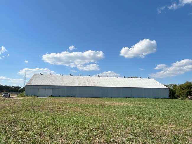
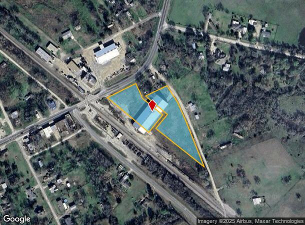
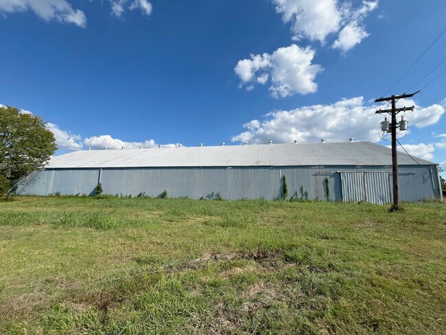
Property Record
19564 Hwy30, Shiro, TX 77876
Property Detail
19564 Hwy30
R24045
Shiro
Commercialnec
SHIRO, BLOCK 4, ACRES 3.28, 1,2,3,4, 12-17, PT OF MAYFIELD RES & S/PT BLK 4
X
Grimes
48185C0275C
Texas
2024
1
2025
3.28 AC
180302
Central Texas Area
25,000 SF
Other Market Areas
NEARBY LISTINGS FOR SALE OR LEASE
DEMOGRAPHICS near 19564 Hwy30
1 mile
3 mile
5 mile
2024 Total Population
100
370
1,344
2029 Population
111
407
1,496
Pop Growth 2024-2029
+ 11.00%
+ 10.00%
+ 11.31%
Average Age
42
43
43
2024 Total Households
40
148
534
HH Growth 2024-2029
+ 12.50%
+ 10.81%
+ 11.80%
Median Household Inc
$67,500
$63,158
$75,538
Avg Household Size
2.50
2.50
2.50
2024 Avg HH Vehicles
2.00
2.00
2.00
Median Home Value
$250,000
$225,000
$286,884
Median Year Built
1982
1981
1985
Nearby Places
Map Layers
Map Styles
 Street
 Aerial
Transit
 Traffic
 Biking
Places
Listings with unknown addresses are not visible on the map
- Restaurants
- Banks
- Shops
- Fitness
- Groceries
PUBLIC TRANSPORTATION
AIRPORT
Easterwood Field
Drive
Walk
Distance
Easterwood Field
52 min
35.6 mi
Freight Ports
Port of Houston
Drive
Walk
Distance
Port of Houston
118 min
98.0 mi
SALE & LEASE HISTORY
LISTING DATE
SALE/LEASE

Oct 16, 2024
For Sale
Nearby Properties
Address
Land Use
TOTAL SIZE
Lot Size
Zoning
Address
Land Use
TOTAL SIZE
Lot Size
Zoning
Address
Land Use
TOTAL SIZE
Lot Size
Zoning
1,200 SF
75 AC
Address
Land Use
TOTAL SIZE
Lot Size
Zoning
2,588 SF
77.57 AC
Address
Land Use
TOTAL SIZE
Lot Size
Zoning
9,572 SF
20.75 AC
Address
Land Use
TOTAL SIZE
Lot Size
Zoning
6,769 SF
13 AC
Address
Land Use
TOTAL SIZE
Lot Size
Zoning
8,240 SF
19.75 AC
Address
Land Use
TOTAL SIZE
Lot Size
Zoning
10,920 SF
11 AC
Address
Land Use
TOTAL SIZE
Lot Size
Zoning
7,024 SF
12.50 AC
Address
Land Use
TOTAL SIZE
Lot Size
Zoning
16,232 SF
59.55 AC
Address
Land Use
TOTAL SIZE
Lot Size
Zoning
60.87 AC
6
Address
Land Use
TOTAL SIZE
Lot Size
Zoning
1,245 SF
43.49 AC
Address
Land Use
TOTAL SIZE
Lot Size
Zoning
1.47 AC
5
Address
Land Use
TOTAL SIZE
Lot Size
Zoning
4,019 SF
10.01 AC
Address
Land Use
TOTAL SIZE
Lot Size
Zoning
13,616 SF
35.07 AC
Address
Land Use
TOTAL SIZE
Lot Size
Zoning
9,332 SF
33.60 AC
Address
Land Use
TOTAL SIZE
Lot Size
Zoning
15,016 SF
30 AC
Address
Land Use
TOTAL SIZE
Lot Size
Zoning
5,456 SF
4.70 AC
Address
Land Use
TOTAL SIZE
Lot Size
Zoning
5,096 SF
19.95 AC
Address
Land Use
TOTAL SIZE
Lot Size
Zoning
22,525 SF
30.23 AC
Address
Land Use
TOTAL SIZE
Lot Size
Zoning
8,526 SF
6 AC
Address
Land Use
TOTAL SIZE
Lot Size
Zoning
6,200 SF
8.24 AC
5
Address
Land Use
TOTAL SIZE
Lot Size
Zoning
2,736 SF
6.40 AC
Address
Land Use
TOTAL SIZE
Lot Size
Zoning
7,980 SF
10.22 AC
Address
Land Use
TOTAL SIZE
Lot Size
Zoning
3,861 SF
39.04 AC
Address
Land Use
TOTAL SIZE
Lot Size
Zoning
7,623 SF
3.50 AC
6
Address
Land Use
TOTAL SIZE
Lot Size
Zoning
39.89 AC
Address
Land Use
TOTAL SIZE
Lot Size
Zoning
3,853 SF
2.20 AC
Address
Land Use
TOTAL SIZE
Lot Size
Zoning
8,004 SF
49.04 AC
Address
Land Use
TOTAL SIZE
Lot Size
Zoning
5,056 SF
10 AC
The World's #1 Commercial Real Estate Marketplace
Connect with us
© 2026 CoStar Group
The information above has been obtained from sources believed reliable. While we do not doubt its accuracy we have not verified it and make no guarantee, warranty or representation about it. It is your responsibility to independently confirm its accuracy and completeness. Any projections, opinions, assumptions, or estimates used are for example only and do not represent the current or future performance of the property. The value of this transaction to you depends on tax and other factors which should be evaluated by your tax, financial, and legal advisors. You and your advisors should conduct a careful, independent investigation of the property to determine to your satisfaction the suitability of the property for your needs.