Property Record
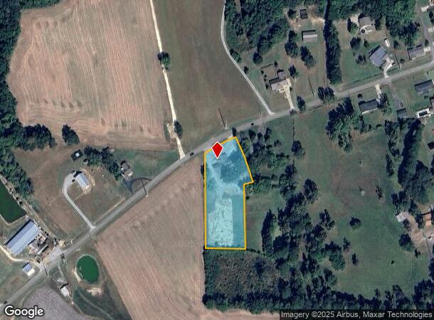
1957 Cedar Bend Rd N, Gadsden, AL 35907

NEARBY LISTINGS FOR SALE OR LEASE
Property Detail
1957 Cedar Bend Rd N
21-03-07-0-001-001.002
H/S BASE YEAR COM SE COR GOVT LT R TH W 412.5 TH N 256.72 TO POB TH N 437.47 TO SE ROW OF CEDAR BEND RD N TH NE 154.87 ALONG
Autorepair
Etowah
X
Alabama
01055C0341E
2 AC
2025
Etowah County
2025
Birmingham
010504
Gadsden, AL
3,912 SF
DEMOGRAPHICS near 1957 Cedar Bend Rd N
1 Mile
3 Mile
5 Mile
2024 Total Population
1,503
12,587
23,806
2029 Population
1,476
12,399
23,517
Pop Growth 2024-2029
(1.80%)
(1.49%)
(1.21%)
Average Age
43
42
43
2024 Total Households
596
5,115
9,698
HH Growth 2024-2029
(1.85%)
(1.52%)
(1.25%)
Median Household Inc
$92,688
$62,141
$62,103
Avg Household Size
2.50
2.40
2.40
2024 Avg HH Vehicles
2.00
2.00
2.00
Median Home Value
$193,477
$184,037
$198,062
Median Year Built
1989
1983
1982
Nearby Places
Map Layers
Map Styles
 Street
 Aerial
- Restaurants
- Banks
- Shops
- Fitness
- Groceries
Nearby Properties
Address
Land Use
TOTAL SIZE
Lot Size
Zoning
Address
Land Use
TOTAL SIZE
Lot Size
Zoning
117,758 SF
1.07 AC
Address
Land Use
TOTAL SIZE
Lot Size
Zoning
27,149 SF
2.33 AC
Address
Land Use
TOTAL SIZE
Lot Size
Zoning
40,805 SF
30.10 AC
Address
Land Use
TOTAL SIZE
Lot Size
Zoning
49,964 SF
10.36 AC
Address
Land Use
TOTAL SIZE
Lot Size
Zoning
8,288 SF
10 AC
Address
Land Use
TOTAL SIZE
Lot Size
Zoning
102,908 SF
15.90 AC
Address
Land Use
TOTAL SIZE
Lot Size
Zoning
71,320 SF
16 AC
Address
Land Use
TOTAL SIZE
Lot Size
Zoning
43,550 SF
1.15 AC
Address
Land Use
TOTAL SIZE
Lot Size
Zoning
38,983 SF
5.12 AC
Address
Land Use
TOTAL SIZE
Lot Size
Zoning
9,028 SF
8.30 AC
Address
Land Use
TOTAL SIZE
Lot Size
Zoning
5,920 SF
8 AC
Address
Land Use
TOTAL SIZE
Lot Size
Zoning
47,502 SF
9.60 AC
Address
Land Use
TOTAL SIZE
Lot Size
Zoning
26,956 SF
0.93 AC
Address
Land Use
TOTAL SIZE
Lot Size
Zoning
16,334 SF
8.50 AC
Address
Land Use
TOTAL SIZE
Lot Size
Zoning
Address
Land Use
TOTAL SIZE
Lot Size
Zoning
28,089 SF
8.90 AC
Address
Land Use
TOTAL SIZE
Lot Size
Zoning
55,564 SF
1.10 AC
Address
Land Use
TOTAL SIZE
Lot Size
Zoning
5,277 SF
2.83 AC
Address
Land Use
TOTAL SIZE
Lot Size
Zoning
7,968 SF
4.88 AC
Address
Land Use
TOTAL SIZE
Lot Size
Zoning
25,002 SF
3.24 AC
Address
Land Use
TOTAL SIZE
Lot Size
Zoning
18,091 SF
3.68 AC
Address
Land Use
TOTAL SIZE
Lot Size
Zoning
29,111 SF
0.81 AC
Address
Land Use
TOTAL SIZE
Lot Size
Zoning
48,820 SF
5.60 AC
Address
Land Use
TOTAL SIZE
Lot Size
Zoning
6,120 SF
2.33 AC
Address
Land Use
TOTAL SIZE
Lot Size
Zoning
18,917 SF
3.58 AC
Address
Land Use
TOTAL SIZE
Lot Size
Zoning
10,152 SF
1.54 AC
Address
Land Use
TOTAL SIZE
Lot Size
Zoning
17,640 SF
11.70 AC
Address
Land Use
TOTAL SIZE
Lot Size
Zoning
12,969 SF
1.91 AC
Address
Land Use
TOTAL SIZE
Lot Size
Zoning
14,629 SF
0.71 AC
Address
Land Use
TOTAL SIZE
Lot Size
Zoning
11,340 SF
2.70 AC
The World's #1 Commercial Real Estate Marketplace
Connect with us
© 2025 CoStar Group
The information above has been obtained from sources believed reliable. While we do not doubt its accuracy we have not verified it and make no guarantee, warranty or representation about it. It is your responsibility to independently confirm its accuracy and completeness. Any projections, opinions, assumptions, or estimates used are for example only and do not represent the current or future performance of the property. The value of this transaction to you depends on tax and other factors which should be evaluated by your tax, financial, and legal advisors. You and your advisors should conduct a careful, independent investigation of the property to determine to your satisfaction the suitability of the property for your needs.