Property Record
1959 Shawnee Rd, Saint Paul, MN 55122


NEARBY LISTINGS FOR SALE OR LEASE
Property Detail
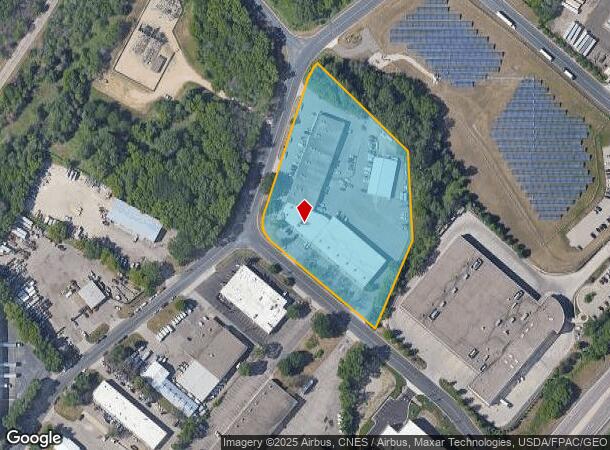
1959 Shawnee Rd
Minneapolis-St. Paul-Bloomington, MN-WI
Cedar Indust Park
10-01700-30-010
17 27 23 PT OF W 1/2 OF NW 1/4 PT OF GOV'T LOT 2 COM INT CEN LINE KENNEBEC DRIVE & N LINE CEDAR IND PK SE ON N LINE PLAT 30 FT TO PT OF BEG N 18D 07M 37SE 385.41 FT CURVE NE 63.37 FT S 46D 02M 30S E 351.86 FT S 2D 52M 30S E 244.87 FT S 22D 34M 08S W
Industrialgeneral
Dakota
X
Minnesota
27053C0479F
2
2024
4.29 AC
2024
South Central
060725
Minneapolis/St Paul
52,621 SF
DEMOGRAPHICS near 1959 Shawnee Rd
1 Mile
3 Mile
5 Mile
2024 Total Population
5,141
59,332
154,921
2029 Population
5,285
60,462
156,049
Pop Growth 2024-2029
+ 2.80%
+ 1.90%
+ 0.73%
Average Age
41
40
40
2024 Total Households
2,552
25,629
62,148
HH Growth 2024-2029
+ 2.90%
+ 2.00%
+ 0.79%
Median Household Inc
$70,317
$81,775
$86,538
Avg Household Size
2.00
2.20
2.40
2024 Avg HH Vehicles
2.00
2.00
2.00
Median Home Value
$281,473
$312,169
$316,819
Median Year Built
1985
1984
1981
Nearby Places
Map Layers
Map Styles
 Street
 Aerial
- Restaurants
- Banks
- Shops
- Fitness
- Groceries
PUBLIC TRANSPORTATION
AIRPORT
Minneapolis-St Paul International/Wold-Chamberlain
DRIVE
WALK
Distance
Minneapolis-St Paul International/Wold-Chamberlain
13 min
7.1 mi
Freight Ports
Port Milwaukee
DRIVE
WALK
Distance
Port Milwaukee
376 min
339.6 mi
SALE & LEASE HISTORY
LISTING DATE
SALE/LEASE

Nov 18, 2019
For Lease
May 11, 2023
For Lease
Nearby Properties
Address
Land Use
TOTAL SIZE
Lot Size
Zoning
Address
Land Use
TOTAL SIZE
Lot Size
Zoning
1,233,880 SF
63.49 AC
Address
Land Use
TOTAL SIZE
Lot Size
Zoning
1,341.19 AC
Address
Land Use
TOTAL SIZE
Lot Size
Zoning
4.26 AC
Address
Land Use
TOTAL SIZE
Lot Size
Zoning
154,216 SF
0.81 AC
GLC3*
Address
Land Use
TOTAL SIZE
Lot Size
Zoning
3.86 AC
Address
Land Use
TOTAL SIZE
Lot Size
Zoning
752,064 SF
24.03 AC
Address
Land Use
TOTAL SIZE
Lot Size
Zoning
4.29 AC
Address
Land Use
TOTAL SIZE
Lot Size
Zoning
78,800 SF
2.12 AC
Address
Land Use
TOTAL SIZE
Lot Size
Zoning
466,503 SF
28.74 AC
Address
Land Use
TOTAL SIZE
Lot Size
Zoning
4.20 AC
Address
Land Use
TOTAL SIZE
Lot Size
Zoning
300,663 SF
4.81 AC
Address
Land Use
TOTAL SIZE
Lot Size
Zoning
657,358 SF
17.12 AC
Address
Land Use
TOTAL SIZE
Lot Size
Zoning
264,370 SF
36.39 AC
Address
Land Use
TOTAL SIZE
Lot Size
Zoning
114,617 SF
17.68 AC
Address
Land Use
TOTAL SIZE
Lot Size
Zoning
168,729 SF
19.02 AC
Address
Land Use
TOTAL SIZE
Lot Size
Zoning
282,095 SF
2.71 AC
Address
Land Use
TOTAL SIZE
Lot Size
Zoning
263,460 SF
3.08 AC
Address
Land Use
TOTAL SIZE
Lot Size
Zoning
2.49 AC
Address
Land Use
TOTAL SIZE
Lot Size
Zoning
383,495 SF
15.41 AC
Address
Land Use
TOTAL SIZE
Lot Size
Zoning
291,589 SF
6.77 AC
Address
Land Use
TOTAL SIZE
Lot Size
Zoning
246,636 SF
7.20 AC
Address
Land Use
TOTAL SIZE
Lot Size
Zoning
192,843 SF
13.32 AC
Address
Land Use
TOTAL SIZE
Lot Size
Zoning
299,435 SF
7.65 AC
Address
Land Use
TOTAL SIZE
Lot Size
Zoning
4.20 AC
Address
Land Use
TOTAL SIZE
Lot Size
Zoning
33,246 SF
5.16 AC
Address
Land Use
TOTAL SIZE
Lot Size
Zoning
206,818 SF
2.84 AC
Address
Land Use
TOTAL SIZE
Lot Size
Zoning
314,237 SF
10.63 AC
Address
Land Use
TOTAL SIZE
Lot Size
Zoning
47,397 SF
6.78 AC
Address
Land Use
TOTAL SIZE
Lot Size
Zoning
240,316 SF
9.57 AC
Address
Land Use
TOTAL SIZE
Lot Size
Zoning
4.20 AC
The World's #1 Commercial Real Estate Marketplace
Connect with us
© 2025 CoStar Group
The information above has been obtained from sources believed reliable. While we do not doubt its accuracy we have not verified it and make no guarantee, warranty or representation about it. It is your responsibility to independently confirm its accuracy and completeness. Any projections, opinions, assumptions, or estimates used are for example only and do not represent the current or future performance of the property. The value of this transaction to you depends on tax and other factors which should be evaluated by your tax, financial, and legal advisors. You and your advisors should conduct a careful, independent investigation of the property to determine to your satisfaction the suitability of the property for your needs.