Property Record
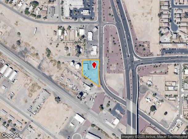
19590 N Maricopa Rd, Maricopa, AZ 85139


NEARBY LISTINGS FOR SALE OR LEASE
Property Detail
19590 N Maricopa Rd
510-28-029C
Maricopa Townsite
Servicestationmarket
BLOCK 7, SUBDIVISION BLOCK 3 OF MARICOPA TOWNSITE IN BK 04 OF MAP S PG 41 EXCEPT THE FOLLOWING DESCRIBED TWO PARCELS: COMMENCING AT THE NORTHEAST CORNER OF SAID BLOCK 7 THENCE WEST 180.00 FT TO TH E POINT OF BEGINNING THENCE SOUTH 151.39 FT THENCE NO
X
Pinal
04021C0741F
Arizona
2024
0.88 AC
2025
Outlying Pinal County
941401
Phoenix
2,760 SF
Phoenix-Mesa-Scottsdale, AZ
DEMOGRAPHICS near 19590 N Maricopa Rd
1 Mile
3 Mile
5 Mile
2024 Total Population
14,579
57,099
62,619
2029 Population
18,313
72,125
79,076
Pop Growth 2024-2029
+ 25.61%
+ 26.32%
+ 26.28%
Average Age
35
38
38
2024 Total Households
4,448
18,757
20,477
HH Growth 2024-2029
+ 25.27%
+ 26.18%
+ 26.15%
Median Household Inc
$92,778
$91,126
$90,278
Avg Household Size
3.20
3.00
3.00
2024 Avg HH Vehicles
2.00
2.00
2.00
Median Home Value
$293,010
$327,145
$324,767
Median Year Built
2005
2006
2006
Nearby Places
Map Layers
Map Styles
 Street
 Aerial
- Restaurants
- Banks
- Shops
- Fitness
- Groceries
PUBLIC TRANSPORTATION
COMMUTER RAIL
Maricopa (Sunset Limited - Amtrak, Texas Eagle - Amtrak)
DRIVE
WALK
Distance
Maricopa (Sunset Limited - Amtrak, Texas Eagle - Amtrak)
0 min
3 min
0.2 mi
AIRPORT
Phoenix Sky Harbor International
DRIVE
WALK
Distance
Phoenix Sky Harbor International
42 min
30.1 mi
Phoenix-Mesa Gateway
DRIVE
WALK
Distance
Phoenix-Mesa Gateway
50 min
35.1 mi
Freight Ports
Port of San Diego
DRIVE
WALK
Distance
Port of San Diego
366 min
340.5 mi
SALE & LEASE HISTORY
LISTING DATE
SALE/LEASE

Mar 31, 2021
For Lease
Aug 12, 2020
For Sale
Nearby Properties
Address
Land Use
TOTAL SIZE
Lot Size
Zoning
Address
Land Use
TOTAL SIZE
Lot Size
Zoning
189,104 SF
20.99 AC
Address
Land Use
TOTAL SIZE
Lot Size
Zoning
112,719 SF
14.37 AC
UNDESIGNAT
Address
Land Use
TOTAL SIZE
Lot Size
Zoning
58,073 SF
5.74 AC
Address
Land Use
TOTAL SIZE
Lot Size
Zoning
102,212 SF
11.98 AC
Address
Land Use
TOTAL SIZE
Lot Size
Zoning
78,634 SF
7.83 AC
Address
Land Use
TOTAL SIZE
Lot Size
Zoning
57,070 SF
9.05 AC
Address
Land Use
TOTAL SIZE
Lot Size
Zoning
92,929 SF
11.43 AC
Address
Land Use
TOTAL SIZE
Lot Size
Zoning
12.02 AC
UNDESIGNAT
Address
Land Use
TOTAL SIZE
Lot Size
Zoning
38,215 SF
9.84 AC
Address
Land Use
TOTAL SIZE
Lot Size
Zoning
20,801 SF
1.94 AC
Address
Land Use
TOTAL SIZE
Lot Size
Zoning
39,454 SF
5 AC
Address
Land Use
TOTAL SIZE
Lot Size
Zoning
83,747 SF
5.01 AC
Address
Land Use
TOTAL SIZE
Lot Size
Zoning
134,977 SF
4.53 AC
Address
Land Use
TOTAL SIZE
Lot Size
Zoning
124,122 SF
2.38 AC
Address
Land Use
TOTAL SIZE
Lot Size
Zoning
Address
Land Use
TOTAL SIZE
Lot Size
Zoning
38,864 SF
5.38 AC
Address
Land Use
TOTAL SIZE
Lot Size
Zoning
25,287 SF
2.72 AC
UNDESIGNAT
Address
Land Use
TOTAL SIZE
Lot Size
Zoning
8,537 SF
6.71 AC
Address
Land Use
TOTAL SIZE
Lot Size
Zoning
26.11 AC
Address
Land Use
TOTAL SIZE
Lot Size
Zoning
13.31 AC
UNDESIGNAT
Address
Land Use
TOTAL SIZE
Lot Size
Zoning
51,440 SF
4.99 AC
Address
Land Use
TOTAL SIZE
Lot Size
Zoning
19,650 SF
317.62 AC
UNDESIGNAT
Address
Land Use
TOTAL SIZE
Lot Size
Zoning
84,308 SF
2.10 AC
UNDESIGNAT
Address
Land Use
TOTAL SIZE
Lot Size
Zoning
Address
Land Use
TOTAL SIZE
Lot Size
Zoning
23,920 SF
2.55 AC
The World's #1 Commercial Real Estate Marketplace
Connect with us
© 2025 CoStar Group
The information above has been obtained from sources believed reliable. While we do not doubt its accuracy we have not verified it and make no guarantee, warranty or representation about it. It is your responsibility to independently confirm its accuracy and completeness. Any projections, opinions, assumptions, or estimates used are for example only and do not represent the current or future performance of the property. The value of this transaction to you depends on tax and other factors which should be evaluated by your tax, financial, and legal advisors. You and your advisors should conduct a careful, independent investigation of the property to determine to your satisfaction the suitability of the property for your needs.