Property Record
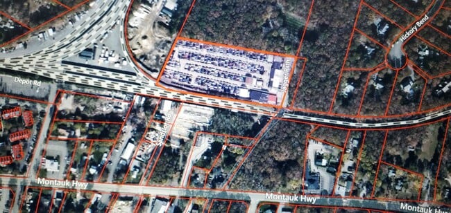
196A Jagger Path, Speonk, NY 11972


Property Detail
196A Jagger Path
0900-353-00-01-00-035-000
1988 LD EQ + 450
Storageyardjunkautowreckingsalvage
SUFFOLK
LI40
New York
B and X Area of moderate flood hazard, usually the area between the limits of the 100-year and 500-year floods.
35
0
4.17 AC
2025
Eastern Suffolk
190503
Long Island (New York)
4,200 SF
Nassau County-Suffolk County, NY
NEARBY LISTINGS FOR SALE OR LEASE
-
-
-
No Photo
-
View all Speonk listings for sale on LoopNet.com
DEMOGRAPHICS near 196A Jagger Path
1 mile
3 mile
5 mile
2025 Total Population
2,796
16,776
32,654
2030 Population
2,766
17,625
34,050
Pop Growth 2025-2030
(1.07%)
+ 5.06%
+ 4.28%
Average Age
44
45
44
2025 Total Households
1,023
6,271
11,795
HH Growth 2025-2030
(1.37%)
+ 5.12%
+ 4.48%
Median Household Inc
$124,231
$132,976
$135,246
Avg Household Size
2.60
2.60
2.70
2025 Avg HH Vehicles
2.00
2.00
2.00
Median Home Value
$874,740
$869,959
$822,510
Median Year Built
1979
1981
1984
Nearby Places
Map Layers
Map Styles
 Street
 Aerial
Layers
 Traffic
 Biking
Places
Listings with unknown addresses are not visible on the map
- Restaurants
- Banks
- Shops
- Fitness
- Groceries
PUBLIC TRANSPORTATION
COMMUTER RAIL
Speonk Station (Montauk Branch - Long Island Rail Road)
Drive
Walk
Distance
Speonk Station (Montauk Branch - Long Island Rail Road)
1 min
11 min
0.6 mi
Westhampton Station (Montauk Branch - Long Island Rail Road)
Drive
Walk
Distance
Westhampton Station (Montauk Branch - Long Island Rail Road)
7 min
3.9 mi
AIRPORT
Long Island MacArthur
Drive
Walk
Distance
Long Island MacArthur
37 min
23.6 mi
Freight Ports
Port of New Haven
Drive
Walk
Distance
Port of New Haven
152 min
64.2 mi
SALE & LEASE HISTORY
LISTING DATE
SALE/LEASE

Dec 14, 2022
For Sale
Nearby Properties
Address
Land Use
TOTAL SIZE
Lot Size
Zoning
Address
Land Use
TOTAL SIZE
Lot Size
Zoning
53,067 SF
6.20 AC
R2
Address
Land Use
TOTAL SIZE
Lot Size
Zoning
55,202 SF
18.50 AC
R2
Address
Land Use
TOTAL SIZE
Lot Size
Zoning
200 SF
67.80 AC
CR200
Address
Land Use
TOTAL SIZE
Lot Size
Zoning
8.26 AC
LI200
Address
Land Use
TOTAL SIZE
Lot Size
Zoning
68,676 SF
9.70 AC
CR200
Address
Land Use
TOTAL SIZE
Lot Size
Zoning
18.28 AC
CR200
Address
Land Use
TOTAL SIZE
Lot Size
Zoning
15,084 SF
10.25 AC
R40
Address
Land Use
TOTAL SIZE
Lot Size
Zoning
31,393 SF
4.90 AC
R3
Address
Land Use
TOTAL SIZE
Lot Size
Zoning
87,569 SF
19 AC
R120
Address
Land Use
TOTAL SIZE
Lot Size
Zoning
28.62 AC
R40
Address
Land Use
TOTAL SIZE
Lot Size
Zoning
36,918 SF
6.27 AC
R40
Address
Land Use
TOTAL SIZE
Lot Size
Zoning
26,798 SF
34.06 AC
CR200
Address
Land Use
TOTAL SIZE
Lot Size
Zoning
7,270 SF
4.20 AC
R2
Address
Land Use
TOTAL SIZE
Lot Size
Zoning
30,512 SF
4.28 AC
VB
Address
Land Use
TOTAL SIZE
Lot Size
Zoning
16,854 SF
11.95 AC
OD
Address
Land Use
TOTAL SIZE
Lot Size
Zoning
92.10 AC
CR200
Address
Land Use
TOTAL SIZE
Lot Size
Zoning
20,822 SF
2.60 AC
B1
Address
Land Use
TOTAL SIZE
Lot Size
Zoning
9,069 SF
4.19 AC
R60
Address
Land Use
TOTAL SIZE
Lot Size
Zoning
7,032 SF
1.96 AC
R1
Address
Land Use
TOTAL SIZE
Lot Size
Zoning
1,500 SF
14.01 AC
CR200
Address
Land Use
TOTAL SIZE
Lot Size
Zoning
6,480 SF
0.16 AC
VILLA
Address
Land Use
TOTAL SIZE
Lot Size
Zoning
10,770 SF
1.50 AC
B1
Address
Land Use
TOTAL SIZE
Lot Size
Zoning
7.40 AC
R40
Address
Land Use
TOTAL SIZE
Lot Size
Zoning
90.50 AC
CR200
Address
Land Use
TOTAL SIZE
Lot Size
Zoning
20,697 SF
1.91 AC
B1
Address
Land Use
TOTAL SIZE
Lot Size
Zoning
3.66 AC
B3
Address
Land Use
TOTAL SIZE
Lot Size
Zoning
11.41 AC
B3
Address
Land Use
TOTAL SIZE
Lot Size
Zoning
1,680 SF
9.50 AC
I1
Address
Land Use
TOTAL SIZE
Lot Size
Zoning
78.40 AC
CR200
Address
Land Use
TOTAL SIZE
Lot Size
Zoning
7,271 SF
2.05 AC
R1
The World's #1 Commercial Real Estate Marketplace
Connect with us
© 2026 CoStar Group
The information above has been obtained from sources believed reliable. While we do not doubt its accuracy we have not verified it and make no guarantee, warranty or representation about it. It is your responsibility to independently confirm its accuracy and completeness. Any projections, opinions, assumptions, or estimates used are for example only and do not represent the current or future performance of the property. The value of this transaction to you depends on tax and other factors which should be evaluated by your tax, financial, and legal advisors. You and your advisors should conduct a careful, independent investigation of the property to determine to your satisfaction the suitability of the property for your needs.