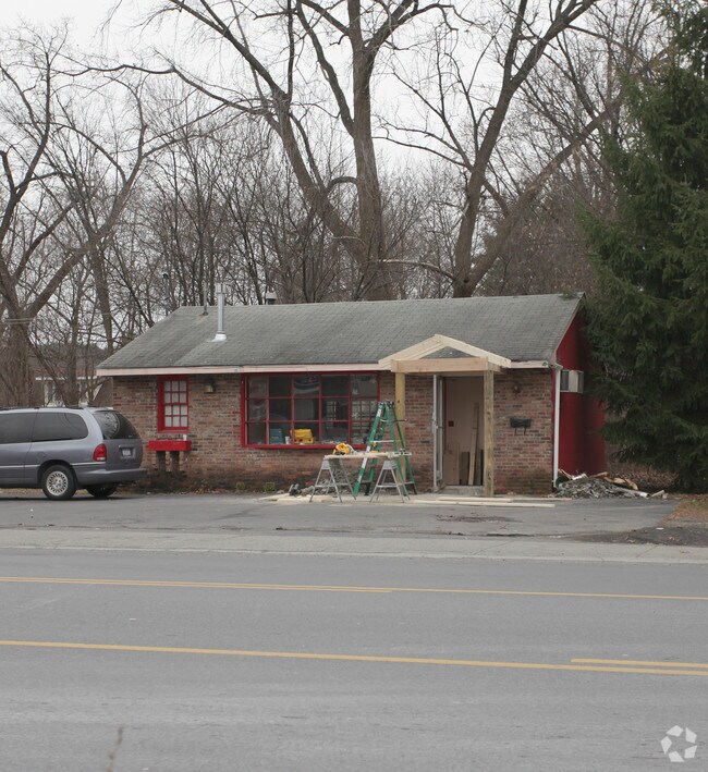
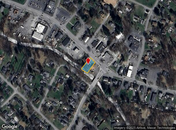
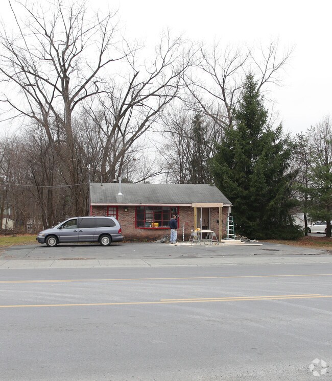
Property Record
196 Main Ave, Wynantskill, NY 12198
NEARBY LISTINGS FOR SALE OR LEASE
Property Detail
196 Main Ave
3200-124.6-9-5
Rensselaer
Storesoffices
New York
ARE
5.000
36083C0234D
0.20 AC
2025
Outer Rensselaer County
2024
Albany/Schenectady/Troy
052305
Albany-Schenectady-Troy, NY
DEMOGRAPHICS near 196 Main Ave
1 Mile
3 Mile
5 Mile
2024 Total Population
3,404
26,719
88,486
2029 Population
3,364
26,519
87,599
Pop Growth 2024-2029
(1.18%)
(0.75%)
(1.00%)
Average Age
44
41
39
2024 Total Households
1,450
10,727
37,168
HH Growth 2024-2029
(1.38%)
(0.86%)
(1.02%)
Median Household Inc
$77,513
$81,486
$67,828
Avg Household Size
2.30
2.30
2.20
2024 Avg HH Vehicles
2.00
2.00
2.00
Median Home Value
$198,448
$216,721
$216,841
Median Year Built
1957
1965
1958
Nearby Places
- Restaurants
- Banks
- Shops
- Fitness
- Groceries
PUBLIC TRANSPORTATION
COMMUTER RAIL
DRIVE
WALK
Distance
18 min
8.8 mi
AIRPORT
Albany International
DRIVE
WALK
Distance
Albany International
23 min
12.0 mi
Freight Ports
Albany, NY Port
DRIVE
WALK
Distance
Albany, NY Port
21 min
10.6 mi
Nearby Properties
Address
Land Use
TOTAL SIZE
Lot Size
Zoning
Address
Land Use
TOTAL SIZE
Lot Size
Zoning
120,579 SF
49.20 AC
CI
Address
Land Use
TOTAL SIZE
Lot Size
Zoning
Address
Land Use
TOTAL SIZE
Lot Size
Zoning
35,392 SF
73.57 AC
CI
Address
Land Use
TOTAL SIZE
Lot Size
Zoning
413,006 SF
37.94 AC
CI
Address
Land Use
TOTAL SIZE
Lot Size
Zoning
Address
Land Use
TOTAL SIZE
Lot Size
Zoning
11,264 SF
34.83 AC
MF
Address
Land Use
TOTAL SIZE
Lot Size
Zoning
136,218 SF
15.39 AC
CC
Address
Land Use
TOTAL SIZE
Lot Size
Zoning
3,202 SF
7.34 AC
CI
Address
Land Use
TOTAL SIZE
Lot Size
Zoning
Address
Land Use
TOTAL SIZE
Lot Size
Zoning
12,954 SF
28.60 AC
MF
Address
Land Use
TOTAL SIZE
Lot Size
Zoning
6,970 SF
11.05 AC
MULTI
Address
Land Use
TOTAL SIZE
Lot Size
Zoning
7,734 SF
8.96 AC
MF
Address
Land Use
TOTAL SIZE
Lot Size
Zoning
55,093 SF
8.25 AC
MF
Address
Land Use
TOTAL SIZE
Lot Size
Zoning
Address
Land Use
TOTAL SIZE
Lot Size
Zoning
66,080 SF
2.22 AC
MU2
Address
Land Use
TOTAL SIZE
Lot Size
Zoning
99,600 SF
11.50 AC
CC
Address
Land Use
TOTAL SIZE
Lot Size
Zoning
115,200 SF
10.73 AC
MF
Address
Land Use
TOTAL SIZE
Lot Size
Zoning
14,608 SF
0.60 AC
CC
Address
Land Use
TOTAL SIZE
Lot Size
Zoning
16,782 SF
5.30 AC
MF
Address
Land Use
TOTAL SIZE
Lot Size
Zoning
66.14 AC
Address
Land Use
TOTAL SIZE
Lot Size
Zoning
6,000 SF
2.95 AC
MF
Address
Land Use
TOTAL SIZE
Lot Size
Zoning
2.70 AC
SF
Address
Land Use
TOTAL SIZE
Lot Size
Zoning
59,294 SF
8.98 AC
CI
Address
Land Use
TOTAL SIZE
Lot Size
Zoning
0.01 AC
WMU
Address
Land Use
TOTAL SIZE
Lot Size
Zoning
52,171 SF
10.80 AC
MF
Address
Land Use
TOTAL SIZE
Lot Size
Zoning
14,058 SF
7.35 AC
MF
Address
Land Use
TOTAL SIZE
Lot Size
Zoning
45,832 SF
1.12 AC
TF
Address
Land Use
TOTAL SIZE
Lot Size
Zoning
4,150 SF
1.29 AC
MU1
Address
Land Use
TOTAL SIZE
Lot Size
Zoning
2,460 SF
2.68 AC
MF
Address
Land Use
TOTAL SIZE
Lot Size
Zoning
14.46 AC
BD
The World's #1 Commercial Real Estate Marketplace
Connect with us
© 2025 CoStar Group
The information above has been obtained from sources believed reliable. While we do not doubt its accuracy we have not verified it and make no guarantee, warranty or representation about it. It is your responsibility to independently confirm its accuracy and completeness. Any projections, opinions, assumptions, or estimates used are for example only and do not represent the current or future performance of the property. The value of this transaction to you depends on tax and other factors which should be evaluated by your tax, financial, and legal advisors. You and your advisors should conduct a careful, independent investigation of the property to determine to your satisfaction the suitability of the property for your needs.