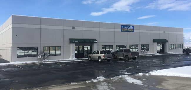
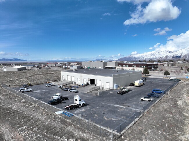
Property Record
196 Millburn St, Tooele, UT 84074


Property Detail
196 Millburn St
Salt Lake City-Murray, UT
ALL OF LOT 7, TOOELE CITY COMMERCIAL PARK PHASE I SUBDIVISION 4.03 AC ---ALSO BEG AT A PT ON THE SW COR OF LOT 7, TOOELE CITY
10-029-F-0007
TOOELE
Commercialnec
Utah
B and X Area of moderate flood hazard, usually the area between the limits of the 100-year and 500-year floods.
7
2025
4.89 AC
2025
Tooele County
130900
Salt Lake City
17,749 SF
NEARBY LISTINGS FOR SALE OR LEASE
-
-
View all Tooele listings for lease on LoopNet.com
DEMOGRAPHICS near 196 Millburn St
1 mile
3 mile
5 mile
2025 Total Population
5,399
37,777
43,868
2030 Population
5,997
42,198
49,038
Pop Growth 2025-2030
+ 11.08%
+ 11.70%
+ 11.79%
Average Age
35
34
34
2025 Total Households
1,769
12,209
13,924
HH Growth 2025-2030
+ 11.14%
+ 11.72%
+ 11.81%
Median Household Inc
$87,892
$87,699
$89,614
Avg Household Size
3.00
3.10
3.10
2025 Avg HH Vehicles
3.00
2.00
3.00
Median Home Value
$388,560
$402,034
$412,333
Median Year Built
1991
1994
1995
Nearby Places
Map Layers
Map Styles
 Street
 Aerial
Layers
 Traffic
 Biking
Places
Listings with unknown addresses are not visible on the map
- Restaurants
- Banks
- Shops
- Fitness
- Groceries
PUBLIC TRANSPORTATION
AIRPORT
Salt Lake City International
Drive
Walk
Distance
Salt Lake City International
43 min
32.2 mi
SALE & LEASE HISTORY
LISTING DATE
SALE/LEASE

Sep 14, 2023
For Lease
Mar 28, 2019
For Lease
Nearby Properties
Address
Land Use
TOTAL SIZE
Lot Size
Zoning
Address
Land Use
TOTAL SIZE
Lot Size
Zoning
205,900 SF
107.47 AC
Address
Land Use
TOTAL SIZE
Lot Size
Zoning
8.47 AC
Address
Land Use
TOTAL SIZE
Lot Size
Zoning
610,536 SF
48.93 AC
Address
Land Use
TOTAL SIZE
Lot Size
Zoning
263,948 SF
47.90 AC
Address
Land Use
TOTAL SIZE
Lot Size
Zoning
8.32 AC
Address
Land Use
TOTAL SIZE
Lot Size
Zoning
999,999 SF
10.51 AC
Address
Land Use
TOTAL SIZE
Lot Size
Zoning
339,571 SF
35.61 AC
Address
Land Use
TOTAL SIZE
Lot Size
Zoning
166,140 SF
7 AC
Address
Land Use
TOTAL SIZE
Lot Size
Zoning
90,340 SF
41.76 AC
Address
Land Use
TOTAL SIZE
Lot Size
Zoning
14,400 SF
5.48 AC
Address
Land Use
TOTAL SIZE
Lot Size
Zoning
3,188 SF
7.64 AC
Address
Land Use
TOTAL SIZE
Lot Size
Zoning
54,648 SF
4.53 AC
Address
Land Use
TOTAL SIZE
Lot Size
Zoning
140,412 SF
10.38 AC
Address
Land Use
TOTAL SIZE
Lot Size
Zoning
86,615 SF
8.87 AC
Address
Land Use
TOTAL SIZE
Lot Size
Zoning
5.34 AC
Address
Land Use
TOTAL SIZE
Lot Size
Zoning
191,115 SF
18.09 AC
Address
Land Use
TOTAL SIZE
Lot Size
Zoning
3.50 AC
Address
Land Use
TOTAL SIZE
Lot Size
Zoning
114,155 SF
20 AC
Address
Land Use
TOTAL SIZE
Lot Size
Zoning
55,381 SF
4.68 AC
Address
Land Use
TOTAL SIZE
Lot Size
Zoning
59,960 SF
16.45 AC
Address
Land Use
TOTAL SIZE
Lot Size
Zoning
191,148 SF
11.08 AC
Address
Land Use
TOTAL SIZE
Lot Size
Zoning
60,127 SF
1.67 AC
Address
Land Use
TOTAL SIZE
Lot Size
Zoning
53,151 SF
1.18 AC
Address
Land Use
TOTAL SIZE
Lot Size
Zoning
1,532 SF
40.33 AC
Address
Land Use
TOTAL SIZE
Lot Size
Zoning
2,540 SF
2.25 AC
Address
Land Use
TOTAL SIZE
Lot Size
Zoning
24,550 SF
0.86 AC
Address
Land Use
TOTAL SIZE
Lot Size
Zoning
60,169 SF
40.57 AC
Address
Land Use
TOTAL SIZE
Lot Size
Zoning
29,667 SF
6.48 AC
Address
Land Use
TOTAL SIZE
Lot Size
Zoning
59,652 SF
2.37 AC
The World's #1 Commercial Real Estate Marketplace
Connect with us
© 2026 CoStar Group
The information above has been obtained from sources believed reliable. While we do not doubt its accuracy we have not verified it and make no guarantee, warranty or representation about it. It is your responsibility to independently confirm its accuracy and completeness. Any projections, opinions, assumptions, or estimates used are for example only and do not represent the current or future performance of the property. The value of this transaction to you depends on tax and other factors which should be evaluated by your tax, financial, and legal advisors. You and your advisors should conduct a careful, independent investigation of the property to determine to your satisfaction the suitability of the property for your needs.