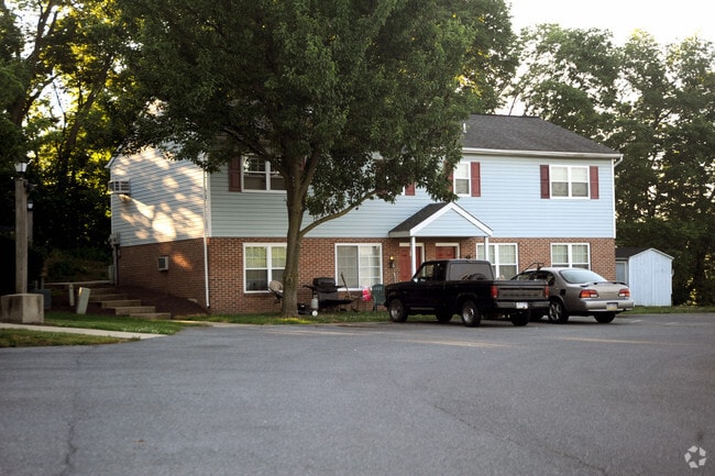
Property Record
196 Stonehouse Ln, Lancaster, PA 17603


NEARBY LISTINGS FOR SALE OR LEASE
Property Detail
196 Stonehouse Ln
Lancaster, PA
Walnut Ridge West
300-78530-0-0000
196 STONEHOUSE LN
Apartment
Lancaster
X
Pennsylvania
42071C0339F
65
2024
2.90 AC
2025
Columbia/Washington Boro
013502
Philadelphia
14,592 SF
DEMOGRAPHICS near 196 Stonehouse Ln
1 Mile
3 Mile
5 Mile
2024 Total Population
2,384
29,016
56,280
2029 Population
2,398
29,205
56,750
Pop Growth 2024-2029
+ 0.59%
+ 0.65%
+ 0.84%
Average Age
39
41
41
2024 Total Households
928
11,494
22,182
HH Growth 2024-2029
+ 0.65%
+ 0.64%
+ 0.85%
Median Household Inc
$50,222
$69,157
$77,186
Avg Household Size
2.60
2.50
2.50
2024 Avg HH Vehicles
2.00
2.00
2.00
Median Home Value
$250,000
$218,656
$237,313
Median Year Built
1979
1973
1976
Nearby Places
Map Layers
Map Styles
 Street
 Aerial
- Restaurants
- Banks
- Shops
- Fitness
- Groceries
PUBLIC TRANSPORTATION
COMMUTER RAIL
Mount Joy Amtrak (Keystone Service - Amtrak)
DRIVE
WALK
Distance
Mount Joy Amtrak (Keystone Service - Amtrak)
16 min
8.9 mi
AIRPORT
Harrisburg International
DRIVE
WALK
Distance
Harrisburg International
41 min
23.2 mi
Freight Ports
Port of Baltimore
DRIVE
WALK
Distance
Port of Baltimore
101 min
70.4 mi
Nearby Properties
Address
Land Use
TOTAL SIZE
Lot Size
Zoning
Address
Land Use
TOTAL SIZE
Lot Size
Zoning
243,960 SF
39.27 AC
Address
Land Use
TOTAL SIZE
Lot Size
Zoning
215,601 SF
50.74 AC
R-3
Address
Land Use
TOTAL SIZE
Lot Size
Zoning
144,849 SF
10 AC
Address
Land Use
TOTAL SIZE
Lot Size
Zoning
97,158 SF
16.55 AC
R-2
Address
Land Use
TOTAL SIZE
Lot Size
Zoning
168,819 SF
38.90 AC
INSR
Address
Land Use
TOTAL SIZE
Lot Size
Zoning
51,459 SF
89.10 AC
R
Address
Land Use
TOTAL SIZE
Lot Size
Zoning
121,268 SF
11.12 AC
RH1
Address
Land Use
TOTAL SIZE
Lot Size
Zoning
160,117 SF
13 AC
I-2
Address
Land Use
TOTAL SIZE
Lot Size
Zoning
64,326 SF
2.20 AC
INSR
Address
Land Use
TOTAL SIZE
Lot Size
Zoning
121,872 SF
15.72 AC
RH1
Address
Land Use
TOTAL SIZE
Lot Size
Zoning
126,086 SF
21.70 AC
R-2
Address
Land Use
TOTAL SIZE
Lot Size
Zoning
164,150 SF
15.68 AC
Address
Land Use
TOTAL SIZE
Lot Size
Zoning
456,878 SF
22.60 AC
I-2
Address
Land Use
TOTAL SIZE
Lot Size
Zoning
64,300 SF
9.30 AC
A
Address
Land Use
TOTAL SIZE
Lot Size
Zoning
61,140 SF
4.07 AC
OS
Address
Land Use
TOTAL SIZE
Lot Size
Zoning
97,926 SF
21.70 AC
Address
Land Use
TOTAL SIZE
Lot Size
Zoning
64,756 SF
8.70 AC
C-2
Address
Land Use
TOTAL SIZE
Lot Size
Zoning
181,404 SF
28.96 AC
Address
Land Use
TOTAL SIZE
Lot Size
Zoning
88,224 SF
38.58 AC
INSR
Address
Land Use
TOTAL SIZE
Lot Size
Zoning
56,389 SF
10.16 AC
Address
Land Use
TOTAL SIZE
Lot Size
Zoning
105,327 SF
13.80 AC
C-2
Address
Land Use
TOTAL SIZE
Lot Size
Zoning
54,597 SF
13.70 AC
I-2
Address
Land Use
TOTAL SIZE
Lot Size
Zoning
123,082 SF
15.10 AC
I-2
Address
Land Use
TOTAL SIZE
Lot Size
Zoning
121,370 SF
16 AC
I-1
Address
Land Use
TOTAL SIZE
Lot Size
Zoning
83,124 SF
2.80 AC
HDRM
Address
Land Use
TOTAL SIZE
Lot Size
Zoning
49,993 SF
4.07 AC
INSR
Address
Land Use
TOTAL SIZE
Lot Size
Zoning
5,708 SF
219.90 AC
Address
Land Use
TOTAL SIZE
Lot Size
Zoning
103,550 SF
1 AC
HDR
Address
Land Use
TOTAL SIZE
Lot Size
Zoning
61,056 SF
5.56 AC
Address
Land Use
TOTAL SIZE
Lot Size
Zoning
43,000 SF
5.77 AC
I-2
The World's #1 Commercial Real Estate Marketplace
Connect with us
© 2025 CoStar Group
The information above has been obtained from sources believed reliable. While we do not doubt its accuracy we have not verified it and make no guarantee, warranty or representation about it. It is your responsibility to independently confirm its accuracy and completeness. Any projections, opinions, assumptions, or estimates used are for example only and do not represent the current or future performance of the property. The value of this transaction to you depends on tax and other factors which should be evaluated by your tax, financial, and legal advisors. You and your advisors should conduct a careful, independent investigation of the property to determine to your satisfaction the suitability of the property for your needs.