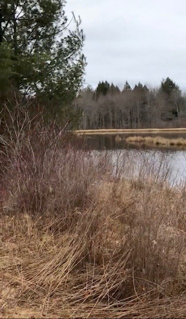
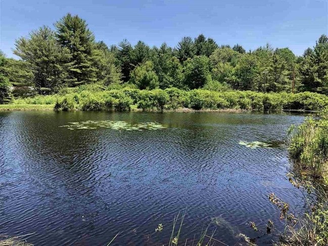
Property Record
196 Tamarack Rd, Greenfield Park, NY 12435

NEARBY LISTINGS FOR SALE OR LEASE
-
-
View all Greenfield Park listings for sale on LoopNet.com
Property Detail
196 Tamarack Rd
5689-081.002-0002-035.000-0000
Ulster
Residentialacreage
New York
X
35.000
36111C0675F
8.70 AC
2025
Hudson Valley Area
2024
Other Market Areas
954700
Kingston, NY
DEMOGRAPHICS near 196 Tamarack Rd
1 Mile
3 Mile
5 Mile
2024 Total Population
110
1,879
9,881
2029 Population
111
1,963
10,248
Pop Growth 2024-2029
+ 0.91%
+ 4.47%
+ 3.71%
Average Age
45
44
42
2024 Total Households
40
580
2,840
HH Growth 2024-2029
0.00%
+ 5.17%
+ 4.61%
Median Household Inc
$67,500
$72,980
$58,426
Avg Household Size
2.30
2.50
2.50
2024 Avg HH Vehicles
2.00
2.00
2.00
Median Home Value
$274,999
$184,966
$180,018
Median Year Built
1958
1970
1980
Nearby Places
- Restaurants
- Banks
- Shops
- Fitness
- Groceries
PUBLIC TRANSPORTATION
AIRPORT
New York Stewart International
DRIVE
WALK
Distance
New York Stewart International
55 min
37.3 mi
Freight Ports
Albany, NY Port
DRIVE
WALK
Distance
Albany, NY Port
103 min
85.8 mi
SALE & LEASE HISTORY
LISTING DATE
SALE/LEASE

Sep 17, 2021
For Sale
May 08, 2019
For Sale
Nearby Properties
Address
Land Use
TOTAL SIZE
Lot Size
Zoning
Address
Land Use
TOTAL SIZE
Lot Size
Zoning
14,400 SF
107 AC
RU
Address
Land Use
TOTAL SIZE
Lot Size
Zoning
10,387 SF
94.20 AC
RU
Address
Land Use
TOTAL SIZE
Lot Size
Zoning
3,640 SF
52.80 AC
RU
Address
Land Use
TOTAL SIZE
Lot Size
Zoning
3,506 SF
125.90 AC
Address
Land Use
TOTAL SIZE
Lot Size
Zoning
10,558 SF
125.40 AC
RU
Address
Land Use
TOTAL SIZE
Lot Size
Zoning
22,875 SF
101.40 AC
Address
Land Use
TOTAL SIZE
Lot Size
Zoning
2,106 SF
32.40 AC
Address
Land Use
TOTAL SIZE
Lot Size
Zoning
Address
Land Use
TOTAL SIZE
Lot Size
Zoning
4,232 SF
85.30 AC
RU
Address
Land Use
TOTAL SIZE
Lot Size
Zoning
6,060 SF
92.14 AC
Address
Land Use
TOTAL SIZE
Lot Size
Zoning
5,255 SF
44.94 AC
R1
Address
Land Use
TOTAL SIZE
Lot Size
Zoning
71.90 AC
RU
Address
Land Use
TOTAL SIZE
Lot Size
Zoning
30,916 SF
138 AC
Address
Land Use
TOTAL SIZE
Lot Size
Zoning
13,464 SF
40 AC
RU
Address
Land Use
TOTAL SIZE
Lot Size
Zoning
5,700 SF
50 AC
Address
Land Use
TOTAL SIZE
Lot Size
Zoning
2,833 SF
164.40 AC
RU
Address
Land Use
TOTAL SIZE
Lot Size
Zoning
5,172 SF
19.60 AC
BH
Address
Land Use
TOTAL SIZE
Lot Size
Zoning
2,400 SF
106.42 AC
RU
Address
Land Use
TOTAL SIZE
Lot Size
Zoning
3,588 SF
76.30 AC
RU
Address
Land Use
TOTAL SIZE
Lot Size
Zoning
4,824 SF
64 AC
RR40
Address
Land Use
TOTAL SIZE
Lot Size
Zoning
7,680 SF
28.90 AC
BH
Address
Land Use
TOTAL SIZE
Lot Size
Zoning
1,040 SF
123.60 AC
RU
Address
Land Use
TOTAL SIZE
Lot Size
Zoning
7,176 SF
2.68 AC
Address
Land Use
TOTAL SIZE
Lot Size
Zoning
1,968 SF
94.46 AC
RU
Address
Land Use
TOTAL SIZE
Lot Size
Zoning
1,414 SF
158.20 AC
RU
Address
Land Use
TOTAL SIZE
Lot Size
Zoning
2,576 SF
81.10 AC
RU
Address
Land Use
TOTAL SIZE
Lot Size
Zoning
2,085 SF
5 AC
RU
Address
Land Use
TOTAL SIZE
Lot Size
Zoning
2,080 SF
127 AC
RU
Address
Land Use
TOTAL SIZE
Lot Size
Zoning
15,456 SF
210.30 AC
BH
Address
Land Use
TOTAL SIZE
Lot Size
Zoning
1,600 SF
54.40 AC
RR40
The World's #1 Commercial Real Estate Marketplace
Connect with us
© 2025 CoStar Group
The information above has been obtained from sources believed reliable. While we do not doubt its accuracy we have not verified it and make no guarantee, warranty or representation about it. It is your responsibility to independently confirm its accuracy and completeness. Any projections, opinions, assumptions, or estimates used are for example only and do not represent the current or future performance of the property. The value of this transaction to you depends on tax and other factors which should be evaluated by your tax, financial, and legal advisors. You and your advisors should conduct a careful, independent investigation of the property to determine to your satisfaction the suitability of the property for your needs.