Property Record
196 Water St, Stonington, CT 06378


NEARBY LISTINGS FOR SALE OR LEASE
-
-
View all Stonington listings for sale on LoopNet.com
Property Detail
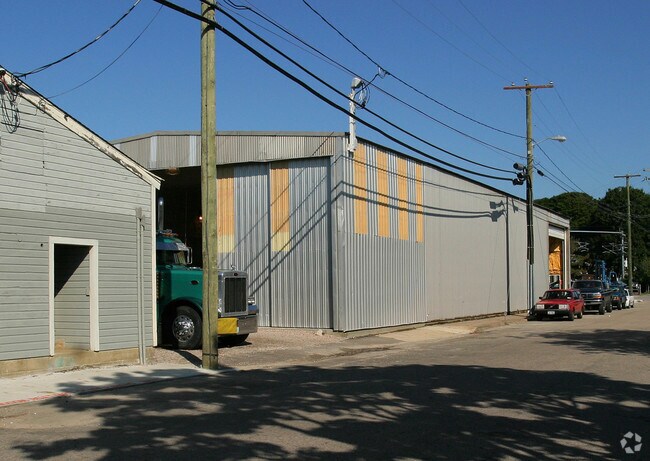
196 Water St
STON-000100-000006-000001
New London
Commercialnec
Connecticut
VE
1
09011C0533J
4.30 AC
2025
SE New London
2025
Hartford
705200
Norwich-New London, CT
DEMOGRAPHICS near 196 Water St
1 Mile
3 Mile
5 Mile
2024 Total Population
1,974
6,157
32,903
2029 Population
2,008
6,241
33,285
Pop Growth 2024-2029
+ 1.72%
+ 1.36%
+ 1.16%
Average Age
52
50
48
2024 Total Households
1,044
2,889
14,854
HH Growth 2024-2029
+ 1.72%
+ 1.38%
+ 1.10%
Median Household Inc
$87,695
$101,647
$98,762
Avg Household Size
1.90
2.00
2.10
2024 Avg HH Vehicles
2.00
2.00
2.00
Median Home Value
$655,619
$550,375
$416,880
Median Year Built
1946
1953
1965
Nearby Places
Map Layers
Map Styles
 Street
 Aerial
- Restaurants
- Banks
- Shops
- Fitness
- Groceries
PUBLIC TRANSPORTATION
COMMUTER RAIL
Mystic Amtrak (Northeast Regional - Amtrak)
DRIVE
WALK
Distance
Mystic Amtrak (Northeast Regional - Amtrak)
8 min
4.3 mi
Westerly Amtrak Station (Northeast Regional - Amtrak)
DRIVE
WALK
Distance
Westerly Amtrak Station (Northeast Regional - Amtrak)
10 min
5.9 mi
Freight Ports
Port of Davisville, RI
DRIVE
WALK
Distance
Port of Davisville, RI
62 min
43.1 mi
Nearby Properties
Address
Land Use
TOTAL SIZE
Lot Size
Zoning
Address
Land Use
TOTAL SIZE
Lot Size
Zoning
32.59 AC
RA-40
Address
Land Use
TOTAL SIZE
Lot Size
Zoning
138,366 SF
11.20 AC
GDD
Address
Land Use
TOTAL SIZE
Lot Size
Zoning
139,952 SF
5.81 AC
GDD
Address
Land Use
TOTAL SIZE
Lot Size
Zoning
74,328 SF
19.50 AC
RR-80
Address
Land Use
TOTAL SIZE
Lot Size
Zoning
45,795 SF
5.60 AC
GDD
Address
Land Use
TOTAL SIZE
Lot Size
Zoning
40.80 AC
M-1
Address
Land Use
TOTAL SIZE
Lot Size
Zoning
85,073 SF
17.60 AC
RA-20
Address
Land Use
TOTAL SIZE
Lot Size
Zoning
68,206 SF
6.40 AC
M-1
Address
Land Use
TOTAL SIZE
Lot Size
Zoning
25.88 AC
RR-80
Address
Land Use
TOTAL SIZE
Lot Size
Zoning
46,652 SF
12.23 AC
RC-120
Address
Land Use
TOTAL SIZE
Lot Size
Zoning
74,984 SF
15.63 AC
M-1
Address
Land Use
TOTAL SIZE
Lot Size
Zoning
48.70 AC
GB-130
Address
Land Use
TOTAL SIZE
Lot Size
Zoning
3.50 AC
RC-120
Address
Land Use
TOTAL SIZE
Lot Size
Zoning
40,534 SF
20.84 AC
RC-120
Address
Land Use
TOTAL SIZE
Lot Size
Zoning
4.80 AC
RL
Address
Land Use
TOTAL SIZE
Lot Size
Zoning
7.62 AC
RM-20
Address
Land Use
TOTAL SIZE
Lot Size
Zoning
2,616 SF
3.21 AC
RR-80
Address
Land Use
TOTAL SIZE
Lot Size
Zoning
12.89 AC
M-1
Address
Land Use
TOTAL SIZE
Lot Size
Zoning
71,673 SF
4.30 AC
M-1
Address
Land Use
TOTAL SIZE
Lot Size
Zoning
1.15 AC
MC-80
Address
Land Use
TOTAL SIZE
Lot Size
Zoning
12.40 AC
RM-20
Address
Land Use
TOTAL SIZE
Lot Size
Zoning
3 AC
RR-80
Address
Land Use
TOTAL SIZE
Lot Size
Zoning
21.96 AC
TC-80
Address
Land Use
TOTAL SIZE
Lot Size
Zoning
22,538 SF
3.26 AC
GC-60
Address
Land Use
TOTAL SIZE
Lot Size
Zoning
17,925 SF
5.38 AC
LS-5
Address
Land Use
TOTAL SIZE
Lot Size
Zoning
40,846 SF
1.92 AC
M-1
Address
Land Use
TOTAL SIZE
Lot Size
Zoning
2.30 AC
RR-80
Address
Land Use
TOTAL SIZE
Lot Size
Zoning
3.60 AC
RR-80
Address
Land Use
TOTAL SIZE
Lot Size
Zoning
2.60 AC
MC-80
Address
Land Use
TOTAL SIZE
Lot Size
Zoning
8.50 AC
LI-130
The World's #1 Commercial Real Estate Marketplace
Connect with us
© 2025 CoStar Group
The information above has been obtained from sources believed reliable. While we do not doubt its accuracy we have not verified it and make no guarantee, warranty or representation about it. It is your responsibility to independently confirm its accuracy and completeness. Any projections, opinions, assumptions, or estimates used are for example only and do not represent the current or future performance of the property. The value of this transaction to you depends on tax and other factors which should be evaluated by your tax, financial, and legal advisors. You and your advisors should conduct a careful, independent investigation of the property to determine to your satisfaction the suitability of the property for your needs.