Property Record
1960 N Loop Rd, Alameda, CA 94502


NEARBY LISTINGS FOR SALE OR LEASE
Property Detail
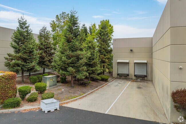
1960 N Loop Rd
074-1359-022-00
Parcel Map 9286
Lightindustrial
LOT: 00004 BLK: PM: 0296 PAGE: 0055
X
Alameda
06001C0251H
California
2024
1.63 AC
2025
Alameda
428301
East Bay/Oakland
24,450 SF
Oakland-Hayward-Berkeley, CA
DEMOGRAPHICS near 1960 N Loop Rd
1 Mile
3 Mile
5 Mile
2024 Total Population
9,230
47,434
305,467
2029 Population
8,953
46,032
295,478
Pop Growth 2024-2029
(3.00%)
(2.96%)
(3.27%)
Average Age
44
43
39
2024 Total Households
3,258
18,332
102,969
HH Growth 2024-2029
(3.19%)
(3.16%)
(3.39%)
Median Household Inc
$188,947
$124,427
$76,376
Avg Household Size
2.80
2.50
2.80
2024 Avg HH Vehicles
2.00
2.00
2.00
Median Home Value
$1,003,887
$1,057,433
$783,861
Median Year Built
1980
1964
1955
Nearby Places
Map Layers
Map Styles
 Street
 Aerial
- Restaurants
- Banks
- Shops
- Fitness
- Groceries
PUBLIC TRANSPORTATION
COMMUTER RAIL
DRIVE
WALK
Distance
17 min
8.2 mi
AIRPORT
Metro Oakland International
DRIVE
WALK
Distance
Metro Oakland International
5 min
2.0 mi
San Francisco International
DRIVE
WALK
Distance
San Francisco International
45 min
33.0 mi
Norman Y Mineta San Jose International
DRIVE
WALK
Distance
Norman Y Mineta San Jose International
49 min
37.5 mi
Freight Ports
Port of Oakland
DRIVE
WALK
Distance
Port of Oakland
18 min
8.7 mi
SALE & LEASE HISTORY
LISTING DATE
SALE/LEASE

Oct 30, 2020
For Sale
Oct 21, 2020
For Lease
Feb 02, 2021
For Lease
Nearby Properties
Address
Land Use
TOTAL SIZE
Lot Size
Zoning
Address
Land Use
TOTAL SIZE
Lot Size
Zoning
Address
Land Use
TOTAL SIZE
Lot Size
Zoning
219,200 SF
5.49 AC
Address
Land Use
TOTAL SIZE
Lot Size
Zoning
285,595 SF
53.21 AC
Address
Land Use
TOTAL SIZE
Lot Size
Zoning
259,247 SF
5.44 AC
R5PD
Address
Land Use
TOTAL SIZE
Lot Size
Zoning
165,923 SF
14.99 AC
Address
Land Use
TOTAL SIZE
Lot Size
Zoning
190,786 SF
3.75 AC
Address
Land Use
TOTAL SIZE
Lot Size
Zoning
128,650 SF
6.38 AC
Address
Land Use
TOTAL SIZE
Lot Size
Zoning
180,959 SF
9.38 AC
Address
Land Use
TOTAL SIZE
Lot Size
Zoning
374,725 SF
18.63 AC
Address
Land Use
TOTAL SIZE
Lot Size
Zoning
336,680 SF
9.93 AC
M40
Address
Land Use
TOTAL SIZE
Lot Size
Zoning
200,238 SF
9.28 AC
Address
Land Use
TOTAL SIZE
Lot Size
Zoning
138,196 SF
8.47 AC
Address
Land Use
TOTAL SIZE
Lot Size
Zoning
155,000 SF
8.41 AC
Address
Land Use
TOTAL SIZE
Lot Size
Zoning
93,964 SF
24.21 AC
Address
Land Use
TOTAL SIZE
Lot Size
Zoning
76,114 SF
6 AC
Address
Land Use
TOTAL SIZE
Lot Size
Zoning
213,600 SF
10.60 AC
Address
Land Use
TOTAL SIZE
Lot Size
Zoning
100,909 SF
6.70 AC
Address
Land Use
TOTAL SIZE
Lot Size
Zoning
121,597 SF
5.75 AC
Address
Land Use
TOTAL SIZE
Lot Size
Zoning
204,006 SF
6.39 AC
M40
Address
Land Use
TOTAL SIZE
Lot Size
Zoning
80,810 SF
5.62 AC
Address
Land Use
TOTAL SIZE
Lot Size
Zoning
86,973 SF
2.92 AC
Address
Land Use
TOTAL SIZE
Lot Size
Zoning
132,446 SF
4.34 AC
Address
Land Use
TOTAL SIZE
Lot Size
Zoning
93,100 SF
24.21 AC
Address
Land Use
TOTAL SIZE
Lot Size
Zoning
6.81 AC
Address
Land Use
TOTAL SIZE
Lot Size
Zoning
60,846 SF
3.75 AC
Address
Land Use
TOTAL SIZE
Lot Size
Zoning
152,535 SF
1.86 AC
Address
Land Use
TOTAL SIZE
Lot Size
Zoning
95,670 SF
1.95 AC
Address
Land Use
TOTAL SIZE
Lot Size
Zoning
66,157 SF
7.68 AC
Address
Land Use
TOTAL SIZE
Lot Size
Zoning
383,560 SF
18.90 AC
Address
Land Use
TOTAL SIZE
Lot Size
Zoning
114,980 SF
3.55 AC
The World's #1 Commercial Real Estate Marketplace
Connect with us
© 2025 CoStar Group
The information above has been obtained from sources believed reliable. While we do not doubt its accuracy we have not verified it and make no guarantee, warranty or representation about it. It is your responsibility to independently confirm its accuracy and completeness. Any projections, opinions, assumptions, or estimates used are for example only and do not represent the current or future performance of the property. The value of this transaction to you depends on tax and other factors which should be evaluated by your tax, financial, and legal advisors. You and your advisors should conduct a careful, independent investigation of the property to determine to your satisfaction the suitability of the property for your needs.