Property Record
1960 Nw 27Th St, Miami, FL 33142

NEARBY LISTINGS FOR SALE OR LEASE
Property Detail
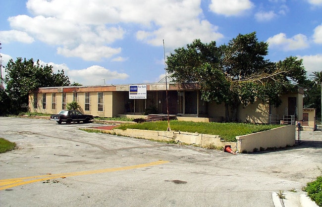
1960 Nw 27Th St
Miami-Miami Beach-Kendall, FL
Riverdale Park A Sub
01-3133-007-0030
RIVERDALE PARK A SUB PB 21-19 LOTS 8 THRU 12 INC & PT OF ALLEY BORDERING LOTS ON S SIDE & PART OF LOTS 7 & 8 LYING N OF STA CAN OF SUB OF PT NE1/4 OF NE1/4 PB B-5 LESS N200FT & LESS PT LYING IN R/W & PORT OF SUBMERGED LAND IN R/W CANAL & LESS PORT OF
Commercialacreage
Miami/Dade
AE
Florida
12086C0311L
8-12
2024
1.76 AC
2025
Miami
001803
South Florida
DEMOGRAPHICS near 1960 Nw 27Th St
1 Mile
3 Mile
5 Mile
2024 Total Population
28,600
273,025
614,121
2029 Population
27,389
266,814
603,897
Pop Growth 2024-2029
(4.23%)
(2.27%)
(1.66%)
Average Age
42
42
41
2024 Total Households
9,842
103,952
248,194
HH Growth 2024-2029
(4.63%)
(2.47%)
(1.67%)
Median Household Inc
$34,240
$37,440
$51,081
Avg Household Size
2.70
2.50
2.40
2024 Avg HH Vehicles
1.00
1.00
1.00
Median Home Value
$321,307
$346,490
$412,892
Median Year Built
1962
1967
1974
Nearby Places
Map Layers
Map Styles
 Street
 Aerial
- Restaurants
- Banks
- Shops
- Fitness
- Groceries
PUBLIC TRANSPORTATION
COMMUTER RAIL
Santa Clara (Metrorail Green Line - Miami-Dade Transit (Metrorail/Metromover))
DRIVE
WALK
Distance
Santa Clara (Metrorail Green Line - Miami-Dade Transit (Metrorail/Metromover))
4 min
1.6 mi
Miami Airport (Tri-County Commuter - South Florida Regional Transportation Authority (Tri-Rail))
DRIVE
WALK
Distance
Miami Airport (Tri-County Commuter - South Florida Regional Transportation Authority (Tri-Rail))
5 min
1.7 mi
AIRPORT
Miami International
DRIVE
WALK
Distance
Miami International
17 min
6.6 mi
Fort Lauderdale/Hollywood International
DRIVE
WALK
Distance
Fort Lauderdale/Hollywood International
35 min
23.5 mi
Freight Ports
Port of Miami
DRIVE
WALK
Distance
Port of Miami
12 min
6.0 mi
Nearby Properties
Address
Land Use
TOTAL SIZE
Lot Size
Zoning
Address
Land Use
TOTAL SIZE
Lot Size
Zoning
955,966 SF
38.91 AC
9600
Address
Land Use
TOTAL SIZE
Lot Size
Zoning
928,000 SF
14.30 AC
8000
Address
Land Use
TOTAL SIZE
Lot Size
Zoning
16.13 AC
6100
Address
Land Use
TOTAL SIZE
Lot Size
Zoning
2,789,683 SF
33.23 AC
7300
Address
Land Use
TOTAL SIZE
Lot Size
Zoning
2,403,353 SF
7.37 AC
6100
Address
Land Use
TOTAL SIZE
Lot Size
Zoning
256,089 SF
20.35 AC
7600
Address
Land Use
TOTAL SIZE
Lot Size
Zoning
585,775 SF
1.86 AC
6101
Address
Land Use
TOTAL SIZE
Lot Size
Zoning
1,262,330 SF
1.39 AC
6402
Address
Land Use
TOTAL SIZE
Lot Size
Zoning
570,694 SF
1.37 AC
4604
Address
Land Use
TOTAL SIZE
Lot Size
Zoning
990,766 SF
1.16 AC
6420
Address
Land Use
TOTAL SIZE
Lot Size
Zoning
566,165 SF
2.09 AC
6101
Address
Land Use
TOTAL SIZE
Lot Size
Zoning
996,100 SF
3.58 AC
9600
Address
Land Use
TOTAL SIZE
Lot Size
Zoning
787,433 SF
2.15 AC
6402
Address
Land Use
TOTAL SIZE
Lot Size
Zoning
627,685 SF
2.06 AC
6100
Address
Land Use
TOTAL SIZE
Lot Size
Zoning
602,884 SF
0.32 AC
6412
Address
Land Use
TOTAL SIZE
Lot Size
Zoning
328,554 SF
668.26 AC
8900
Address
Land Use
TOTAL SIZE
Lot Size
Zoning
428,154 SF
1.39 AC
6101
Address
Land Use
TOTAL SIZE
Lot Size
Zoning
375,762 SF
3.39 AC
8000
Address
Land Use
TOTAL SIZE
Lot Size
Zoning
221,570 SF
1.79 AC
6100
Address
Land Use
TOTAL SIZE
Lot Size
Zoning
596,081 SF
4.33 AC
9600
Address
Land Use
TOTAL SIZE
Lot Size
Zoning
1,212,604 SF
10.50 AC
9600
Address
Land Use
TOTAL SIZE
Lot Size
Zoning
648,350 SF
9.78 AC
6118
Address
Land Use
TOTAL SIZE
Lot Size
Zoning
526,358 SF
3.62 AC
6100
Address
Land Use
TOTAL SIZE
Lot Size
Zoning
545,220 SF
15.32 AC
6100
Address
Land Use
TOTAL SIZE
Lot Size
Zoning
482,246 SF
0.83 AC
5005
Address
Land Use
TOTAL SIZE
Lot Size
Zoning
525,786 SF
2.64 AC
6100
Address
Land Use
TOTAL SIZE
Lot Size
Zoning
498,242 SF
2.69 AC
6100
Address
Land Use
TOTAL SIZE
Lot Size
Zoning
215,207 SF
0.28 AC
6412
Address
Land Use
TOTAL SIZE
Lot Size
Zoning
480,664 SF
26.03 AC
9600
Address
Land Use
TOTAL SIZE
Lot Size
Zoning
516,808 SF
1.09 AC
6110
The World's #1 Commercial Real Estate Marketplace
Connect with us
© 2025 CoStar Group
The information above has been obtained from sources believed reliable. While we do not doubt its accuracy we have not verified it and make no guarantee, warranty or representation about it. It is your responsibility to independently confirm its accuracy and completeness. Any projections, opinions, assumptions, or estimates used are for example only and do not represent the current or future performance of the property. The value of this transaction to you depends on tax and other factors which should be evaluated by your tax, financial, and legal advisors. You and your advisors should conduct a careful, independent investigation of the property to determine to your satisfaction the suitability of the property for your needs.