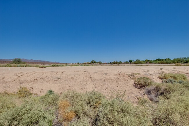
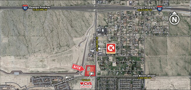
Property Record
19604 W Blue Aster Ct N, Buckeye, AZ 85326


NEARBY LISTINGS FOR SALE OR LEASE
Property Detail
19604 W Blue Aster Ct N
502-35-019A
BEG W4 COR SEC 5 TH E 130F S 1697.77F N 60D 11M E 245.47F N 57D E 420F S 88D E 300F N 70D E 900F S 75D E 390F N 85D E 780F N 75D E 550F S 73D E 585F N 45D E 820F S 82D 22M E 300F S 7D 38M W 2033.10F W 4691.28F N 2590.29F POB EX W 130F OF N 1978.90F
Municipalproperty
Maricopa
AE
Arizona
04013C2130L
164.45 AC
0
West I-10
2025
Phoenix
050611
Phoenix-Mesa-Scottsdale, AZ
5,597 SF
DEMOGRAPHICS near 19604 W Blue Aster Ct N
1 Mile
3 Mile
5 Mile
2024 Total Population
6,195
43,603
108,983
2029 Population
6,922
48,488
121,210
Pop Growth 2024-2029
+ 11.74%
+ 11.20%
+ 11.22%
Average Age
32
35
37
2024 Total Households
1,876
13,077
34,357
HH Growth 2024-2029
+ 11.78%
+ 11.22%
+ 11.44%
Median Household Inc
$89,894
$99,876
$99,361
Avg Household Size
3.20
3.20
3.10
2024 Avg HH Vehicles
2.00
2.00
2.00
Median Home Value
$317,602
$379,472
$396,241
Median Year Built
2011
2010
2010
Nearby Places
Map Layers
Map Styles
 Street
 Aerial
- Restaurants
- Banks
- Shops
- Fitness
- Groceries
PUBLIC TRANSPORTATION
AIRPORT
Phoenix Sky Harbor International
DRIVE
WALK
Distance
Phoenix Sky Harbor International
39 min
30.2 mi
Freight Ports
Port of San Diego
DRIVE
WALK
Distance
Port of San Diego
368 min
331.8 mi
SALE & LEASE HISTORY
LISTING DATE
SALE/LEASE

Sep 02, 2022
For Sale
Nearby Properties
Address
Land Use
TOTAL SIZE
Lot Size
Zoning
Address
Land Use
TOTAL SIZE
Lot Size
Zoning
551,831 SF
609.49 AC
AG
Address
Land Use
TOTAL SIZE
Lot Size
Zoning
196,353 SF
13.05 AC
C-C
Address
Land Use
TOTAL SIZE
Lot Size
Zoning
721,156 SF
44.90 AC
PAD
Address
Land Use
TOTAL SIZE
Lot Size
Zoning
231,044 SF
48.70 AC
Address
Land Use
TOTAL SIZE
Lot Size
Zoning
239,259 SF
22.68 AC
PAD
Address
Land Use
TOTAL SIZE
Lot Size
Zoning
179,632 SF
16.64 AC
PR
Address
Land Use
TOTAL SIZE
Lot Size
Zoning
152,901 SF
22.52 AC
Address
Land Use
TOTAL SIZE
Lot Size
Zoning
1.98 AC
PAD
Address
Land Use
TOTAL SIZE
Lot Size
Zoning
156,060 SF
12.04 AC
R-43
Address
Land Use
TOTAL SIZE
Lot Size
Zoning
254,903 SF
26.70 AC
Address
Land Use
TOTAL SIZE
Lot Size
Zoning
82,692 SF
23.68 AC
Address
Land Use
TOTAL SIZE
Lot Size
Zoning
108,281 SF
11.95 AC
PC
Address
Land Use
TOTAL SIZE
Lot Size
Zoning
12,418 SF
54.25 AC
PC
Address
Land Use
TOTAL SIZE
Lot Size
Zoning
91,505 SF
16.57 AC
PAD
Address
Land Use
TOTAL SIZE
Lot Size
Zoning
80,531 SF
7.51 AC
PAD
Address
Land Use
TOTAL SIZE
Lot Size
Zoning
40,300 SF
19.53 AC
CC
Address
Land Use
TOTAL SIZE
Lot Size
Zoning
138.68 AC
Address
Land Use
TOTAL SIZE
Lot Size
Zoning
44,463 SF
79.72 AC
RR
Address
Land Use
TOTAL SIZE
Lot Size
Zoning
64,720 SF
2.24 AC
PC
Address
Land Use
TOTAL SIZE
Lot Size
Zoning
34,356 SF
14.43 AC
CC
Address
Land Use
TOTAL SIZE
Lot Size
Zoning
39.31 AC
Address
Land Use
TOTAL SIZE
Lot Size
Zoning
33,775 SF
7.68 AC
PAD
Address
Land Use
TOTAL SIZE
Lot Size
Zoning
51,512 SF
18.71 AC
I-1
Address
Land Use
TOTAL SIZE
Lot Size
Zoning
65,023 SF
12.52 AC
C-C
Address
Land Use
TOTAL SIZE
Lot Size
Zoning
65,506 SF
5 AC
C-C
Address
Land Use
TOTAL SIZE
Lot Size
Zoning
52.66 AC
Address
Land Use
TOTAL SIZE
Lot Size
Zoning
616.15 AC
AG
The World's #1 Commercial Real Estate Marketplace
Connect with us
© 2025 CoStar Group
The information above has been obtained from sources believed reliable. While we do not doubt its accuracy we have not verified it and make no guarantee, warranty or representation about it. It is your responsibility to independently confirm its accuracy and completeness. Any projections, opinions, assumptions, or estimates used are for example only and do not represent the current or future performance of the property. The value of this transaction to you depends on tax and other factors which should be evaluated by your tax, financial, and legal advisors. You and your advisors should conduct a careful, independent investigation of the property to determine to your satisfaction the suitability of the property for your needs.