Property Record
19605 Pilot Knob Rd, Farmington, MN 55024
NEARBY LISTINGS FOR SALE OR LEASE
Property Detail
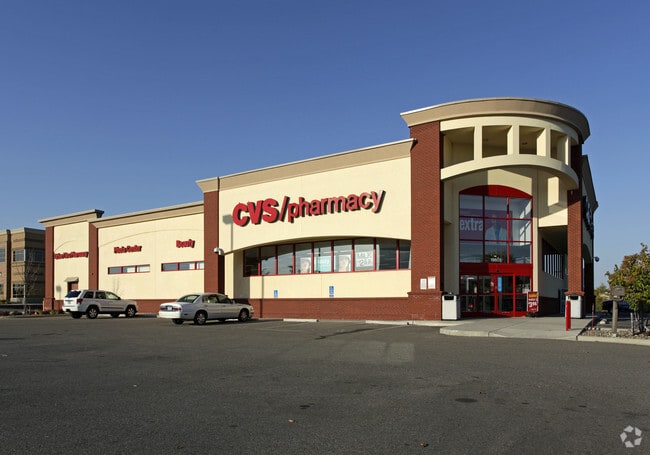
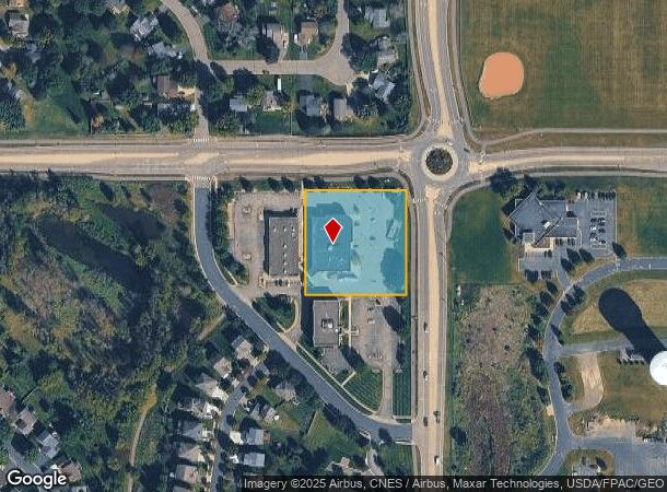
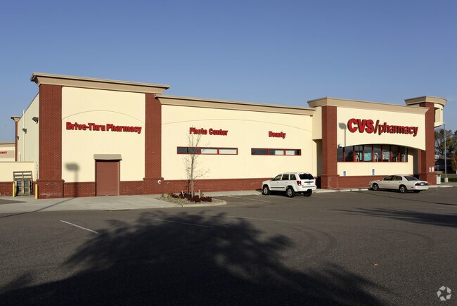
19605 Pilot Knob Rd
Minneapolis-St. Paul-Bloomington, MN-WI
Charleswood Marketplace
14-16800-01-020
CHARLESWOOD MARKETPLACE 2 1
Commercialnec
Dakota
X
Minnesota
27037C0216E
20
2024
1.58 AC
2024
Apple Vly/Lakeville
060902
Minneapolis/St Paul
15,207 SF
DEMOGRAPHICS near 19605 Pilot Knob Rd
1 Mile
3 Mile
5 Mile
2024 Total Population
7,809
44,962
112,747
2029 Population
7,914
46,365
115,803
Pop Growth 2024-2029
+ 1.34%
+ 3.12%
+ 2.71%
Average Age
36
35
37
2024 Total Households
2,593
15,034
38,857
HH Growth 2024-2029
+ 1.27%
+ 3.23%
+ 2.80%
Median Household Inc
$127,678
$114,778
$109,711
Avg Household Size
2.90
2.90
2.80
2024 Avg HH Vehicles
2.00
2.00
2.00
Median Home Value
$338,438
$351,581
$347,731
Median Year Built
1998
2001
1997
Nearby Places
Map Layers
Map Styles
 Street
 Aerial
- Restaurants
- Banks
- Shops
- Fitness
- Groceries
PUBLIC TRANSPORTATION
AIRPORT
Minneapolis-St Paul International/Wold-Chamberlain
DRIVE
WALK
Distance
Minneapolis-St Paul International/Wold-Chamberlain
31 min
18.4 mi
Nearby Properties
Address
Land Use
TOTAL SIZE
Lot Size
Zoning
Address
Land Use
TOTAL SIZE
Lot Size
Zoning
78.77 AC
Address
Land Use
TOTAL SIZE
Lot Size
Zoning
484,566 SF
98.37 AC
Address
Land Use
TOTAL SIZE
Lot Size
Zoning
234,110 SF
5.60 AC
Address
Land Use
TOTAL SIZE
Lot Size
Zoning
496,248 SF
28.67 AC
Address
Land Use
TOTAL SIZE
Lot Size
Zoning
245,486 SF
5.29 AC
Address
Land Use
TOTAL SIZE
Lot Size
Zoning
360,000 SF
22.85 AC
Address
Land Use
TOTAL SIZE
Lot Size
Zoning
1.64 AC
Address
Land Use
TOTAL SIZE
Lot Size
Zoning
248,545 SF
21.65 AC
Address
Land Use
TOTAL SIZE
Lot Size
Zoning
147,983 SF
46.75 AC
Address
Land Use
TOTAL SIZE
Lot Size
Zoning
147,426 SF
29.47 AC
Address
Land Use
TOTAL SIZE
Lot Size
Zoning
160,611 SF
14.08 AC
Address
Land Use
TOTAL SIZE
Lot Size
Zoning
113,717 SF
26.46 AC
Address
Land Use
TOTAL SIZE
Lot Size
Zoning
141,819 SF
12.95 AC
Address
Land Use
TOTAL SIZE
Lot Size
Zoning
12.51 AC
Address
Land Use
TOTAL SIZE
Lot Size
Zoning
79,076 SF
3.14 AC
Address
Land Use
TOTAL SIZE
Lot Size
Zoning
82,983 SF
8.94 AC
Address
Land Use
TOTAL SIZE
Lot Size
Zoning
61,674 SF
10.31 AC
Address
Land Use
TOTAL SIZE
Lot Size
Zoning
112,730 SF
5.73 AC
Address
Land Use
TOTAL SIZE
Lot Size
Zoning
131,634 SF
10.76 AC
Address
Land Use
TOTAL SIZE
Lot Size
Zoning
118,065 SF
7.63 AC
Address
Land Use
TOTAL SIZE
Lot Size
Zoning
137,542 SF
11.85 AC
Address
Land Use
TOTAL SIZE
Lot Size
Zoning
99,365 SF
0.50 AC
Address
Land Use
TOTAL SIZE
Lot Size
Zoning
92,744 SF
31.10 AC
Address
Land Use
TOTAL SIZE
Lot Size
Zoning
94,244 SF
4.06 AC
Address
Land Use
TOTAL SIZE
Lot Size
Zoning
176,291 SF
13.79 AC
Address
Land Use
TOTAL SIZE
Lot Size
Zoning
48,990 SF
1.19 AC
Address
Land Use
TOTAL SIZE
Lot Size
Zoning
23,842 SF
1.31 AC
Address
Land Use
TOTAL SIZE
Lot Size
Zoning
105,040 SF
19.97 AC
Address
Land Use
TOTAL SIZE
Lot Size
Zoning
77,816 SF
18.01 AC
The World's #1 Commercial Real Estate Marketplace
Connect with us
© 2026 CoStar Group
The information above has been obtained from sources believed reliable. While we do not doubt its accuracy we have not verified it and make no guarantee, warranty or representation about it. It is your responsibility to independently confirm its accuracy and completeness. Any projections, opinions, assumptions, or estimates used are for example only and do not represent the current or future performance of the property. The value of this transaction to you depends on tax and other factors which should be evaluated by your tax, financial, and legal advisors. You and your advisors should conduct a careful, independent investigation of the property to determine to your satisfaction the suitability of the property for your needs.