Property Record
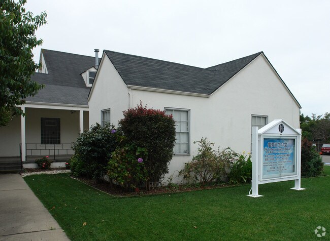
1963 Carlson Blvd, Richmond, CA 94804


This Property Is For Sale
Property Detail
1963 Carlson Blvd
Oakland-Fremont-Berkeley, CA
RICH ANNEX LOTS 11-16&POR L10,17,22-24 BLK42
507-090-025-2
CONTRA COSTA
Religious
California
B and X Area of moderate flood hazard, usually the area between the limits of the 100-year and 500-year floods.
11
2025
0.57 AC
2025
Richmond/San Pablo
383000
East Bay/Oakland
5,416 SF
NEARBY LISTINGS FOR SALE OR LEASE
-
-
View all Richmond listings for sale on LoopNet.com
DEMOGRAPHICS near 1963 Carlson Blvd
1 mile
3 mile
5 mile
2025 Total Population
24,812
139,482
345,496
2030 Population
24,988
140,041
346,828
Pop Growth 2025-2030
+ 0.71%
+ 0.40%
+ 0.39%
Average Age
41
42
39
2025 Total Households
9,833
52,777
125,950
HH Growth 2025-2030
+ 0.70%
+ 0.35%
+ 0.42%
Median Household Inc
$105,204
$121,184
$101,320
Avg Household Size
2.50
2.50
2.50
2025 Avg HH Vehicles
2.00
2.00
2.00
Median Home Value
$893,746
$1,015,193
$925,167
Median Year Built
1958
1953
1957
Nearby Places
Map Layers
Map Styles
 Street
 Aerial
Layers
 Traffic
 Biking
Places
Listings with unknown addresses are not visible on the map
- Restaurants
- Banks
- Shops
- Fitness
- Groceries
PUBLIC TRANSPORTATION
TRANSIT/SUBWAY
El Cerrito Plaza Station (Fremont - Richmond - Bay Area Rapid Transit (BART), Richmond - Millbrae - Bay Area Rapid Transit (BART))
Drive
Walk
Distance
El Cerrito Plaza Station (Fremont - Richmond - Bay Area Rapid Transit (BART), Richmond - Millbrae - Bay Area Rapid Transit (BART))
2 min
19 min
1.0 mi
COMMUTER RAIL
Berkeley Amtrak (Capitol Corridor - Amtrak)
Drive
Walk
Distance
Berkeley Amtrak (Capitol Corridor - Amtrak)
6 min
3.8 mi
Richmond (Capitol Corridor - Capitol Corridor Joint Powers Authority)
Drive
Walk
Distance
Richmond (Capitol Corridor - Capitol Corridor Joint Powers Authority)
8 min
3.9 mi
AIRPORT
Metro Oakland International
Drive
Walk
Distance
Metro Oakland International
27 min
18.7 mi
San Francisco International
Drive
Walk
Distance
San Francisco International
39 min
26.3 mi
Freight Ports
Port of Richmond
Drive
Walk
Distance
Port of Richmond
14 min
7.0 mi
Nearby Properties
Address
Land Use
TOTAL SIZE
Lot Size
Zoning
Address
Land Use
TOTAL SIZE
Lot Size
Zoning
820,000 SF
6.36 AC
Address
Land Use
TOTAL SIZE
Lot Size
Zoning
476,200 SF
22.92 AC
Address
Land Use
TOTAL SIZE
Lot Size
Zoning
254,000 SF
1.71 AC
Address
Land Use
TOTAL SIZE
Lot Size
Zoning
195,281 SF
0.96 AC
Address
Land Use
TOTAL SIZE
Lot Size
Zoning
163,721 SF
0.76 AC
Address
Land Use
TOTAL SIZE
Lot Size
Zoning
159,705 SF
1.64 AC
COMM
Address
Land Use
TOTAL SIZE
Lot Size
Zoning
105,704 SF
10.85 AC
M3
Address
Land Use
TOTAL SIZE
Lot Size
Zoning
12.31 AC
Address
Land Use
TOTAL SIZE
Lot Size
Zoning
202,811 SF
10.98 AC
Address
Land Use
TOTAL SIZE
Lot Size
Zoning
191,800 SF
1.09 AC
Address
Land Use
TOTAL SIZE
Lot Size
Zoning
83,538 SF
0.60 AC
Address
Land Use
TOTAL SIZE
Lot Size
Zoning
124,257 SF
2.72 AC
Address
Land Use
TOTAL SIZE
Lot Size
Zoning
69,949 SF
0.65 AC
C2 CD
Address
Land Use
TOTAL SIZE
Lot Size
Zoning
47,575 SF
1.79 AC
Address
Land Use
TOTAL SIZE
Lot Size
Zoning
182,408 SF
10.55 AC
Address
Land Use
TOTAL SIZE
Lot Size
Zoning
34.95 AC
M3
Address
Land Use
TOTAL SIZE
Lot Size
Zoning
81,352 SF
5.06 AC
C2
Address
Land Use
TOTAL SIZE
Lot Size
Zoning
71,774 SF
12.66 AC
Address
Land Use
TOTAL SIZE
Lot Size
Zoning
96,440 SF
4.73 AC
Address
Land Use
TOTAL SIZE
Lot Size
Zoning
162,660 SF
9.09 AC
Address
Land Use
TOTAL SIZE
Lot Size
Zoning
404,098 SF
24.03 AC
MSL1RD
Address
Land Use
TOTAL SIZE
Lot Size
Zoning
131,400 SF
8.93 AC
M-1
Address
Land Use
TOTAL SIZE
Lot Size
Zoning
54,728 SF
0.96 AC
Address
Land Use
TOTAL SIZE
Lot Size
Zoning
147,500 SF
9.84 AC
Address
Land Use
TOTAL SIZE
Lot Size
Zoning
78,873 SF
0.84 AC
M
Address
Land Use
TOTAL SIZE
Lot Size
Zoning
136,648 SF
13.27 AC
Address
Land Use
TOTAL SIZE
Lot Size
Zoning
137,293 SF
10.52 AC
Address
Land Use
TOTAL SIZE
Lot Size
Zoning
107,100 SF
27.35 AC
Address
Land Use
TOTAL SIZE
Lot Size
Zoning
113,960 SF
6 AC
Address
Land Use
TOTAL SIZE
Lot Size
Zoning
67,968 SF
5.62 AC
The World's #1 Commercial Real Estate Marketplace
Connect with us
© 2026 CoStar Group
The information above has been obtained from sources believed reliable. While we do not doubt its accuracy we have not verified it and make no guarantee, warranty or representation about it. It is your responsibility to independently confirm its accuracy and completeness. Any projections, opinions, assumptions, or estimates used are for example only and do not represent the current or future performance of the property. The value of this transaction to you depends on tax and other factors which should be evaluated by your tax, financial, and legal advisors. You and your advisors should conduct a careful, independent investigation of the property to determine to your satisfaction the suitability of the property for your needs.