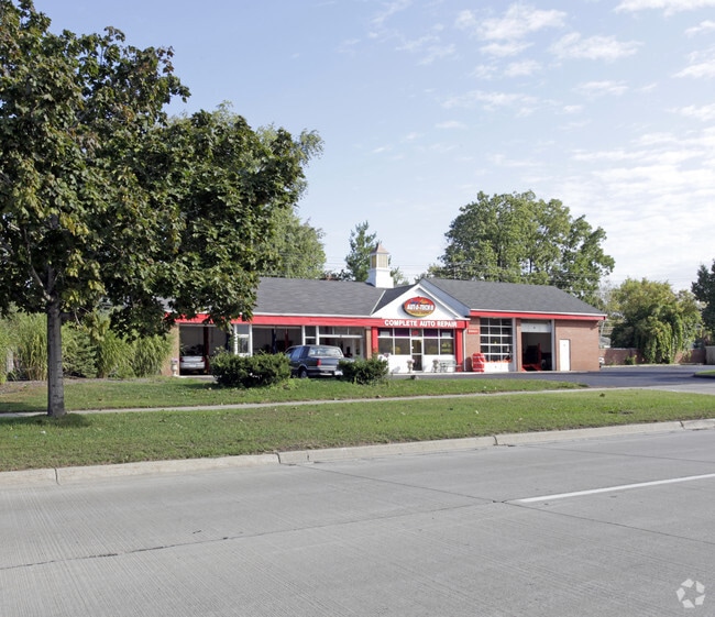
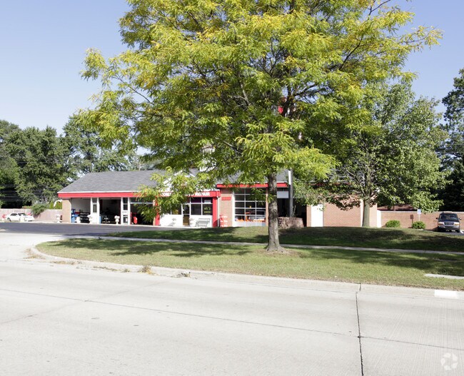
Property Record
19632 W 10 Mile Rd, Southfield, MI 48075

NEARBY LISTINGS FOR SALE OR LEASE
Property Detail
19632 W 10 Mile Rd
Detroit-Warren-Dearborn, MI
Evershire Sub
24-23-354-026
T1N,R10E,SEC 23 78-88 EVERSHIRE LOTS 78 TO 88 INCL ALSO 1/2 OF VAC ALLEY ADJ TO SAME
Vehiclerentalsvehiclesales
Oakland
X
Michigan
26163C0100E
78-88
2024
0.56 AC
2025
Southfield
161500
Detroit
3,210 SF
DEMOGRAPHICS near 19632 W 10 Mile Rd
1 Mile
3 Mile
5 Mile
2024 Total Population
7,682
105,104
310,606
2029 Population
7,635
103,631
305,351
Pop Growth 2024-2029
(0.61%)
(1.40%)
(1.69%)
Average Age
43
42
41
2024 Total Households
2,944
44,901
132,426
HH Growth 2024-2029
(0.61%)
(1.39%)
(1.67%)
Median Household Inc
$77,010
$60,072
$62,914
Avg Household Size
2.20
2.20
2.30
2024 Avg HH Vehicles
2.00
2.00
2.00
Median Home Value
$199,775
$182,678
$197,592
Median Year Built
1967
1962
1957
Nearby Places
Map Layers
Map Styles
 Street
 Aerial
- Restaurants
- Banks
- Shops
- Fitness
- Groceries
PUBLIC TRANSPORTATION
COMMUTER RAIL
Royal Oak Amtrak (Wolverine - Amtrak)
DRIVE
WALK
Distance
Royal Oak Amtrak (Wolverine - Amtrak)
12 min
5.9 mi
Troy Amtrak Station (Wolverine - Amtrak)
DRIVE
WALK
Distance
Troy Amtrak Station (Wolverine - Amtrak)
17 min
8.3 mi
AIRPORT
Windsor International
DRIVE
WALK
Distance
Windsor International
44 min
24.8 mi
Detroit Metro Wayne County
DRIVE
WALK
Distance
Detroit Metro Wayne County
40 min
25.6 mi
Freight Ports
Port of Toledo
DRIVE
WALK
Distance
Port of Toledo
88 min
67.7 mi
Nearby Properties
Address
Land Use
TOTAL SIZE
Lot Size
Zoning
Address
Land Use
TOTAL SIZE
Lot Size
Zoning
2,373,792 SF
17.35 AC
RC
Address
Land Use
TOTAL SIZE
Lot Size
Zoning
350,140 SF
37.78 AC
RC
Address
Land Use
TOTAL SIZE
Lot Size
Zoning
882,862 SF
8.22 AC
RC
Address
Land Use
TOTAL SIZE
Lot Size
Zoning
588 SF
53.02 AC
RM
Address
Land Use
TOTAL SIZE
Lot Size
Zoning
383,602 SF
36.60 AC
I-1
Address
Land Use
TOTAL SIZE
Lot Size
Zoning
187,801 SF
5.49 AC
RM-2
Address
Land Use
TOTAL SIZE
Lot Size
Zoning
535,287 SF
9.26 AC
RC
Address
Land Use
TOTAL SIZE
Lot Size
Zoning
460,062 SF
10.01 AC
RC
Address
Land Use
TOTAL SIZE
Lot Size
Zoning
859,104 SF
9.59 AC
RC
Address
Land Use
TOTAL SIZE
Lot Size
Zoning
301,269 SF
25.47 AC
OS
Address
Land Use
TOTAL SIZE
Lot Size
Zoning
280,500 SF
3.58 AC
RC
Address
Land Use
TOTAL SIZE
Lot Size
Zoning
405,020 SF
18.74 AC
RMM
Address
Land Use
TOTAL SIZE
Lot Size
Zoning
233,598 SF
17.24 AC
RS
Address
Land Use
TOTAL SIZE
Lot Size
Zoning
17.19 AC
RC
Address
Land Use
TOTAL SIZE
Lot Size
Zoning
367,101 SF
37.77 AC
R-E
Address
Land Use
TOTAL SIZE
Lot Size
Zoning
325,654 SF
7.45 AC
ERO
Address
Land Use
TOTAL SIZE
Lot Size
Zoning
344,960 SF
8.90 AC
RC
Address
Land Use
TOTAL SIZE
Lot Size
Zoning
350,140 SF
27.11 AC
RC
Address
Land Use
TOTAL SIZE
Lot Size
Zoning
120,093 SF
38.18 AC
TV-R
Address
Land Use
TOTAL SIZE
Lot Size
Zoning
300,830 SF
54 AC
LI
Address
Land Use
TOTAL SIZE
Lot Size
Zoning
170,465 SF
4.84 AC
BV
Address
Land Use
TOTAL SIZE
Lot Size
Zoning
97.05 AC
RS
Address
Land Use
TOTAL SIZE
Lot Size
Zoning
210 SF
20.52 AC
R-2
Address
Land Use
TOTAL SIZE
Lot Size
Zoning
212 SF
16.59 AC
RM
Address
Land Use
TOTAL SIZE
Lot Size
Zoning
655,519 SF
9.18 AC
ERO
Address
Land Use
TOTAL SIZE
Lot Size
Zoning
12.70 AC
RS
Address
Land Use
TOTAL SIZE
Lot Size
Zoning
5.65 AC
RC
Address
Land Use
TOTAL SIZE
Lot Size
Zoning
37,006 SF
5.12 AC
B-3
Address
Land Use
TOTAL SIZE
Lot Size
Zoning
11.12 AC
RC
Address
Land Use
TOTAL SIZE
Lot Size
Zoning
397,200 SF
14.07 AC
RMU
The World's #1 Commercial Real Estate Marketplace
Connect with us
© 2025 CoStar Group
The information above has been obtained from sources believed reliable. While we do not doubt its accuracy we have not verified it and make no guarantee, warranty or representation about it. It is your responsibility to independently confirm its accuracy and completeness. Any projections, opinions, assumptions, or estimates used are for example only and do not represent the current or future performance of the property. The value of this transaction to you depends on tax and other factors which should be evaluated by your tax, financial, and legal advisors. You and your advisors should conduct a careful, independent investigation of the property to determine to your satisfaction the suitability of the property for your needs.