Property Record
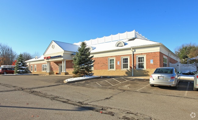
19668 Hunt Rd, Strongsville, OH 44136


NEARBY LISTINGS FOR SALE OR LEASE
Property Detail
19668 Hunt Rd
Cleveland-Elyria, OH
Strongsville
399-33-008
PCL B VOL 355 PG 91 FF 166.44 D 444.77 2.979AC OL 1 2009S/R
Stripcommercialcenter
Cuyahoga
X
Ohio
39103C0043E
b
2024
2.98 AC
2024
Southwest
186203
Cleveland
32,000 SF
DEMOGRAPHICS near 19668 Hunt Rd
1 Mile
3 Mile
5 Mile
2024 Total Population
7,029
40,456
112,416
2029 Population
6,916
40,097
111,426
Pop Growth 2024-2029
(1.61%)
(0.89%)
(0.88%)
Average Age
42
43
43
2024 Total Households
2,522
15,886
45,724
HH Growth 2024-2029
(1.82%)
(1.07%)
(1.07%)
Median Household Inc
$114,458
$90,124
$86,304
Avg Household Size
2.70
2.50
2.40
2024 Avg HH Vehicles
2.00
2.00
2.00
Median Home Value
$269,130
$247,802
$244,421
Median Year Built
1982
1981
1982
Nearby Places
Map Layers
Map Styles
 Street
 Aerial
- Restaurants
- Banks
- Shops
- Fitness
- Groceries
PUBLIC TRANSPORTATION
AIRPORT
Cleveland-Hopkins International
DRIVE
WALK
Distance
Cleveland-Hopkins International
22 min
12.6 mi
Freight Ports
Port of Baltimore
DRIVE
WALK
Distance
Port of Baltimore
1 min
306.8 mi
Nearby Properties
Address
Land Use
TOTAL SIZE
Lot Size
Zoning
Address
Land Use
TOTAL SIZE
Lot Size
Zoning
127,666 SF
2.79 AC
Address
Land Use
TOTAL SIZE
Lot Size
Zoning
830,541 SF
51.19 AC
SC
Address
Land Use
TOTAL SIZE
Lot Size
Zoning
127,666 SF
9.53 AC
Address
Land Use
TOTAL SIZE
Lot Size
Zoning
149,328 SF
14.78 AC
RM-D
Address
Land Use
TOTAL SIZE
Lot Size
Zoning
143,074 SF
25.34 AC
PDA-2
Address
Land Use
TOTAL SIZE
Lot Size
Zoning
17,682 SF
36.78 AC
MF1
Address
Land Use
TOTAL SIZE
Lot Size
Zoning
8,511 SF
77.80 AC
Address
Land Use
TOTAL SIZE
Lot Size
Zoning
230,291 SF
17.35 AC
Address
Land Use
TOTAL SIZE
Lot Size
Zoning
34,005 SF
514.86 AC
PF
Address
Land Use
TOTAL SIZE
Lot Size
Zoning
73,920 SF
22.53 AC
RM-D
Address
Land Use
TOTAL SIZE
Lot Size
Zoning
10,560 SF
19.12 AC
RM-D
Address
Land Use
TOTAL SIZE
Lot Size
Zoning
242.53 AC
PF
Address
Land Use
TOTAL SIZE
Lot Size
Zoning
576 SF
17.10 AC
Address
Land Use
TOTAL SIZE
Lot Size
Zoning
365,180 SF
93.02 AC
Address
Land Use
TOTAL SIZE
Lot Size
Zoning
83,961 SF
6.58 AC
GB
Address
Land Use
TOTAL SIZE
Lot Size
Zoning
128,979 SF
3.87 AC
R1-75
Address
Land Use
TOTAL SIZE
Lot Size
Zoning
96,685 SF
16.21 AC
R-RS
Address
Land Use
TOTAL SIZE
Lot Size
Zoning
8,316 SF
14.90 AC
Address
Land Use
TOTAL SIZE
Lot Size
Zoning
195.95 AC
PF
Address
Land Use
TOTAL SIZE
Lot Size
Zoning
62,070 SF
18.43 AC
GB
Address
Land Use
TOTAL SIZE
Lot Size
Zoning
191.03 AC
PF
Address
Land Use
TOTAL SIZE
Lot Size
Zoning
10,400 SF
18.39 AC
Address
Land Use
TOTAL SIZE
Lot Size
Zoning
83,969 SF
10.94 AC
PF
Address
Land Use
TOTAL SIZE
Lot Size
Zoning
111,553 SF
17.78 AC
SC
Address
Land Use
TOTAL SIZE
Lot Size
Zoning
23,448 SF
13.32 AC
COMMERCIAL
Address
Land Use
TOTAL SIZE
Lot Size
Zoning
10.64 AC
PF
Address
Land Use
TOTAL SIZE
Lot Size
Zoning
100,597 SF
7.38 AC
COMMERCIAL
Address
Land Use
TOTAL SIZE
Lot Size
Zoning
10,192 SF
9.22 AC
COMMERCIAL
Address
Land Use
TOTAL SIZE
Lot Size
Zoning
105,669 SF
11.66 AC
SR
Address
Land Use
TOTAL SIZE
Lot Size
Zoning
125,842 SF
15.05 AC
The World's #1 Commercial Real Estate Marketplace
Connect with us
© 2025 CoStar Group
The information above has been obtained from sources believed reliable. While we do not doubt its accuracy we have not verified it and make no guarantee, warranty or representation about it. It is your responsibility to independently confirm its accuracy and completeness. Any projections, opinions, assumptions, or estimates used are for example only and do not represent the current or future performance of the property. The value of this transaction to you depends on tax and other factors which should be evaluated by your tax, financial, and legal advisors. You and your advisors should conduct a careful, independent investigation of the property to determine to your satisfaction the suitability of the property for your needs.