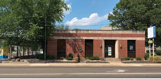
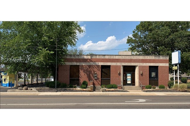
Property Record
1967 Central Ave, Middletown, OH 45044

NEARBY LISTINGS FOR SALE OR LEASE
Property Detail
1967 Central Ave
Cincinnati, OH-KY-IN
Middletown
Q6532-028-000-047
4330 ENT
Financialbuilding
Butler
X
Ohio
39017C0094F
4330
2024
0.21 AC
2025
Butler County
014400
Cincinnati/Dayton
DEMOGRAPHICS near 1967 Central Ave
1 Mile
3 Mile
5 Mile
2024 Total Population
13,437
51,769
86,950
2029 Population
13,725
52,948
89,570
Pop Growth 2024-2029
+ 2.14%
+ 2.28%
+ 3.01%
Average Age
37
39
40
2024 Total Households
5,492
21,449
34,480
HH Growth 2024-2029
+ 2.24%
+ 2.23%
+ 3.01%
Median Household Inc
$41,770
$44,616
$57,553
Avg Household Size
2.30
2.30
2.40
2024 Avg HH Vehicles
2.00
2.00
2.00
Median Home Value
$106,513
$127,597
$159,236
Median Year Built
1947
1959
1967
Nearby Places
Map Layers
Map Styles
 Street
 Aerial
- Restaurants
- Banks
- Shops
- Fitness
- Groceries
PUBLIC TRANSPORTATION
AIRPORT
James M Cox Dayton International
DRIVE
WALK
Distance
James M Cox Dayton International
53 min
38.7 mi
Freight Ports
Port of Toledo
DRIVE
WALK
Distance
Port of Toledo
209 min
178.9 mi
SALE & LEASE HISTORY
LISTING DATE
SALE/LEASE

Oct 03, 2019
For Sale
Oct 03, 2019
For Lease
Nov 08, 2022
For Lease
May 11, 2022
For Lease
Jan 26, 2021
For Sale
Nearby Properties
Address
Land Use
TOTAL SIZE
Lot Size
Zoning
Address
Land Use
TOTAL SIZE
Lot Size
Zoning
7.19 AC
Address
Land Use
TOTAL SIZE
Lot Size
Zoning
16.57 AC
Address
Land Use
TOTAL SIZE
Lot Size
Zoning
Address
Land Use
TOTAL SIZE
Lot Size
Zoning
17.24 AC
ADV
Address
Land Use
TOTAL SIZE
Lot Size
Zoning
84,352 SF
0.30 AC
Address
Land Use
TOTAL SIZE
Lot Size
Zoning
86.47 AC
ADV
Address
Land Use
TOTAL SIZE
Lot Size
Zoning
54,005 SF
0.33 AC
Address
Land Use
TOTAL SIZE
Lot Size
Zoning
57,248 SF
224.87 AC
Address
Land Use
TOTAL SIZE
Lot Size
Zoning
Address
Land Use
TOTAL SIZE
Lot Size
Zoning
33,362 SF
0.73 AC
Address
Land Use
TOTAL SIZE
Lot Size
Zoning
371,743 SF
24.58 AC
ADV
Address
Land Use
TOTAL SIZE
Lot Size
Zoning
9,069 SF
115.70 AC
Address
Land Use
TOTAL SIZE
Lot Size
Zoning
118,671 SF
5.46 AC
ADV
Address
Land Use
TOTAL SIZE
Lot Size
Zoning
166 AC
ADV
Address
Land Use
TOTAL SIZE
Lot Size
Zoning
16,779 SF
2.19 AC
Address
Land Use
TOTAL SIZE
Lot Size
Zoning
14.86 AC
Address
Land Use
TOTAL SIZE
Lot Size
Zoning
Address
Land Use
TOTAL SIZE
Lot Size
Zoning
499,497 SF
20.30 AC
ADV
Address
Land Use
TOTAL SIZE
Lot Size
Zoning
19,168 SF
7.69 AC
Address
Land Use
TOTAL SIZE
Lot Size
Zoning
29.15 AC
ADV
Address
Land Use
TOTAL SIZE
Lot Size
Zoning
236,670 SF
17.78 AC
Address
Land Use
TOTAL SIZE
Lot Size
Zoning
20,160 SF
0.10 AC
Address
Land Use
TOTAL SIZE
Lot Size
Zoning
34,090 SF
2.14 AC
Address
Land Use
TOTAL SIZE
Lot Size
Zoning
50,389 SF
5.84 AC
Address
Land Use
TOTAL SIZE
Lot Size
Zoning
23,260 SF
4 AC
Address
Land Use
TOTAL SIZE
Lot Size
Zoning
60 AC
ADV
Address
Land Use
TOTAL SIZE
Lot Size
Zoning
2.92 AC
ADV
Address
Land Use
TOTAL SIZE
Lot Size
Zoning
3.14 AC
Address
Land Use
TOTAL SIZE
Lot Size
Zoning
522,237 SF
11.14 AC
ADV
Address
Land Use
TOTAL SIZE
Lot Size
Zoning
11.21 AC
ADV
The World's #1 Commercial Real Estate Marketplace
Connect with us
© 2026 CoStar Group
The information above has been obtained from sources believed reliable. While we do not doubt its accuracy we have not verified it and make no guarantee, warranty or representation about it. It is your responsibility to independently confirm its accuracy and completeness. Any projections, opinions, assumptions, or estimates used are for example only and do not represent the current or future performance of the property. The value of this transaction to you depends on tax and other factors which should be evaluated by your tax, financial, and legal advisors. You and your advisors should conduct a careful, independent investigation of the property to determine to your satisfaction the suitability of the property for your needs.